back to top
27.8 C
New York
Tuesday, April 22, 2025
Home Blog Page 27

Earthquake, tsunami hazards from subduction zones might be higher than current estimates

Seismogram
Representative Image: Seismogram

Two of the most destructive forces of nature — earthquakes and tsunamis — might actually be more of a threat than current estimates according to new research conducted by scientists at The University of New Mexico and the Nanyang Technological University published today in Nature Geoscience.

The researchers developed a new method to assess earthquake and tsunami hazards represented by the most distant part of offshore subduction zones and found that the hazard might have been systematically underestimated in some areas, meaning that tsunami risk assessments should be redone given the new results. The findings have important implications for the mitigation of risk in affected areas worldwide, including Southeast Asia and the Pacific Rim, in the event of future earthquakes and tsunamis.

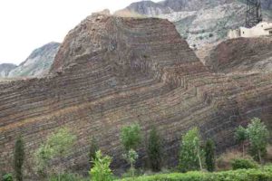
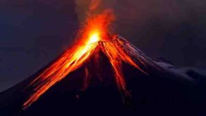
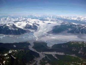
Megathrust earthquakes are among the most powerful earthquakes experienced worldwide and occur in subduction zones, where two tectonic plates converge, and one slides under the other. The plates move toward each other continuously, but if the interface, or fault, between them is stuck, then a slip deficit builds up over time. Like a debt, this slip deficit has to be paid off eventually, and for tectonic plates pay day is earthquake day. When these earthquakes affect the shallowest part of the fault near the seafloor, they have the potential to shift the seafloor upward and create devastating tsunamis as well.

Understanding the potential rupture behavior of megathrusts, particularly in the shallow offshore part of the fault where most destructive tsunamis are generated, is therefore a critical task for geoscientists forecasting seismic and tsunami inundation hazards. The likelihood of seismic behavior is often assumed to be somewhat low in the shallow part of the fault, based on laboratory studies of recovered fault zone material.

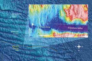
The fault’s rate of slip deficit buildup can also be measured through the use of geodetic observations that track how the earth’s surface moves over time, for example by using highly precise GPS sensors installed on land, together with a model that relates how slip on the fault affects the movement of these stations. However, it is hard for scientists to use this technique to “see” what is going on in the shallowest part of the fault, because it is far from land, below kilometers of water, where traditional GPS instruments cannot operate.

Now, scientists at The University of New Mexico and the Nanyang Technological University (NTU) in Singapore have developed a new geodetic method for inferring this value that accounts for the interaction between different parts of the fault, resulting in a much more physically accurate result. Lindsey’s team noted that previous models have failed to take into account the fact that if the deep part of the fault is stuck between earthquakes, the shallow part can’t move either — it is in what they term a ‘stress shadow’ and there is no buildup of energy available to cause it to slip. By taking this effect into account, the team developed a technique that uses the same land-based data but results in a vast improvement in their ability to “see” the fault slip in the areas that are farthest from shore, allowing researchers to reassess the hazard presented by the offshore parts of subduction zones most prone to tsunami generation.

“We applied this technique to the Cascadia and Japan subduction zones and found that wherever deeper locked patches are present, the shallow fault must also have a high slip deficit — regardless of its own frictional properties,” said Eric Lindsey, an assistant professor in the UNM Department of Earth and Planetary Sciences who conducted the research while at the Earth Observatory of Singapore at NTU. “If these areas can slip seismically, global tsunami hazard could be higher than currently recognized. Our method identifies critical locations where seafloor observations could yield information about frictional properties of these faults in order to better understand their slip behavior.”

This study is important because it calls for a reassessment of previous models of tsunami hazard on megathrusts worldwide. Because this can be done with existing data, the reassessment can be done comparatively quickly as well. Hopefully, this will lead to better preparedness among coastal communities for future events.

Reference:
Eric O. Lindsey, Rishav Mallick, Judith A. Hubbard, Kyle E. Bradley, Rafael V. Almeida, James D. P. Moore, Roland Bürgmann, Emma M. Hill. Slip rate deficit and earthquake potential on shallow megathrusts. Nature Geoscience, 2021; DOI: 10.1038/s41561-021-00736-x

Note: The above post is reprinted from materials provided by University of New Mexico. Original written by Steve Carr.

Local impacts from fracking the Eagle Ford

Fracking
Representative Image : Fracking

Hydraulic fracturing to extract trapped fossil fuels can trigger earthquakes. Most are so small or far from homes and infrastructure that they may go unnoticed; others can rattle windows, sway light fixtures and jolt people from sleep; some have damaged buildings.

Stanford University geophysicists have simulated and mapped the risk of noticeable shaking and possible building damage from earthquakes caused by hydraulic fracturing at all potential fracking sites across the Eagle Ford shale formation in Texas, which has hosted some of the largest fracking-triggered earthquakes in the United States.

Published April 29 in Science, the results show the most densely populated areas — particularly a narrow section of the Eagle Ford nestled between San Antonio and Houston — face the greatest risk of experiencing shaking strong enough to damage buildings or be felt by people. “We found that risks from nuisance or damage varies greatly across space, depending mostly on population density,” said lead study author Ryan Schultz, a PhD student in geophysics at Stanford.

Social license

Tens of thousands of wells drilled in the vast formation over the past decade helped to fuel the U.S. shale boom and contributed to a dramatic increase in earthquakes in the central and eastern U.S. starting around 2009. Although damaging earthquakes are rare, the authors write, “the perceived risks of hydraulic fracturing have both caused public concern and impeded industry development.”

In sparsely populated areas within the southwestern portion of the Eagle Ford, the researchers found damage is unlikely even if fracking causes earthquakes as large as magnitude 5.0. Allowing such powerful quakes, however, could jeopardize the “social license to operate,” they write. The phrase, which emerged within the mining industry in the 1990s and has since been adopted by climate activists, refers to the unofficial acceptance by local community members and broader civil society that oil, gas and mining operations need to do business without costly conflicts.

“Seismicity is part of the social license for hydraulic fracturing, but far from the only issue,” said study co-author Bill Ellsworth, a geophysics research professor at Stanford’s School of Earth, Energy & Environmental Sciences (Stanford Earth). “Eliminating hydraulic fracturing seismicity altogether wouldn’t change any of the other concerns.”

Among those concerns are health threats from living near oil and gas wells and greenhouse gas emissions from fossil fuel production and use. California’s recent announcement of plans to stop issuing new permits for hydraulic fracturing by 2024, for example, comes as part of an effort to phase out oil extraction and reduce greenhouse gas emissions.

Starting with risk

The researchers say their goal is to make it easier for operators, regulators, local residents and property owners to discuss the risks that are important to them without technical expertise. “The approach we’ve developed provides the risk of nuisance or damage as a shared frame of reference and tools to evaluate it,” said study co-author and geophysics professor Greg Beroza, co-director of the Stanford Center for Induced and Triggered Seismicity (SCITS).

The new risk analysis applies a technique first published last year for considering where people and structures are located as well as forecasts for maximum earthquake magnitude and geological factors that can amplify or dampen tremors as they travel underground. The approach makes it possible to start out with some level of risk — such as a 50 percent chance of 30 households experiencing shaking that feels exciting but not frightening, based on community questionnaires — and calculate the largest earthquake magnitude that would keep risk at or below that level.

The authors propose using this type of analysis as a starting point for managing earthquake risk caused by fracking using a system known as a traffic-light protocol. Adopted in states including Ohio and Oklahoma to manage seismic hazards related to oil, gas and some geothermal energy development, traffic-light protocols give operators a green light to proceed as long as quakes remain relatively small. Larger earthquakes may require an operator to adjust or halt fluid injections, knowing that shaking may continue and even intensify after the pumps shut down.

“If the goal is to treat everyone equally in terms of risk, our analysis shows action should be taken at lower magnitudes for drill sites near the cities in the north of the Eagle Ford than for those in rural areas in the south,” explained Ellsworth, who is also a co-director of SCITS.

According to the researchers, it’s “unfair” to set a uniform threshold for the amount of shaking allowed across a large formation like the Eagle Ford. “Single valued thresholds can allow for thresholds that are too permissive in urban regions or too restrictive in rural regions,” said Beroza, the Wayne Loel Professor at Stanford Earth. “Instead, if you start with a tolerance to risk, you can set thresholds that vary according to changes in the risk.”

Beroza is also co-director of the Southern California Earthquake Center (SCEC).

This research was supported by SCITS.

Reference:
Ryan Schultz, Gregory C. Beroza, William L. Ellsworth. A risk-based approach for managing hydraulic fracturing–induced seismicity. Science, 2021; 372 (6541): 504 DOI: 10.1126/science.abg5451

Note: The above post is reprinted from materials provided by Stanford University. Original written by Josie Garthwaite.

Fearsome tyrannosaurs were social animals, study shows

"Hollywood" specimen, same species as Teratophoneus, discovered approximately two miles north of the "Rainbows and Unicorns Quarry" on Grand Staircase-Escalante National Monument. Credit: U.S. Bureau of Land Management
“Hollywood” specimen, same species as Teratophoneus, discovered approximately two miles north of the “Rainbows and Unicorns Quarry” on Grand Staircase-Escalante National Monument.
Credit: U.S. Bureau of Land Management

The fearsome tyrannosaur dinosaurs that ruled the northern hemisphere during the Late Cretaceous period (66-100 million years ago) may not have been solitary predators as popularly envisioned, but social carnivores similar to wolves, according to a new study.

The finding, based on research at a unique fossil bone site inside Utah’s Grand Staircase-Escalante National Monument containing the remains of several dinosaurs of the same species, was made by a team of scientists including Celina Suarez, University of Arkansas associate professor of geosciences.

“This supports our hypothesis that these tyrannosaurs died in this site and were all fossilized together; they all died together, and this information is key to our interpretation that the animals were likely gregarious in their behavior,” Suarez said.

The research team also include scientists from the U.S. Bureau of Land Management, Denver Museum of Nature and Science, Colby College of Maine and James Cook University in Australia. The study examines a unique fossil bone site inside Grand Staircase-Escalante National Monument called the “Rainbows and Unicorns Quarry” that they say exceeded the expectations raised even from the site’s lofty nickname.

“Localities [like Rainbows and Unicorns Quarry] that produce insights into the possible behavior of extinct animals are especially rare, and difficult to interpret,” said tyrannosaur expert Philip Currie in a press release from the BLM. “Traditional excavation techniques, supplemented by the analysis of rare earth elements, stable isotopes and charcoal concentrations convincingly show a synchronous death event at the Rainbows site of four or five tyrannosaurids. Undoubtedly, this group died together, which adds to a growing body of evidence that tyrannosaurids were capable of interacting as gregarious packs.”

In 2014, BLM paleontologist Alan Titus discovered the Rainbows and Unicorns Quarry site in Grand Staircase-Escalante National Monument and led the subsequent research on the site, which is the first tyrannosaur mass death site found in the southern United States. Researchers ran a battery of tests and analyses on the vestiges of the original site, now preserved as small rock fragments and fossils in their final resting place, and sandbar deposits from the ancient river.

“We realized right away this site could potentially be used to test the social tyrannosaur idea. Unfortunately, the site’s ancient history is complicated,” Titus said. “With bones appearing to have been exhumed and reburied by the action of a river, the original context within which they lay has been destroyed. However, all has not been lost.” As the details of the site’s history emerged, the research team concluded that the tyrannosaurs died together during a seasonal flooding event that washed their carcasses into a lake, where they sat, largely undisturbed until the river later churned its way through the bone bed.

“We used a truly multidisciplinary approach (physical and chemical evidence) to piece the history of the site together, with the end-result being that the tyrannosaurs died together during a seasonal flooding event,” said Suarez.

Using analysis of stable carbon and oxygen isotopes and concentrations of rare earth elements within the bones and rock, Suarez and her then-doctoral student, Daigo Yamamura, were able to provide a chemical fingerprint of the site. Based on the geochemical work, they were able to conclusively determine that the remains from the site all fossilized in the same environment and were not the result of an attritional assemblage of fossils washed in from a variety of areas.

“None of the physical evidence conclusively suggested that these organisms came to be fossilized together, so we turned to geochemistry to see if that could help us. The similarity of rare earth element patterns is highly suggestive that these organisms died and were fossilized together,” said Suarez.

Excavation of the quarry site has been ongoing since its discovery in 2014 and due to the size of the site and volume of bones found there the excavation will probably continue into the foreseeable future. In addition to tyrannosaurs, the site has also yielded seven species of turtles, multiple fish and ray species, two other kinds of dinosaurs, and a nearly complete skeleton of a juvenile (12-foot-long) Deinosuchus alligator, although they do not appear to have all died together like the tyrannosaurs.

“The new Utah site adds to the growing body of evidence showing that tyrannosaurs were complex, large predators capable of social behaviors common in many of their living relatives, the birds,” said project contributor, Joe Sertich, curator of dinosaurs at the Denver Museum of Nature & Science. “This discovery should be the tipping point for reconsidering how these top carnivores behaved and hunted across the northern hemisphere during the Cretaceous.”

Future research plans for the Rainbows and Unicorns Quarry fossils include additional trace element and isotopic analysis of the tyrannosaur bones, which paleontologists hope will determine with a greater degree of certainty the mystery of Teratophoneus’ social behavior.

In stark contrast to the social interaction between humans and among many species of animals, paleontologists have long debated whether tyrannosaurs lived and hunted alone or in groups.

Based on findings at a site in Alberta, Canada, with over 12 individuals, the idea that tyrannosaurs were social with complex hunting strategies was first formulated by Philip Currie over 20 years ago. This idea has been widely debated, with many scientists doubting the giant killing machines had the brainpower to organize into anything more complex than what is observed in modern crocodiles. Because the Canadian site appeared to be an isolated case, skeptics claimed it represented unusual circumstances that did not reflect normal tyrannosaur behavior. Discovery of a second tyrannosaur mass death site in Montana again raised the possibility of social tyrannosaurs, but this site was still not widely accepted by the scientific community as evidence for social behavior. The researcher’s findings at the Unicorns and Rainbows Quarry provides even more compelling evidence that tyrannosaurs may have habitually lived in groups.

Reference:
Alan L. Titus, Katja Knoll, Joseph J.W. Sertich, Daigo Yamamura, Celina A. Suarez, Ian J. Glasspool, Jonathan E. Ginouves, Abigail K. Lukacic, Eric M. Roberts. Geology and taphonomy of a unique tyrannosaurid bonebed from the upper Campanian Kaiparowits Formation of southern Utah: implications for tyrannosaurid gregariousness. PeerJ, 2021; 9: e11013 DOI: 10.7717/peerj.11013

Note: The above post is reprinted from materials provided by University of Arkansas. Original written by Bob Whitby.

Fossils of ‘giant cloud rats’ discovered in Philippine caves

Illustration showing how the three new species of fossil cloud rats might have looked. Credit: © Velizar Simeonovski, Field Museum.

Rats, by and large, aren’t terribly popular animals. But while you don’t want an infestation of common black rats living in your house, their distant cousins in the Philippines are downright cuddly. These “giant cloud rats” live in the treetops of misty mountain forests, and they fill an ecological role occupied by squirrels in the US. And, it turns out, we have new evidence that they’ve been living in the Philippines for a long time — scientists have discovered the fossils of three new species of giant cloud rats that lived alongside ancient humans.

“Our previous studies have demonstrated that the Philippines has the greatest concentration of unique species of mammals of any country, most of which are small animals, less than half a pound, that live in the tropical forest,” Larry Heaney, the Neguanee Curator of Mammals at Chicago’s Field Museum and an author of a study in the Journal of Mammalogy describing the new species. “These recently extinct fossil species not only show that biodiversity was even greater in the very recent past, but that the two that became extinct just a few thousand years ago were giants among rodents, both weighing more than two pounds. Their abrupt disappearance just a few thousand years ago leaves us to wonder if they were big enough that it might have been worthwhile to hunt and eat them.”

“We have had evidence of extinct large mammals on the Philippine island of Luzon for a long time, but there has been virtually no information about fossils of smaller-sized mammals. The reason is probably that research had focused on open-air sites where the large fossil mammal faunas were known to have been preserved, rather than the careful sieving of cave deposits that preserve a broader size-range of vertebrates including the teeth and bones of rodents,” says Janine Ochoa, an Assistant Professor of Archaeology at the University of the Philippines — Diliman and the study’s lead author.

At the outset of the study, Ochoa was examining the fossil assemblages from caves in the Callao limestone formation, where a couple of years ago, scientists discovered the remains of an ancient species of humans, Homo luzonensis. “We were looking at the fossil assemblages associated with that hominin, and we found teeth and fragments of bone that ended up belonging to these new species of cloud rats,” says Ochoa.

The fossil fragments discovered by the excavation team in Callao Cave aren’t the only traces of the cloud rats, though — they were able to add to them some other fossils in the collections of the National Museum of the Philippines. “Some of these fossils were actually excavated decades ago, in the 1970s and 1980s, and they were in the museum, waiting for someone to have time to do a detailed study. When we began to analyze the fossil material, we were expecting fossil records for known living species. To our surprise, we found that we were dealing with not just one but three buot, or giant cloud rat species that were previously unknown,” said Marian Reyes, a zooarcheologist at the National Museum of the Philippines, one of the study’s authors.

The researchers didn’t have a ton of material to work with, though — just fifty or so fragments. “Normally, when we’re looking at fossil assemblages, we’re dealing with thousands and thousands of fragments before you find something rare and really nice,” says Ochoa. “It’s crazy that in these fifty fragments, we found three new species that haven’t been recorded before.”

The fragments that the researchers found were mostly teeth, which are covered in a hard enamel substance that makes them hardier than bone. From just a few dozen teeth and bits of bone, though, the researchers were able to put together a picture of what these animals were like in life, thanks to, in Heaney’s words, “days and days and days staring through a microscope”

By comparing the fossils to the 18 living species of giant cloud rats, the researchers have a decent idea of what these three new fossil species would have looked like.

“The bigger ones would have looked almost like a woodchuck with a squirrel tail,” says Heaney. “Cloud rats eat plants, and they’ve got great big pot bellies that allow them to ferment the plants that they eat, kind of like cows. They have big fluffy or furry tails. They’re really quite cute.”

The newly recorded fossil species came from Callao Cave, where Homo luzonensis was discovered in 2019, and several adjacent smaller caves in Penablanca, Cagayan Province. Some specimens of all three of the new fossil rodents occurred in the same deep layer in the cave where Homo luzonensis was found, which has been dated at about 67,000 years ago. One of the new fossil rodents is known from only two specimens from that ancient layer, but the other two are represented by specimens from that early date all the way up to about 2000 years ago or later, which means that they were resilient and persistent for at least 60,000 years. “Our records demonstrate that these giant rodents were able to survive the profound climatic changes from the Ice Age to current humid tropics that have impacted the earth over tens of millennia. The question is what might have caused their final extinction?” adds Philip Piper, a coauthor based at the Australian National University.

Two of these giant rodents apparently disappeared about two thousand years ago, or soon after. “That seems significant, because that is roughly the same time that pottery and Neolithic stone tools first appear in the archeological record, and when dogs, domestic pigs, and probably monkeys were introduced to the Philippines, probably from Borneo. While we can’t say for certain based on our current information, this implies that humans likely played some role in their extinction,” says Armand Mijares, Professor in the Archaeological Studies Program at the University of the Philippines — Diliman, who headed the excavations of Callao Cave.

“Our discoveries suggest that future studies that look specifically for fossils of small mammals may be very productive, and may tell us a great deal about how environmental changes and human activities have impacted the really exceptionally distinctive biodiversity of the Philippines,” according to Ochoa. And such studies may also tell us a lot specifically about the impact of human activities, perhaps specifically including over-hunting, on biodiversity, notes Heaney. “This is something we need to understand if we are going to be effective in preventing extinction in the future.”

Reference:
Janine Ochoa, Armand S B Mijares, Philip J Piper, Marian C Reyes, Lawrence R Heaney. Three new extinct species from the endemic Philippine cloud rat radiation (Rodentia, Muridae, Phloeomyini). Journal of Mammalogy, 2021; DOI: 10.1093/jmammal/gyab023

Note: The above post is reprinted from materials provided by Field Museum.

New insights into mass extinctions

Rafinesquina, seen in this close-up shot, was an ancient genus of brachiopod belonging to order Strophomenida. This order survived two mass extinction events, but the second represented a ‘death sentence’ from which they were unable to recover diversity, persisting for another hundred million years as a ‘dead clade walking’ before their eventual extinction. IMAGE: Provided by Benjamin Barnes
Rafinesquina, seen in this close-up shot, was an ancient genus of brachiopod belonging to order Strophomenida. This order survived two mass extinction events, but the second represented a ‘death sentence’ from which they were unable to recover diversity, persisting for another hundred million years as a ‘dead clade walking’ before their eventual extinction.
IMAGE: Provided by Benjamin Barnes

Mass extinctions are known as times of global upheaval, causing rapid losses in biodiversity that wipe out entire animal groups. Some of the doomed groups linger on before going extinct, and a team of scientists found these “dead clades walking” (DCW) are more common and long-lasting than expected.

“Dead clades walking are a pattern in the fossil record where some animal groups make it past the extinction event, but they also can’t succeed in the aftermath,” said Benjamin Barnes, a doctoral student in geosciences at Penn State. “It paints the pictures of a group consigned to an eventual extinction.”

The scientists found 70 of the 134 orders of ancient sea-dwelling invertebrates they examined could be identified as DCW in a new statistical analysis of the fossil record.

“What really fascinated us was that over half of all the orders we looked at have this phenomenon and that it can look like many different things,” said Barnes, who led a group of graduate students and a postdoctoral researcher on the study. “In some cases, you have a group that has a sudden drop in diversity and lasts for a few more million years before disappearing from the record. But we also found many orders straggled along sometimes for tens or hundreds of millions of years.”

The findings, published in the journal Proceedings of the National Academy of Sciences, challenge the view of extinction as a sudden disappearance and suggest that the full impact of mass extinctions lag behind the events themselves longer than previously expected, the scientists said.

“I think it raises questions about how the so-called kill mechanism operates,” Barnes said. “We think of mass extinctions as being these selective forces that cause large groups of animals to go extinct, but our results really show there are a lot of instances where it’s not so sudden. It raises questions about why that’s such a long delay.”

Paleontologist David Jablonski first coined the term DCW more than 20 years ago, and since then it has been associated almost exclusively with mass extinctions. Using a wealth of new fossil record data made available over the last two decades, the study found DCW are also common around smaller, more localized background extinction stages, the scientists said.

“Our results suggest that rather than representing a rare, brief fossil pattern in the wake of mass extinction events, DCWs are actually a really diverse phenomenon and that there might be a lot of drivers that produce this pattern in the fossil record,” Barnes said. “These DCWs may represent a major macroevolutionary pattern.”

The scientists used a statistical technique called a Bayesian change point algorithm to analyze fossil records from the Paleobiology Database, a public record of paleontological data maintained by international scientists.

The method allowed the researchers to search time series data for significant points where the data deviated from the pattern. They were able to identify negative jagged shifts in diversity and rule out that the organism went extinct immediately but instead persisted.

“So you might be looking in the fossil record and you’ll find tons of a type of brachiopod,” Barnes said. “Each order has a handful of families and dozens of genera within those families. Then you might see a drop in diversity, and the majority of those genera disappear and perhaps there’s only one family that continues to survive.”

Those survivors can continue in their niche for millions of years, even into the present. But their lack of diversity makes them more susceptible to future environmental challenges or extinction events, the scientists said.

“I think these findings cause you to reexamine how you measure success,” Barnes said. “It’s quite possible for an animal group not to produce new families and new genera at a rate like it did before, but if it continues to survive for many millions of years, that’s still some form of success. I think it raises a lot of questions about what it means to be successful as a fossil organism and what ultimately are the controls of origination.”

Reference:
B. Davis Barnes, Judith A. Sclafani, Andrew Zaffos. Dead clades walking are a pervasive macroevolutionary pattern. Proceedings of the National Academy of Sciences, 2021; 118 (15): e2019208118 DOI: 10.1073/pnas.2019208118

Note: The above post is reprinted from materials provided by Penn State.

Red Sea is no longer a baby ocean

Bathymetric chart of a part of the Red Sea. Source GEOMAR.

The Red Sea is a fascinating and still puzzling area of investigation for geoscientists. Controversial questions include its age and whether it represents a special case in ocean basin formation or if it has evolved similarly to other, larger ocean basins. Researchers have now published a new tectonic model that suggests that the Red Sea is not only a typical ocean, but more mature than thought before.

It is 2,250 kilometers long, but only 355 kilometers wide at its widest point — on a world map, the Red Sea hardly resembles an ocean. But this is deceptive. A new, albeit still narrow, ocean basin is actually forming between Africa and the Arabian Peninsula. Exactly how young it is and whether it can really be compared with other young oceans in Earth’s history has been a matter of dispute in the geosciences for decades. The problem is that the newly formed oceanic crust along the narrow, north-south aligned rift is widely buried under a thick blanket of salt and sediments. This complicates direct investigations.

In the international journal Nature Communications, scientists from GEOMAR Helmholtz Centre for Ocean Research Kiel, King Abdullah University for Science and Technology in Thuwal (Saudi Arabia) and the University of Iceland have now published a study that makes a good case for the Red Sea being quite mature and having an almost classical oceanic evolution. “Using a combination of different methods, we can show for the first time that the structures in the Red Sea are typical for a young but already fully developed ocean basin.” says Dr. Nico Augustin from GEOMAR, lead author of the study.

In addition to information from high-resolution seafloor maps and chemical investigations of rock samples, the team primarily used gravity and earthquake data to develop a new tectonic model of the Red Sea basin. Gravity anomalies have already helped to detect hidden seafloor structures such as rift axes, transform faults and deep-sea mountains in other regions, for example in the Gulf of Mexico, the Labrador Sea or the Andaman Sea.

The authors of the current study compared gravity patterns of the Red Sea axis with comparable mid-ocean ridges and found more similarities than differences. For example, they identified positive gravity anomalies running perpendicular to the rift axis, which are caused by variations in crustal thickness running along the axis. “These so-called ‘off-axis segmentation trails’ are very typical features of oceanic crust originating from magmatically more active, thicker and thus, heavier areas along the axis. However, this observation is new for the Red Sea,” says Dr. Nico Augustin.

Bathymetric maps as well as earthquake data also support the idea of an almost continuous rift valley throughout the Red Sea basin. This is also confirmed by geochemical analyses of rock samples from the few areas that are not overlain by salt masses. “All the samples we have from the Red Sea rift have geochemical fingerprints of normal oceanic crust,” says Dr. Froukje van der Zwan, co-author of the study.

With this new analysis of gravity and earthquake data, the team constrains the onset of ocean expansion in the Red Sea to about 13 million years ago. “That’s more than twice the generally accepted age,” Dr. Augustin says. That means the Red Sea is no longer a baby ocean, but a young adult with a structure similar to the young southern Atlantic some 120 million years ago.

The model now presented is, of course, still being debated in the scientific community, says the lead author, “but it is the most straightforward interpretation of what we observe in the Red Sea. Many details in salt- and sediment-covered areas that were previously difficult to explain suddenly make sense with our model.” While it has thus been able to answer some questions about the Red Sea, the model also raises many new ones that inspire further research in the Red Sea from a whole new scientific perspective.

Reference:
Nico Augustin, Froukje M. van der Zwan, Colin W. Devey, Bryndís Brandsdóttir. 13 million years of seafloor spreading throughout the Red Sea Basin. Nature Communications, 2021; 12 (1) DOI: 10.1038/s41467-021-22586-2

Note: The above post is reprinted from materials provided by Helmholtz Centre for Ocean Research Kiel (GEOMAR).

3D printed models provide clearer understanding of ground motion

Experimental setup for 3D seismic model.

It seems like a smooth slab of stainless steel, but look a little closer, and you’ll see a simplified cross-section of the Los Angeles sedimentary basin.

Caltech researcher Sunyoung Park and her colleagues are printing 3D models like the metal Los Angeles proxy to provide a novel platform for seismic experiments. By printing a model that replicates a basin’s edge or the rise and fall of a topographic feature and directing laser light at it, Park can simulate and record how seismic waves might pass through the real Earth.

In her presentation at the Seismological Society of America (SSA)’s 2021 Annual Meeting, Park explained why these physical models can address some of the drawbacks of numerical modeling of ground motion in some cases.

Small-scale, complex structures in a landscape can amplify and alter ground motion after an earthquake, but seismologists have a difficult time modeling these impacts, said Park. “Even though we know that these things are very important to ground shaking, the effects of topography, interfaces and edges are hard problems to study numerically.”

Incorporating these features in ground motion simulations requires a lot of computational power, and it can be hard to verify these numerical calculations, she added.

To address these challenges, Park began creating 3D models of simple topographical and basin features to explore these effects on ground shaking. Metal is her preferred printing material, “because it can be as rigid as the conditions at the Earth’s lower crust,” she said.

By controlling the printing parameters, Park can also control the density of the metal as it is laid down by the printer, creating a material with different seismic velocities. The result, in the case of the Los Angeles basin example that she showed at the meeting, is a 20 by 4-centimeter model that represents a 50-kilometer cross-section through the basin.

At a scale of about 1:250,000 for the printed landscape, Park needed to scale down the wavelengths that she used to simulate seismic waves as well, which is where the laser-based source and receiver system comes in. A laser shot at the model mimics a seismic source event, and laser doppler receivers sense the resulting vibrations as the seismic waves interact with the model’s features.

Experiments with the models have yielded some intriguing findings. With a shallow basin cross-section, for instance, Park found that some of the high-frequency waves were blocked from traveling across the basin.

“We know that basins are usually amplifying ground motions,” she said, “but this suggests we should be thinking about that in terms of different frequency contents as well.”

Park said the models might also be useful for studying wave propagation through other seismologically complex features, such as highly damaged rock near a fault, rock layers injected with fluids and gases during oil and gas extraction or carbon sequestration, and features in the deep Earth.

Park will join the Department of Geophysical Sciences at The University of Chicago in June 2021.

Note: The above post is reprinted from materials provided by Seismological Society of America.

Scientists probe mysterious melting of Earth’s crust in western North America

From left, University of Wyoming students Shane Scoggin, Adam Trzinski and Jessie Shields are part of new research investigating crustal melting in western North America. Here, they examine igneous rocks in the Snake Range of Nevada. Credit: Jay Chapman
From left, University of Wyoming students Shane Scoggin, Adam Trzinski and Jessie Shields are part of new research investigating crustal melting in western North America. Here, they examine igneous rocks in the Snake Range of Nevada.
Credit: Jay Chapman

A group of University of Wyoming professors and students has identified an unusual belt of igneous rocks that stretches for over 2,000 miles from British Columbia, Canada, to Sonora, Mexico.

The rock belt runs through Idaho, Montana, Nevada, southeast California and Arizona. “Geoscientists usually associate long belts of igneous rocks with chains of volcanoes at subduction zones, like Mount Shasta, Mount Hood, Mount St. Helens and Mount Rainer,” says Jay Chapman, an assistant professor in UW’s Department of Geology and Geophysics. “What makes this finding so interesting and mysterious is that this belt of igneous rocks is located much farther inland, away from the edge of the continent, and doesn’t contain any evidence for producing volcanoes. In fact, all of the melting to generate the igneous rocks originally took place deep underground, five to 10 miles beneath the surface.”

Chapman is lead author of a paper, titled “The North American Cordilleran Anatectic Belt,” which was published online in February in the journal Earth-Science Reviews. The print version will be published this month.

The paper is a result of a special course taught by Simone Runyon, an assistant professor in UW’s Department of Geology and Geophysics, and Chapman. Runyon, six UW graduate students and one undergraduate student, who took part in the course, are co-authors of the paper.

“It was really fascinating to start with a scientific question in a classroom, then collect and analyze data, and eventually publish our results,” says Cody Pridmore, a UW graduate student from Orange, Calif., and co-author of the paper. “It’s a process most college students don’t get to experience.”

One clue to the origin of the belt of igneous rocks is that the rocks chiefly formed 80 million to 50 million years ago, during a mountain-building event called the Laramide orogeny.

“The Laramide orogeny created most of the major mountain ranges we have in Wyoming, and the name actually comes from the Laramie Range,” Chapman says. “Although there are no igneous rocks of this type and age present in those mountains, we suspect that the tectonic processes that created the mountains also contributed to melting Earth’s crust.”

The researchers have several working hypotheses about what caused the rocks to melt. One hypothesis is that water infiltrated the deep crust.

“The geochemistry of these rocks indicates that melting may have occurred at relatively low temperatures, below 800 degrees Celsius,” says Jessie Shields, a Ph.D. student at UW from Minneapolis, Minn., who is working to solve this mystery. “That is still very hot, but not hot enough to produce very large volumes of magma. Water lowers the melting point of rocks, similar to how salt lowers the melting point of ice, and could increase the amount of magma generated.”

This work has implications for what causes rocks to melt and where specific types of magmas can be found.

“Many of the igneous systems in the study area contain economically important ore deposits,” says Runyon, who specializes in ore deposits. “Understanding the large-scale igneous processes that form these provinces helps us to better understand how ore deposits form and to better explore for natural resources.”

Reference:
James B. Chapman, Simone E. Runyon, Jessie E. Shields, Brandi L. Lawler, Cody J. Pridmore, Shane H. Scoggin, Nathan T. Swaim, Adam E. Trzinski, Hannah N. Wiley, Andrew P. Barth, Gordon B. Haxel. The North American Cordilleran Anatectic Belt. Earth-Science Reviews, 2021; 215: 103576 DOI: 10.1016/j.earscirev.2021.103576

Note: The above post is reprinted from materials provided by University of Wyoming.

Energy unleashed by submarine volcanoes could power a continent

West Mato Volcano erupting in 2009, courtesy of the National Oceanic and Atmospheric Administration.

Volcanic eruptions deep in our oceans are capable of extremely powerful releases of energy, at a rate high enough to power the whole of the United States, according to research published today.

Eruptions from deep-sea volcanoes were long-thought to be relatively uninteresting compared with those on land. While terrestrial volcanoes often produce spectacular eruptions, dispersing volcanic ash into the environment, it was thought that deep marine eruptions only produced slow moving lava flows.

But data gathered by remotely operated vehicles deep in the North East Pacific and analysed by scientists at the University of Leeds, has revealed a link between the way ash is dispersed during submarine eruptions and the creation of large and powerful columns of heated water rising from the ocean floor, known as megaplumes.

These megaplumes contain hot chemical-rich water and act in the same way as the atmospheric plumes seen from land-based volcanoes, spreading first upwards and then outwards, carrying volcanic ash with them. The size of megaplumes is immense, with the volumes of water equivalent to forty million Olympic-sized swimming pools. They have been detected above various submarine volcanoes but their origin has remained unknown. The results of this new research show that they form rapidly during the eruption of lava.

The research was carried out by Sam Pegler, from the School of Mathematics and David Ferguson, from the School of Earth and Environment and is being published today in the journal Nature Communications.

Together they developed a mathematical model which shows how ash from these submarine eruptions spreads several kilometres from the volcano. They used the ash pattern deposited by a historic submarine eruption to reconstruct its dynamics. This showed that the rate of energy released and required to carry ash to the observed distances is extremely high — equivalent to the power used by the whole of the USA.

David Ferguson said: “The majority of Earth’s volcanic activity occurs underwater, mostly at depths of several kilometres in the deep ocean but, in contrast to terrestrial volcanoes, even detecting that an eruption has occurred on the seafloor is extremely challenging. Consequently, there remains much for scientists to learn about submarine volcanism and its effects on the marine environment.”

The research shows that submarine eruptions cause megaplumes to form but the release of energy is so rapid that it cannot be supplied from the erupted molten lava alone. Instead, the research concludes that submarine volcanic eruptions lead to the rapid emptying of reservoirs of hot fluids within the earth’s crust. As the magma forces its way upwards towards the seafloor, it drives this hot fluid with it.

Sam Pegler added: “Our work provides evidence that megaplumes are directly linked to the eruption of lava and are responsible for transporting volcanic ash in the deep ocean. It also shows that plumes must have formed in a matter of hours, creating an immense rate of energy release.

David Ferguson adds: “Observing a submarine eruption in person remains extremely difficult but the development of instruments based on the seafloor means data can be streamed live as the activity occurs.

Efforts like these, in concert with continued mapping and sampling of the ocean floor means the volcanic character of our oceans is slowly being revealed.”

Reference:
Samuel S. Pegler, David J. Ferguson. Rapid heat discharge during deep-sea eruptions generates megaplumes and disperses tephra. Nature Communications, 2021; 12 (1) DOI: 10.1038/s41467-021-22439-y

Note: The above post is reprinted from materials provided by University of Leeds.

How many T. rexes were there? Billions

Over approximately 2.5 million years, North America likely hosted 2.5 billion Tyrannosaurus rexes, a minuscule proportion of which have been dug up and studied by paleontologists, according to a UC Berkeley study. (Image by Julius Csotonyi, courtesy of Science magazine)

How many Tyrannosaurus rexes roamed North America during the Cretaceous period?

That’s a question Charles Marshall pestered his paleontologist colleagues with for years until he finally teamed up with his students to find an answer.

What the team found, to be published this week in the journal Science, is that about 20,000 adult T. rexes probably lived at any one time, give or take a factor of 10, which is in the ballpark of what most of his colleagues guessed.

What few paleontologists had fully grasped, he said, including himself, is that this means that some 2.5 billion lived and died over the approximately 2 1/2 million years the dinosaur walked the earth.

Until now, no one has been able to compute population numbers for long-extinct animals, and George Gaylord Simpson, one of the most influential paleontologists of the last century, felt that it couldn’t be done.

Marshall, director of the University of California Museum of Paleontology, the Philip Sandford Boone Chair in Paleontology and a UC Berkeley professor of integrative biology and of earth and planetary science, was also surprised that such a calculation was possible.

“The project just started off as a lark, in a way,” he said. “When I hold a fossil in my hand, I can’t help wondering at the improbability that this very beast was alive millions of years ago, and here I am holding part of its skeleton — it seems so improbable. The question just kept popping into my head, ‘Just how improbable is it? Is it one in a thousand, one in a million, one in a billion?’ And then I began to realize that maybe we can actually estimate how many were alive, and thus, that I could answer that question.”

Marshall is quick to point out that the uncertainties in the estimates are large. While the population of T. rexes was most likely 20,000 adults at any give time, the 95% confidence range — the population range within which there’s a 95% chance that the real number lies — is from 1,300 to 328,000 individuals. Thus, the total number of individuals that existed over the lifetime of the species could have been anywhere from 140 million to 42 billion.

“As Simpson observed, it is very hard to make quantitative estimates with the fossil record,” he said. “In our study, we focused in developing robust constraints on the variables we needed to make our calculations, rather than on focusing on making best estimates, per se.”

He and his team then used Monte Carlo computer simulation to determine how the uncertainties in the data translated into uncertainties in the results.

The greatest uncertainty in these numbers, Marshall said, centers around questions about the exact nature of the dinosaur’s ecology, including how warm-blooded T. rex was. The study relies on data published by John Damuth of UC Santa Barbara that relates body mass to population density for living animals, a relationship known as Damuth’s Law. While the relationship is strong, he said, ecological differences result in large variations in population densities for animals with the same physiology and ecological niche. For example, jaguars and hyenas are about the same size, but hyenas are found in their habitat at a density 50 times greater than the density of jaguars in their habitat.

“Our calculations depend on this relationship for living animals between their body mass and their population density, but the uncertainty in the relationship spans about two orders of magnitude,” Marshall said. “Surprisingly, then, the uncertainty in our estimates is dominated by this ecological variability and not from the uncertainty in the paleontological data we used.”

As part of the calculations, Marshall chose to treat T. rex as a predator with energy requirements halfway between those of a lion and a Komodo dragon, the largest lizard on Earth.

The issue of T. rex’s place in the ecosystem led Marshall and his team to ignore juvenile T. rexes, which are underrepresented in the fossil record and may, in fact, have lived apart from adults and pursued different prey. As T. rex crossed into maturity, its jaws became stronger by an order of magnitude, enabling it to crush bone. This suggests that juveniles and adults ate different prey and were almost like different predator species.

This possibility is supported by a recent study, led by evolutionary biologist Felicia Smith of the University of New Mexico, which hypothesized that the absence of medium-size predators alongside the massive predatory T. rex during the late Cretaceous was because juvenile T. rex filled that ecological niche.

What the fossils tell us

The UC Berkeley scientists mined the scientific literature and the expertise of colleagues for data they used to estimate that the likely age at sexual maturity of a T. rex was 15.5 years; its maximum lifespan was probably into its late 20s; and its average body mass as an adult — its so-called ecological body mass, — was about 5,200 kilograms, or 5.2 tons. They also used data on how quickly T. rexes grew over their life span: They had a growth spurt around sexual maturity and could grow to weigh about 7,000 kilograms, or 7 tons.

From these estimates, they also calculated that each generation lasted about 19 years, and that the average population density was about one dinosaur for every 100 square kilometers.

Then, estimating that the total geographic range of T. rex was about 2.3 million square kilometers, and that the species survived for roughly 2 1/2 million years, they calculated a standing population size of 20,000. Over a total of about 127,000 generations that the species lived, that translates to about 2.5 billion individuals overall.

With such a large number of post-juvenile dinosaurs over the history of the species, not to mention the juveniles that were presumably more numerous, where did all those bones go? What proportion of these individuals have been discovered by paleontologists? To date, fewer than 100 T. rex individuals have been found, many represented by a single fossilized bone.

“There are about 32 relatively well-preserved, post-juvenile T. rexes in public museums today,” he said. “Of all the post-juvenile adults that ever lived, this means we have about one in 80 million of them.”

“If we restrict our analysis of the fossil recovery rate to where T. rex fossils are most common, a portion of the famous Hell Creek Formation in Montana, we estimate we have recovered about one in 16,000 of the T. rexes that lived in that region over that time interval that the rocks were deposited,” he added. “We were surprised by this number; this fossil record has a much higher representation of the living than I first guessed. It could be as good as one in a 1,000, if hardly any lived there, or it could be as low as one in a quarter million, given the uncertainties in the estimated population densities of the beast.”

Marshall expects his colleagues will quibble with many, if not most, of the numbers, but he believes that his calculational framework for estimating extinct populations will stand and be useful for estimating populations of other fossilized creatures.

“In some ways, this has been a paleontological exercise in how much we can know, and how we go about knowing it,” he said. “It’s surprising how much we actually know about these dinosaurs and, from that, how much more we can compute. Our knowledge of T. rex has expanded so greatly in the past few decades thanks to more fossils, more ways of analyzing them and better ways of integrating information over the multiple fossils known.”

The framework, which the researchers have made available as computer code, also lays the foundation for estimating how many species paleontologists might have missed when excavating for fossils, he said.

“With these numbers, we can start to estimate how many short-lived, geographically specialized species we might be missing in the fossil record,” he said. “This may be a way of beginning to quantify what we don’t know.”

Reference:
Charles R. Marshall, Daniel V. Latorre, Connor J. Wilson, Tanner M. Frank, Katherine M. Magoulick, Joshua B. Zimmt, Ashley W. Poust. Absolute abundance and preservation rate of Tyrannosaurus rex. Science, 2021 DOI: 10.1126/science.abc8300

Note: The above post is reprinted from materials provided by University of California – Berkeley. Original written by Robert Sanders.

Tiny cat-sized stegosaur leaves its mark

The world's smallest stegosaur footprint (less than 6 cm long), Xingjiang, China. Photo credit - Lida Xing.
The world’s smallest stegosaur footprint (less than 6 cm long), Xingjiang, China. Photo credit – Lida Xing.

A single footprint left by a cat-sized dinosaur around 100 million years ago has been discovered in China by an international team of palaeontologists.

University of Queensland researcher Dr Anthony Romilio was part of the team that investigated the track, originally found by Associate Professor Lida Xing from the China University of Geosciences (Beijing).

“This footprint was made by a herbivorous, armoured dinosaur known broadly as a stegosaur — the family of dinosaurs that includes the famed stegosaurus,” Dr Romilio said.

“Like the stegosaurus, this little dinosaur probably had spikes on its tail and bony plates along its back as an adult.

“With a footprint of less than six centimetres, this is the smallest stegosaur footprint known in the world.

“It’s in strong contrast with other stegosaur prints found at the Chinese track site which measured up to 30 centimetres, and prints found in places like Broome in Western Australia where they can be up to 80 centimetres.”

The tiny footprint has similar characteristics of other stegosaur footprints with three short, wide, round toe impressions.

However researchers found the print wasn’t elongated like larger counterpart prints discovered at the track sites, which suggests the young stegosaur had a different behaviour.

“Stegosaurs typically walked with their heels on the ground, much like humans do, but on all fours which creates long footprints,” Dr Romilio said.

“The tiny track shows that this dinosaur had been moving with its heel lifted off the ground, much like a bird or cat does today.

“We’ve only previously seen shortened tracks like this when dinosaurs walked on two legs.”

Associate Professor Xing said that it was plausible young stegosaurs were toe-walkers.

“This could be possible as this is the ancestral condition and a posture of most dinosaurs, but the stegosaur could also have transitioned to heel-walking as it got older,” Dr Xing said.

“A complete set of tracks of these tiny footprints would provide us with the answer to this question, but unfortunately we only have a single footprint.”

Finding the tiny tracks on crowded track sites will be challenging for the researchers.

“The footprints made by tiny armoured dinosaur are much rarer than those formed by other groups of dinosaurs,” Associate Professor Xing said.

“Now that our study has identified nine different dinosaur track sites from this locality, we will look even closer to see if we can find more of these tiny tracks.”

Reference:
Lida Xing, Martin G. Lockley, W. Scott Persons, Hendrik Klein, Anthony Romilio, Donghao Wang, Miaoyan Wang. Stegosaur Track Assemblage from Xinjiang, China, Featuring the Smallest Known Stegosaur Record. PALAIOS, 2021; 36 (2): 68 DOI: 10.2110/palo.2020.036

Note: The above post is reprinted from materials provided by University of Queensland.

Study reveals the workings of nature’s own earthquake blocker

Seismogram
Representative Image: Seismogram

A new study finds a naturally occurring “earthquake gate” that decides which earthquakes are allowed to grow into magnitude 8 or greater.

Sometimes, the “gate” stops earthquakes in the magnitude 7 range, while ones that pass through the gate grow to magnitude 8 or greater, releasing over 32 times as much energy as a magnitude 7.

“An earthquake gate is like someone directing traffic at a one-lane construction zone. Sometimes you pull up and get a green ‘go’ sign, other times you have a red ‘stop’ sign until conditions change,” said UC Riverside geologist Nicolas Barth.

Researchers learned about this gate while studying New Zealand’s Alpine Fault, which they determined has about a 75 percent chance of producing a damaging earthquake within the next 50 years. The modeling also suggests this next earthquake has an 82 percent chance of rupturing through the gate and being magnitude 8 or greater. These insights are now published in the journal Nature Geoscience.

Barth was part of an international research team including scientists from Victoria University of Wellington, GNS Science, the University of Otago, and the US Geological Survey.

Their work combined two approaches to studying earthquakes: evidence of past earthquakes collected by geologists and computer simulations run by geophysicists. Only by using both jointly were the researchers able to get new insight into the expected behavior of future earthquakes on the Alpine Fault.

“Big earthquakes cause serious shaking and landslides that carry debris down rivers and into lakes,” said lead author Jamie Howarth, Victoria University of Wellington geologist. “We can drill several meters through the lake sediments and recognize distinct patterns that indicate an earthquake shook the region nearby. By dating the sediments, we can precisely determine when the earthquake occurred.”

Sedimentary records collected at six sites along the Alpine Fault identified the extent of the last 20 significant earthquakes over the past 4,000 years, making it one of the most detailed earthquake records of its kind in the world.

The completeness of this earthquake record offered a rare opportunity for the researchers to compare their data against a 100,000-year record of computer-generated earthquakes. The research team used an earthquake simulation code developed by James Dieterich, distinguished professor emeritus at UC Riverside.

Only the model with the fault geometry matching the Alpine Fault was able to reproduce the earthquake data. “The simulations show that a smaller magnitude 6 to 7 earthquake at the earthquake gate can change the stress and break the streak of larger earthquakes,” Barth said. “We know the last three ruptures passed through the earthquake gate. In our best-fit model the next earthquake will also pass 82% of the time.”

Looking beyond New Zealand, earthquake gates are an important area of active research in California. The Southern California Earthquake Center, a consortium of over 100 institutions of which UCR is a core member, has made earthquake gates a research priority. In particular, researchers are targeting the Cajon Pass region near San Bernardino, where the interaction of the San Andreas and San Jacinto faults may cause earthquake gate behavior that could regulate the size of the next damaging earthquake there.

“We are starting to get to the point where our data and models are detailed enough that we can begin forecasting earthquake patterns. Not just how likely an earthquake is, but how big and how widespread it may be, which will help us better prepare,” Barth said.

Reference:
Jamie D. Howarth, Nicolas C. Barth, Sean J. Fitzsimons, Keith Richards-Dinger, Kate J. Clark, Glenn P. Biasi, Ursula A. Cochran, Robert M. Langridge, Kelvin R. Berryman, Rupert Sutherland. Spatiotemporal clustering of great earthquakes on a transform fault controlled by geometry. Nature Geoscience, 2021; DOI: 10.1038/s41561-021-00721-4

Note: The above post is reprinted from materials provided by University of California – Riverside. Original written by Jules Bernstein.

Hidden magma pools pose eruption risks that we can’t yet detect

Viti Crater (formed in the 1724 event), where the Iceland Deep Drilling Project accidentally drilled into magma in 2009. They were drilling there originally to explore the potential for geothermal energy. Credit: Shane Rooyakkers.

Volcanologists’ ability to estimate eruption risks is largely reliant on knowing where pools of magma are stored, deep in the Earth’s crust. But what happens if the magma can’t be spotted?

Shane Rooyakkers, a postdoctoral scholar at GNS Science in New Zealand, grew up in the shadow of Mount Taranaki on the country’s North Island, hiking on the island’s many volcanoes. Today, his research is revealing hidden dangers that may have been beneath his feet all along.

A new study, published yesterday in Geology, explores a threat volcanologists discovered only recently: surprisingly shallow magma pools that are too small to be detected with common volcano monitoring equipment. Such a magma body was discovered in Iceland in 2009, when scientists with the Iceland Deep Drilling Project accidentally drilled directly into the molten rock two kilometers shallower than the depths where magma had been detected before. Magma began to creep up the drill hole, reaching several meters before it was stopped with cold drilling fluids. The study adds a critical piece of information to the puzzle by linking the hidden magma to a centuries-old eruption.

Rooyakkers, who is lead author on the study and completed the work while at McGill University, compared the composition of the quenched magma, which had formed smooth volcanic glass, with rocks from an eruption from that same volcano, Krafla, in 1724. Before his study, scientists thought the shallow magma they’d drilled into had been emplaced after a series of eruptions in the 1980s. No one expected the hidden magma to be related to the 1724 eruption, so what Rooyakkers found was a surprise.

“When we looked at the compositions from 1724, we found an almost perfect match for what was sampled during the drilling,” Rooyakkers says. “That suggests that actually, this magma body has been there since 1724 and has previously been involved in an eruption at Krafla. So that raises the question of, ‘Why did geophysics not pick it up?'”

The answer is size. Most magma detection relies on seismic imaging, like oil companies use to detect reserves deep under the seafloor. When there’s an earthquake, the instruments detect how long it takes for sound waves to travel through the crust. Depending on the density of the rocks, the soundwaves return at different times. So if there’s water, oil, or magma stored underground, the soundwaves should reflect it. But these hidden magma chambers are too small for these instruments, as well as other detection tools, to find.

“In traditional approaches to volcano monitoring, a lot of emphasis is placed on knowing where magma is and which magma bodies are active,” says Rooyakkers. “Krafla is one of the most intensely-monitored and instrumented volcanoes in the world. They’ve thrown everything but the kitchen sink at it in terms of geophysics. And yet we still didn’t know there was this rhyolitic magma body sitting at just two kilometers’ depth that’s capable of producing a hazardous eruption.”

Studies like Rooyakkers’ suggest that smaller, more widely-distributed magma bodies might be more common than previously thought, challenging the conventional view that most eruptions are fed from larger and deeper magma chambers that can be reliably detected.

Beyond not being able to monitor magmatic activity, planning for eruptions and estimating risks becomes more difficult if scientists suspect that hidden magma bodies could be present. For example, the Krafla volcano is usually dominated by basalt, a type of magma that tends to erupt passively (like the recent eruption at Fagradallsfjall in Iceland) rather than in an explosion. But the hidden magma body at Krafla is made of rhyolite, a magma type that often creates violent explosions when it erupts.

“So the concern in this case would be that you have a shallow rhyolitic magma that you don’t know about, so it hasn’t been considered in hazards planning,” Rooyakkers explains. “If it’s hit by new magma moving up, you might have a much more explosive eruption than you were anticipating.”

As volcanologists become aware of the hazards associated with these shallow, distributed magma systems, they can work on improving monitoring, trying to capture these hidden magma pools. Covering a volcanic area in more detectors may be costly, but by improving the resolution of magma imaging, scientists may save a community or company far more than the cost of the study. The risks vary from volcano to volcano, but in general, as we learn more about these magma systems, scientists concerned with estimating hazards can be aware of the possibility of hidden magma.

Despite the risks he’s uncovering, will Rooyakkers still live around volcanoes?

“Oh yeah, for sure,” he says with a laugh. “I mean, there’s risk with anything, isn’t there?”

Reference:
Shane M. Rooyakkers ; John Stix ; Kim Berlo ; Maurizio Petrelli ; Freysteinn Sigmundsson. Eruption risks from covert silicic magma bodies. Geology, 2021 DOI: 10.1130/G48697.1/596166

Note: The above post is reprinted from materials provided by Geological Society of America.

A new look at evolution in the oceans

The Xiamaling Formation in China, which contains fossilised algae from primeval times. Credit: © Don E. Canfield

The first photosynthetic oxygen-producing organisms on Earth were cyanobacteria. Their evolution dramatically changed the Earth allowing oxygen to accumulate into the atmosphere for the first time and further allowing the evolution of oxygen-utilizing organisms including eukaryotes. Eukaryotes include animals, but also algae, a broad group of photosynthetic oxygen-producing organisms that now dominate photosynthesis in the modern oceans. When, however, did algae begin to occupy marine ecosystems and compete with cyanobacteria as important phototrophic organisms?

In a new study Zhang et al use the molecular remains of ancient algae (so-called biomarkers) to show that algae occupied an important role in marine ecosystems 1400 million years ago, some 600 million years earlier than previously recognized.

The specific biomarkers explored by Zhang et al are a group of sterane molecules derived from sterols that are prominent components of cell membranes in eukaryotic organisms. A particular difficulty in analyzing for ancient steranes is that samples are easily contaminated with steranes from other sources. The sources of contamination range from steranes introduced during the sampling, transport and processing of the samples, to geological contamination of steranes as fluids have flow through the rocks.

Zhang et al carefully controlled for each of the sources of contamination and found, as have others, that no steranes were liberated when using standard protocols to extract biomarkers from such ancient rocks, in this case the 1400 million-year-old Xiamaling Formation in North China.

However, Shuichang Zhang, the lead author of the study speculated that “There is some fossil evidence for eukaryotic algae 1400 million years ago, or even earlier, so we wondered whether any steranes in these rocks might be more tightly bound to the kerogens and not easily released during standard biomarker extraction.” Therefore, Zhang et al utilized a stepwise heating protocol where samples were slowly heated in gold tubes in 9 steps from 300°C to 490°C. The organic molecules liberated in each of the nine steps were extracted and steranes indicating the presence of both red and green algae were liberated, especially at the higher temperatures.

Zhang continues “Many will be concerned that the steranes we found were a product of some kind of contamination. We were also worried about this, but we ran in parallel samples that have been heated to high temperatures during their geologic history and that, therefore, contained no biomarkers. We found no steranes in these. This means that our protocols were clean, and we are therefore confident that the steranes we found were indigenous to the rock.”

It’s still not completely clear why the steranes were so tightly bound to the kerogen and not released during standard protocols. But, the findings of Zhang et al. show that both green and red algal groups were present in marine ecosystems by 1400 million years ago. This is 600 million years earlier than evident from previous biomarker studies. This work shows that the red and green algal lineages had certainly evolved by 1400 million years ago, and this should be a useful constraint in timing the overall history of eukaryote evolution. This work also shows that at least some ancient marine ecosystems functioned more similarly to modern ecosystems than previously thought, at least with respect to the types of photosynthetic organisms producing organic matter. This means furthermore that there was sufficient nutrients and oxygen available to drive the presence of algae-containing ecosystems.

Professor Don Canfield, Nordic Center for Earth Evolution, University of Southern Denmark, a co-author on the study adds: “We hope that our study will inspire others to utilize similar techniques to better unravel the full history of eukaryote evolution through geologic time.”

Reference:
Shuichang Zhang, Jin Su, Sihong Ma, Huajian Wang, Xiaomei Wang, Kun He, Huitong Wang, Donald E. Canfield. Eukaryotic red and green algae populated the tropical ocean 1400 million years ago. Precambrian Research, 2021; 357: 106166 DOI: 10.1016/j.precamres.2021.106166

Note: The above post is reprinted from materials provided by University of Southern Denmark. Original written by Birgitte Svennevig.

Earth’s crust mineralogy drives hotspots for intraterrestrial life

DeMMO field team from left to right: Lily Momper, Brittany Kruger, and Caitlin Casar sampling fracture fluids from a DeMMO borehole installation. Credit: ©Matt Kapust

Below the verdant surface and organic rich soil, life extends kilometers into Earth’s deep rocky crust. The continental deep subsurface is likely one of the largest reservoirs of bacteria and archaea on Earth, many forming biofilms—like a microbial coating of the rock surface. This microbial population survives without light or oxygen and with minimal organic carbon sources, and can get energy by eating or respiring minerals. Distributed throughout the deep subsurface, these biofilms could represent 20-80% of the total bacterial and archaeal biomass in the continental subsurface according to the most recent estimate. But are these microbial populations spread evenly on rock surfaces, or do they prefer to colonize specific minerals in the rocks?

To answer this question, researchers from Northwestern University in Evanston, Illinois, led a study to analyze the growth and distribution of microbial communities in deep continental subsurface settings. This work shows that the host rock mineral composition drives biofilm distribution, producing “hotspots” of microbial life. The study was published in Frontiers in Microbiology.

Hotspots of microbial life

To realize this study, the researchers went 1.5 kilometers below the surface in the Deep Mine Microbial Observatory (DeMMO), housed within a former gold mine now known as the Sanford Underground Research Facility (SURF), located in Lead, South Dakota. There, below-ground, the researchers cultivated biofilms on native rocks rich in iron and sulfur-bearing minerals. After six months, the researchers analyzed the microbial composition and physical characteristics of newly grown biofilms, as well as its distributions using microscopy, spectroscopy and spatial modelling approaches.

The spatial analyses conducted by the researchers revealed hotspots where the biofilm was denser. These hotspots correlate with iron-rich mineral grains in the rocks, highlighting some mineral preferences for biofilm colonization. “Our results demonstrate the strong spatial dependence of biofilm colonization on minerals in rock surfaces. We think that this spatial dependence is due to microbes getting their energy from the minerals they colonize.” explains Caitlin Casar, first author of the study.

Future research

Altogether, these results demonstrate that host rock mineralogy is a key driver of biofilm distribution, which could help improve estimates of the microbial distribution of the Earth’s deep continental subsurface. But leading intraterrestrial studies could also inform other topics. “Our findings could inform the contribution of biofilms to global nutrient cycles, and also have astrobiological implications as these findings provide insight into biomass distributions in a Mars analog system” says Caitlin Casar.

Indeed, extraterrestrial life could exist in similar subsurface environments where the microorganisms are protected from both radiation and extreme temperatures. Mars, for example, has an iron and sulfur-rich composition similar to DeMMO’s rock formations, which we now know are capable of driving the formation of microbial hotspots below-ground.

Reference:
Caitlin P. Casar et al, Rock-Hosted Subsurface Biofilms: Mineral Selectivity Drives Hotspots for Intraterrestrial Life, Frontiers in Microbiology (2021). DOI: 10.3389/fmicb.2021.658988

Note: The above post is reprinted from materials provided by Frontiers.

A new view on plate tectonics

The Atlantis II fracture zone in the southwestern Indian Ocean with a zoom on the northern corner. The greater water depth in the transform valley is clearly visible. As the plates move, magmatism in the corners refills the deep transform valleys so that the adjacent fracture zones are shallower. Graphic: Christoph Kersten/GEOMAR according to Grevemeyer et al., 2021

Forces acting inside the Earth have been constantly reshaping the continents and ocean basins over millions of years. What Alfred Wegener published as an idea in 1915 has finally been accepted since the 1960s, providing a unifying view about our planet. The fact that the theory of plate tectonics took so long to gain acceptance had two simple reasons. First, the geological formations that are most important for its understanding lie at the bottom of the oceans. Secondly, forces controlling the processes act below the seafloor and are hence hidden from our view. Many details of plate tectonics are therefore still unclear today.

Today, five scientists from GEOMAR Helmholtz Centre for Ocean Research Kiel, the Southern University of Science and Technology (Shenzhen, China) and GeoModelling Solutions GmbH (Switzerland) publish a study in the international scientific journal Nature that questions a previous basic assumption of plate tectonics. It is about so-called transform faults. “These are large offsets in the mid-ocean ridges. So far, they have been assigned a purely passive role within plate tectonics. However, our analyses show that they are definitely actively involved in shaping the ocean floors,” explains Prof. Ingo Grevemeyer from GEOMAR, lead author of the study.

A look at a global overview map of the ocean floors helps to understand the study. Even at low resolution, several tens of thousands of kilometres long mid-ocean ridges can be recognised on such maps. They mark the boundaries of the Earth’s plates. In between, hot material from the Earth’s interior reaches the surface, cools down, forms new ocean floor and pushes the older ocean floor apart. “This is the engine that keeps the plates moving,” explains Prof. Grevemeyer.

However, the mid-ocean ridges do not form unbroken lines. They are cut by transverse valleys at almost regular intervals. The individual segments of the ridges each begin or end in an offset at these incisions. “These are the transform faults. Because the Earth is a sphere, plate movements repeatedly cause faults that produce these ridge offsets,” explains Prof. Lars Rüpke from GEOMAR, co-author of the study.

Earthquakes can occur at the transform faults and they leave long scars, so-called fracture zones, on oceanic plates. Until now, however, research assumed that the two plates only slide past each other at transform faults, but that seafloor is neither formed nor destroyed in the process.

The authors of the current study have now looked at available maps of 40 transform faults in all ocean basins. “In all examples, we could see that the transform valleys are significantly deeper than the adjacent fractures zones, which were previously thought to be simple continuations of the transform valleys,” says co-author Prof. Colin Devey from GEOMAR. The team also detected traces of extensive magmatism at the outer corners of the intersections between transform valleys and the mid-ocean ridges.

Using sophisticated numerical models, the team found an explanation for the phenomenon. According to this, the plate boundary along the transform fault is increasingly tilted at depth, so that shearing occurs. This causes extension of the seafloor, forming the deep transform valleys. Magmatism at the outer corners to the mid-ocean ridges then fills up the valleys, so that the fracture zones become much shallower. Oceanic crust that forms at the corners is therefore the only crust in the ocean that is formed by two-stage volcanism. What effects this has on its composition or, for example, the distribution of metals in the crust is still unknown.

Since transform faults are a fundamental type of plate boundary and frequent phenomenon along active plate boundaries in the oceans, this new finding is an important addition to the theory of plate tectonics and thus to understanding our planet. “Actually, the observation was obvious. But there are simply not enough high-resolution maps of the seafloor yet, so no one has noticed it until now,” says Prof. Grevemeyer.

Reference:
Ingo Grevemeyer, Lars H. Rüpke, Jason P. Morgan, Karthik Iyer, Colin W. Devey. Extensional tectonics and two-stage crustal accretion at oceanic transform faults. Nature, 2021; 591 (7850): 402 DOI: 10.1038/s41586-021-03278-9

Note: The above post is reprinted from materials provided by Helmholtz Centre for Ocean Research Kiel (GEOMAR).

Rare earth unlocks copper, gold and silver secrets

The research potentially has wide implications for the materials sector and industry. Credit: Monash University

A study by Monash scientists has found that a rare earth affects the fate of a key reaction with copper, gold, silver, and uranium mineralisation.

The work is part of the “Olympic Dam in a test tube” project, where researchers tried to reproduce the processes that resulted in the concentration of more than a trillion dollars worth of metals at Olympic Dam in South Australia in the laboratory.

The study, published in Nature Communications, found that Cerium, which belongs to the group of elements called ‘rare earths‘ speeds up important reactions and plays other significant roles.

“Previous thinking was that Cerium just came along for the ride, that is, the ore fluids picked up some cerium on their way to Olympic Dam,” said study author Professor Joël Brugger, from the Monash School of Earth, Atmosphere and Environment.

“But our results place Cerium in the driver’s seat, as the presence of Cerium affects the fate of one of the key reactions associated with copper, gold, silver, and uranium mineralisation at Olympic Dam,” he said.

“The study establishes the fact that trace elements can have an important, yet difficult to predict, effect on the coupling between fluid flow, creation of porosity, and mineral dissolution and precipitation, that controls large-scale element mobility and rheology in the Earth’s crust.”

Giant ore deposits are natural wonders, where enormous amounts of metals are accumulate.

They represent an important part of Australia’s wealth and are key for resourcing a carbon-free economy, which requires large amounts of traditional metals such as copper, as well as high-tech metals such as rare earth elements (until now used only in some niche applications).

“In order to discover new giant deposits and efficiently mine existing ones, we need a mechanistic understanding of the processes that form—and transform—the minerals that host valuable metals,” Professor Brugger said.

The research team discovered that Cerium plays an active role during the replacement of magnetite by hematite: it acts as a catalyst that speeds up the reaction; provides space for the precipitation of the value minerals; and promotes a positive feedback between reaction and fluid-flow, that contributes to increasing the metal endowment of the deposit.

The study potentially has wide implications for the materials sector and industry.

“Although more recycling is an important part of raw materials’ future, we need more metals than the sum of those mined to date to resource the transition to a carbon-free economy,” Professor Brugger said.

“Giant deposits are attractive because they can produce for decades, providing long-term security of supply and justifying large investment to ensure sustainable mining.”

Reference:
Yanlu Xing et al. Trace element catalyses mineral replacement reactions and facilitates ore formation, Nature Communications (2021). DOI: 10.1038/s41467-021-21684-5

Note: The above post is reprinted from materials provided by Monash University. The original article was written by Silvia Dropulich.

When volcanoes go metal

Volcano magma chamber. Credit: Cardiff University

What would a volcano — and its lava flows — look like on a planetary body made primarily of metal? A pilot study from North Carolina State University offers insights into ferrovolcanism that could help scientists interpret landscape features on other worlds.

Volcanoes form when magma, which consists of the partially molten solids beneath a planet’s surface, erupts. On Earth, that magma is mostly molten rock, composed largely of silica. But not every planetary body is made of rock — some can be primarily icy or even metallic.

“Cryovolcanism is volcanic activity on icy worlds, and we’ve seen it happen on Saturn’s moon Enceladus,” says Arianna Soldati, assistant professor of marine, earth and atmospheric sciences at NC State and lead author of a paper describing the work. “But ferrovolcanism, volcanic activity on metallic worlds, hasn’t been observed yet.”

Enter 16 Psyche, a 140-mile diameter asteroid situated in the asteroid belt between Mars and Jupiter. Its surface, according to infrared and radar observations, is mainly iron and nickel. 16 Psyche is the subject of an upcoming NASA mission, and the asteroid inspired Soldati to think about what volcanic activity might look like on a metallic world.

“When we look at images of worlds unlike ours, we still use what happens on Earth — like evidence of volcanic eruptions — to interpret them,” Soldati says. “However, we don’t have widespread metallic volcanism on Earth, so we must imagine what those volcanic processes might look like on other worlds so that we can interpret images correctly.”

Soldati defines two possible types of ferrovolcanism: Type 1, or pure ferrovolcanism, occurring on entirely metallic bodies; and Type 2, spurious ferrovolcanism, occurring on hybrid rocky-metallic bodies.

In a pilot study, Soldati and colleagues from the Syracuse Lava Project produced Type 2 ferrovolcanism, in which metal separates from rock as the magma forms.

“The Lava Project’s furnace is configured for melting rock, so we were working with the metals (mainly iron) that naturally occur within them,” Soldati says. “When you melt rock under the extreme conditions of the furnace, some of the iron will separate out and sink to the bottom since it’s heavier. By completely emptying the furnace, we were able to see how that metal magma behaved compared to the rock one.”

The metallic lava flows travelled 10 times faster and spread more thinly than the rock flows, breaking into a myriad of braided channels. The metal also traveled largely beneath the rock flow, emerging from the leading edge of the rocky lava.

The smooth, thin, braided, widely spread layers of metallic lava would leave a very different impression on a planet’s surface than the often thick, rough, rocky flows we find on Earth, according to Soldati.

“Although this is a pilot project, there are still some things we can say,” Soldati says. “If there were volcanoes on 16 Psyche — or on another metallic body — they definitely wouldn’t look like the steep-sided Mt. Fuji, an iconic terrestrial volcano. Instead, they would probably have gentle slopes and broad cones. That’s how an iron volcano would be built — thin flows that expand over longer distances.”

Reference:
A. Soldati, J. A. Farrell, R. Wysocki, J. A. Karson. Imagining and constraining ferrovolcanic eruptions and landscapes through large-scale experiments. Nature Communications, 2021; 12 (1) DOI: 10.1038/s41467-021-21582-w

Note: The above post is reprinted from materials provided by North Carolina State University. Original written by Tracey Peake.

Extinct Caribbean bird’s closest relatives hail from Africa, South Pacific

Adzebills, also close relatives of cave-rails, were large, flightless birds with big beaks that could have been used to prey on small animals or strip vegetation. Illustration courtesy of Nobu Tamura, CC BY 3.0

In a genetic surprise, ancient DNA shows the closest family members of an extinct bird known as the Haitian cave-rail are not in the Americas, but Africa and the South Pacific, uncovering an unexpected link between Caribbean bird life and the Old World.

Like many animals unique to the Caribbean, cave-rails became extinct soon after people settled the islands. The last of three known West Indian species of cave-rails — flightless, chicken-sized birds — vanished within the past 1,000 years. Florida Museum of Natural History researchers sought to resolve the group’s long-debated ancestry by analyzing DNA from a fossil toe bone of the Haitian cave-rail, Nesotrochis steganinos. But they were unprepared for the results: The genus Nesotrochis is most closely related to the flufftails, flying birds that live in sub-Saharan Africa, Madagascar and New Guinea, and the adzebills, large, extinct, flightless birds native to New Zealand.

The study presents the first example of a Caribbean bird whose closest relatives live in the Old World, showcasing the power of ancient DNA to reveal a history erased by humans.

The discovery was “just mind-blowing,” said study lead author Jessica Oswald, who began the project as a postdoctoral researcher at the Florida Museum.

“If this study had not happened, we might still be under the assumption that the closest relatives of most things in the Caribbean are on the mainland in the Americas,” said Oswald, now a postdoctoral researcher at the University of Nevada, Reno and a Florida Museum research affiliate. “This gives us an understanding of the region’s biodiversity that would otherwise be obscured.”

Many animals evolved unusual forms on islands, often making it difficult to classify extinct species based on their physical characteristics alone. But advancements in extracting viable DNA from fossils now enables scientists like Oswald to answer longstanding questions with ancient genetic evidence. Oswald described her work as similar to a forensic investigation, tracing the evolutionary backstory of extinct animals by piecing together fragmented, degraded genetic material.

“Understanding where all of these extinct species fit into a larger family tree or evolutionary history gives us insight into what a place looked like before people arrived,” she said. “That’s why my job is so fun. It’s always this whodunit.”

Oswald was just starting her ancient DNA work at the Florida Museum when David Steadman, curator of ornithology and study co-author, suggested the Haitian cave-rail as a good candidate for analysis.

Cave-rails share physical characteristics with several types of modern birds, and scientists have conjectured for decades whether they are most closely related to wood rails, coots or swamphens — birds that all belong to the rail family, part of a larger group known as the Gruiformes. Oswald and Steadman hoped that studying cave-rail DNA would clarify “what the heck this thing is,” Oswald said.

When preliminary results indicated the species had a trans-Atlantic connection, Steadman, who has worked in the Caribbean for more than 40 years, was skeptical.

The genetics also showed that the cave-rail isn’t a rail at all: While flufftails and adzebills are also members of the Gruiformes, they are in separate families from rails.

“It just didn’t seem logical that you’d have to go across the Atlantic to find the closest relative,” Steadman said. “But the fact that people had a hard time classifying where Nesotrochis was within the rails — in hindsight, maybe that should have been a clue. Now I have a much more open mind.”

One reason the cave-rail was so difficult to classify is that when birds lose the ability to fly, they often converge on a similar body plan, Steadman said. Flightlessness is a common adaptation in island birds, which face far fewer predators in the absence of humans and invasive species such as dogs, cats, rats and pigs.

“You don’t have to outfly or outrun predators, so your flying and running abilities become reduced,” Steadman said. “Because island birds spend less energy avoiding predators, they also tend to have a lower metabolic rate and nest on the ground. It’s no longer life in the fast lane. They’re essentially living in a Corona commercial.”

While sheltered from the mass extinctions that swept the mainland, cave-rails were helpless once people touched foot on the islands, having lost their defenses and cautiousness.

“Being flightless and plump was not a great strategy during human colonization of the Caribbean,” said study co-author Robert Guralnick, Florida Museum curator of biodiversity informatics.

How did cave-rails get to the Caribbean in the first place? Monkeys and capybara-like rodents journeyed from Africa to the New World about 25-36 million years ago, likely by rafting, and cave-rails may also have migrated during that timespan, Steadman said. He and Oswald envision two probable scenarios: The ancestors of cave-rails either made a long-distance flight across an Atlantic Ocean that was not much narrower than today, or the group was once more widespread across the continents, with more relatives remaining to be discovered in the fossil record.

Other researchers have recently published findings that corroborate the story told by cave-rail DNA: A study of foot features suggested Nesotrochis could be more closely related to flufftails than rails, and other research showed that adzebills are close relatives of the flufftails. Like cave-rails, adzebills are also an example of a flightless island bird extinguished by human hunters.

“Humans have meddled so much in the region and caused so many extinctions, we need ancient DNA to help us sort out what’s related to what,” Oswald said.

The findings also underscore the value of museum collections, Steadman said. The toe bone Oswald used in her analysis was collected in 1983 by Charles Woods, then the Florida Museum’s curator of mammals. At that time, “nobody was thinking about ancient DNA,” Steadman said. “It shows the beauty of keeping things well curated in a museum.”

Ryan Terrill of Occidental College, the Florida Museum’s Brian Stucky and Michelle LeFebvre and Julie Allen of the University of Nevada, Reno, and the University of Illinois Urbana-Champaign also co-authored the study.

Reference:
Jessica A. Oswald, Ryan S. Terrill, Brian J. Stucky, Michelle J. LeFebvre, David W. Steadman, Robert P. Guralnick, Julie M. Allen. Ancient DNA from the extinct Haitian cave-rail ( Nesotrochis steganinos ) suggests a biogeographic connection between the Caribbean and Old World. Biology Letters, 2021; 17 (3) DOI: 10.1098/rsbl.2020.0760

Note: The above post is reprinted from materials provided by Florida Museum of Natural History. Original written by Natalie van Hoose.

Melting glaciers contribute to Alaska earthquakes

Glaciers such as the Yakutat in Southeast Alaska, shown here, have been melting since the end of the Little Ice Age, influencing earthquakes in the region. Credit: Sam Herreid

In 1958, a magnitude 7.8 earthquake triggered a rockslide into Southeast Alaska’s Lituya Bay, creating a tsunami that ran 1,700 feet up a mountainside before racing out to sea.

Researchers now think the region’s widespread loss of glacier ice helped set the stage for the quake.

In a recently published research article, scientists with the University of Alaska Fairbanks Geophysical Institute found that ice loss near Glacier Bay National Park has influenced the timing and location of earthquakes with a magnitude of 5.0 or greater in the area during the past century.

Scientists have known for decades that melting glaciers have caused earthquakes in otherwise tectonically stable regions, such as Canada’s interior and Scandinavia. In Alaska, this pattern has been harder to detect, as earthquakes are common in the southern part of the state.

Alaska has some of the world’s largest glaciers, which can be thousands of feet thick and cover hundreds of square miles. The ice’s weight causes the land beneath it to sink, and, when a glacier melts, the ground springs back like a sponge.

“There are two components to the uplift,” said Chris Rollins, the study’s lead author who conducted the research while at the Geophysical Institute. “There’s what’s called the ‘elastic effect,’ which is when the earth instantly springs back up after an ice mass is removed. Then there’s the prolonged effect from the mantle flowing back upwards under the vacated space.”

In the study, researchers link the expanding movement of the mantle with large earthquakes across Southeast Alaska, where glaciers have been melting for over 200 years. More than 1,200 cubic miles of ice have been lost.

Southern Alaska sits at the boundary between the continental North American plate and the Pacific Plate. They grind past each other at about two inches per year — roughly twice the rate of the San Andreas fault in California — resulting in frequent earthquakes.

The disappearance of glaciers, however, has also caused Southeast Alaska’s land to rise at about 1.5 inches per year.

Rollins ran models of earth movement and ice loss since 1770, finding a subtle but unmistakable correlation between earthquakes and earth rebound.

When they combined their maps of ice loss and shear stress with seismic records back to 1920, they found that most large quakes were correlated with the stress from long-term earth rebound.

Unexpectedly, the greatest amount of stress from ice loss occurred near the exact epicenter of the 1958 quake that caused the Lituya Bay tsunami.

While the melting of glaciers is not the direct cause of earthquakes, it likely modulates both the timing and severity of seismic events.

When the earth rebounds following a glacier’s retreat, it does so much like bread rising in an oven, spreading in all directions. This effectively unclamps strike-slip faults, such as the Fairweather in Southeast Alaska, and makes it easier for the two sides to slip past one another.

In the case of the 1958 quake, the postglacial rebound torqued the crust around the fault in a way that increased stress near the epicenter as well. Both this and the unclamping effect brought the fault closer to failure.

“The movement of plates is the main driver of seismicity, uplift and deformation in the area,” said Rollins. “But postglacial rebound adds to it, sort of like the de-icing on the cake. It makes it more likely for faults that are in the red zone to hit their stress limit and slip in an earthquake.”

Reference:
Chris Rollins, Jeffrey T. Freymueller, Jeanne M. Sauber. Stress Promotion of the 1958 M w ∼7.8 Fairweather Fault Earthquake and Others in Southeast Alaska by Glacial Isostatic Adjustment and Inter‐earthquake Stress Transfer. Journal of Geophysical Research: Solid Earth, 2021; 126 (1) DOI: 10.1029/2020JB020411

Note: The above post is reprinted from materials provided by University of Alaska Fairbanks.

Related Articles