back to top
27.8 C
New York
Sunday, March 9, 2025
Home Blog Page 283

Scientists discover link between climate change and ocean currents over 6 million years

The research vessel JOIDES Resolution arriving Lisbon after the IODP Expedition 339. Credit: Prof. F. Barriga

Scientists have discovered a relationship between climate change and ocean currents over the past six million years after analysing an area of the Atlantic near the Strait of Gibraltar, according to research published today (Friday, 13 June) in the journal Science.
An expedition of scientists, jointly led by Dr Javier Hernandez-Molina, from the Department of Earth Sciences at Royal Holloway, University of London, examined core samples from the seabed off the coast of Spain and Portugal which provided proof of shifts of climate change over millions of years.

The team also discovered new evidence of a deep-earth tectonic pulse in the region, as well as thick layers of sand within mountains of mud in a vast sheet, spreading out nearly 100km into the Atlantic from the Gibraltar gateway. The quantity of sand is far more than was expected and has been caused by the strength, speed and long duration of bottom currents flowing through the Strait of Gibraltar from the Mediterranean.

“The sediments we examined show various shifts of climate change over millions of years,” Dr Hernandez-Molina said. “In addition, our findings could herald a significant shift in future targets for oil and gas exploration in deep-water settings. The thickness, extent and properties of these sands make them an ideal target in places where they are buried deep enough to allow for the trapping of hydrocarbons. The sand is especially clean and well sorted and therefore very porous and permeable.”

The expedition, carrying an international team of 35 scientists from 14 countries, recovered 5km of core samples from an area along the Gulf of Cadiz and west of Portugal.

The research found that a powerful cascade of Mediterranean water spilling into the Atlantic was scouring the rocky seafloor, carving deep-sea channels and building up mountains of mud. This is due to Mediterranean water being saltier than the Atlantic and therefore denser, causing it to plunge downwards.

Dr Hernandez-Molina added: “We set out to understand how the Strait of Gibraltar acted first as a barrier and then a gateway over the past six million years. The fascinating results we came back with have hugely increased our understanding of the Mediterranean Outflow Water (MOW) that flows through the Gibraltar gateway and have led to some key discoveries about the relationship between climatic shifts, deep-water circulation and plate tectonic events over a huge timescale.”

Journal Reference:

F. J. Hernandez-Molina, D. A. V. Stow, C. A. Alvarez-Zarikian, G. Acton, A. Bahr, B. Balestra, E. Ducassou, R. Flood, J.-A. Flores, S. Furota, P. Grunert, D. Hodell, F. Jimenez-Espejo, J. K. Kim, L. Krissek, J. Kuroda, B. Li, E. Llave, J. Lofi, L. Lourens, M. Miller, F. Nanayama, N. Nishida, C. Richter, C. Roque, H. Pereira, M. F. Sanchez Goni, F. J. Sierro, A. D. Singh, C. Sloss, Y. Takashimizu, A. Tzanova, A. Voelker, T. Williams, C. Xuan. Onset of Mediterranean outflow into the North Atlantic. Science, 2014; 344 (6189): 1244 DOI: 10.1126/science.1251306

Note : The above story is based on materials provided by Royal Holloway, University of London.

Mottramite

Mottramite Ojuela Mine, Mapimi, Mun. de Mapimi, Durango, Mexico Size: 13.0 x 11.0 x 8.0 cm (cabinet) © danweinrich

Chemical Formula: PbCu(VO4)(OH)
Locality: Mottram, St. Andrews, Cheshire, England.
Name Origin: Named for the locality.

Mottramite is an orthorhombic mineral, PbCu(VO4)(OH), at the copper end of the descloizite group. It was formerly called cuprodescloizite or psittacinite (this mineral characterized in 1868 by Frederick Augustus Genth).

History

Discovery date : 1876
Town of Origin: MOTTRAM, ST. ANDREW’S, CHESHIRE
Country of Origin : ANGLETERRE

Optical properties

Optical and misc. Properties: Transparent to Opaque
Refractive Index: from 2,17 to 2,32
Axial angle 2V : ~73°

Physical Properties

Cleavage: None
Color:     Brown, Brown red, Brownish black, Green, Dark green.
Density: 5.9 – 6, Average = 5.95
Diaphaneity: Transparent to Opaque
Fracture: Brittle – Generally displayed by glasses and most non-metallic minerals.
Hardness: 3.5 – Copper Penny
Luster: Greasy (Oily)
Streak: light brownish green

Photos:

Mottramite 5.2×3.6×2.3 cm Tsumeb Corp. Mine Tsumeb Namibia Copyright © David K. Joyce Minerals
Mottramite Ojuela Mine, Mapimi, Mun. de Mapimi, Durango, Mexico Size: 2.9 x 2.0 x 0.8 cm (thumbnail) © danweinrich
Cerussite on Mottramite Tsumeb Mine, Tsumeb, Otjikoto Region, Namibia Cabinet, 9.4 x 6.3 x 5.3 cm © irocks

New evidence for oceans of water deep in the Earth

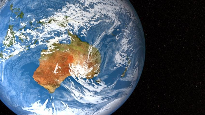
Researchers from Northwestern University and the University of New Mexico report evidence for potentially oceans worth of water deep beneath the United States. Though not in the familiar liquid form — the ingredients for water are bound up in rock deep in the Earth’s mantle — the discovery may represent the planet’s largest water reservoir.

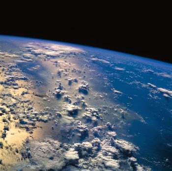
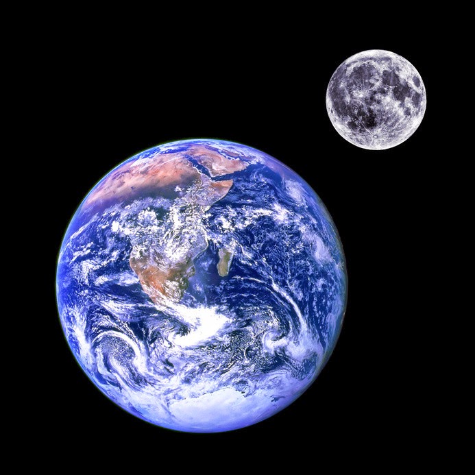
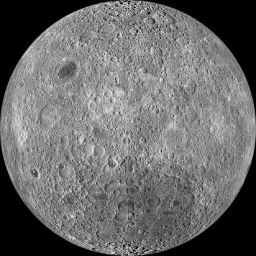
The presence of liquid water on the surface is what makes our “blue planet” habitable, and scientists have long been trying to figure out just how much water may be cycling between Earth’s surface and interior reservoirs through plate tectonics.

Northwestern geophysicist Steve Jacobsen and University of New Mexico seismologist Brandon Schmandt have found deep pockets of magma located about 400 miles beneath North America, a likely signature of the presence of water at these depths. The discovery suggests water from the Earth’s surface can be driven to such great depths by plate tectonics, eventually causing partial melting of the rocks found deep in the mantle.

The findings, to be published June 13 in the journal Science, will aid scientists in understanding how the Earth formed, what its current composition and inner workings are and how much water is trapped in mantle rock.

“Geological processes on the Earth’s surface, such as earthquakes or erupting volcanoes, are an expression of what is going on inside the Earth, out of our sight,” said Jacobsen, a co-author of the paper. “I think we are finally seeing evidence for a whole-Earth water cycle, which may help explain the vast amount of liquid water on the surface of our habitable planet. Scientists have been looking for this missing deep water for decades.”

Scientists have long speculated that water is trapped in a rocky layer of the Earth’s mantle located between the lower mantle and upper mantle, at depths between 250 miles and 410 miles. Jacobsen and Schmandt are the first to provide direct evidence that there may be water in this area of the mantle, known as the “transition zone,” on a regional scale. The region extends across most of the interior of the United States.

Schmandt, an assistant professor of geophysics at the University of New Mexico, uses seismic waves from earthquakes to investigate the structure of the deep crust and mantle. Jacobsen, an associate professor of Earth and planetary sciences at Northwestern’s Weinberg College of Arts and Sciences, uses observations in the laboratory to make predictions about geophysical processes occurring far beyond our direct observation.

The study combined Jacobsen’s lab experiments in which he studies mantle rock under the simulated high pressures of 400 miles below the Earth’s surface with Schmandt’s observations using vast amounts of seismic data from the USArray, a dense network of more than 2,000 seismometers across the United States.

Jacobsen’s and Schmandt’s findings converged to produce evidence that melting may occur about 400 miles deep in the Earth. H2O stored in mantle rocks, such as those containing the mineral ringwoodite, likely is the key to the process, the researchers said.

“Melting of rock at this depth is remarkable because most melting in the mantle occurs much shallower, in the upper 50 miles,” said Schmandt, a co-author of the paper. “If there is a substantial amount of H2O in the transition zone, then some melting should take place in areas where there is flow into the lower mantle, and that is consistent with what we found.”

If just one percent of the weight of mantle rock located in the transition zone is H2O, that would be equivalent to nearly three times the amount of water in our oceans, the researchers said.

This water is not in a form familiar to us — it is not liquid, ice or vapor. This fourth form is water trapped inside the molecular structure of the minerals in the mantle rock. The weight of 250 miles of solid rock creates such high pressure, along with temperatures above 2,000 degrees Fahrenheit, that a water molecule splits to form a hydroxyl radical (OH), which can be bound into a mineral’s crystal structure.

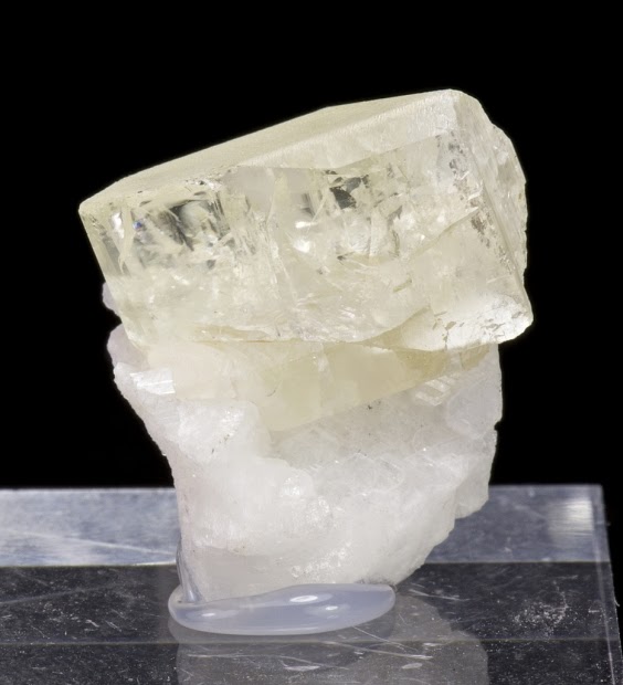
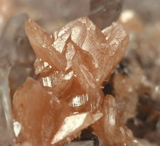
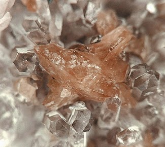
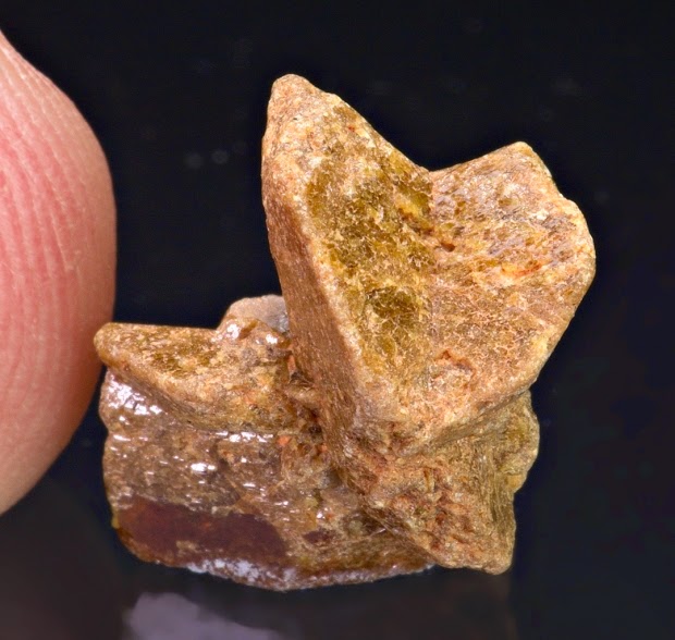
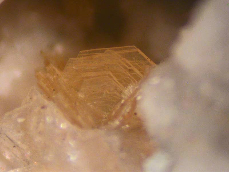
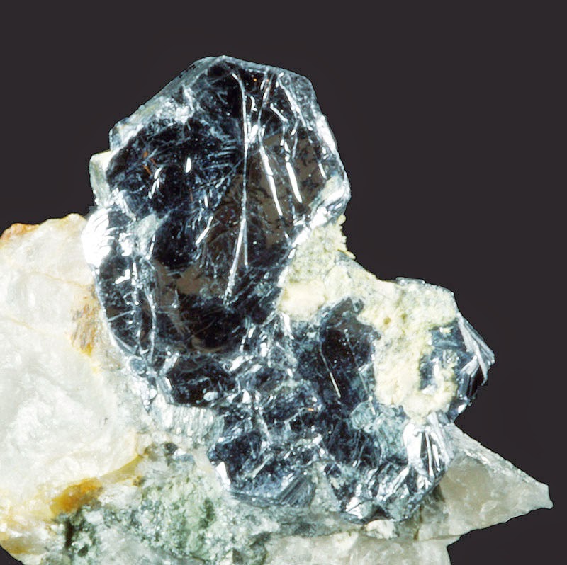
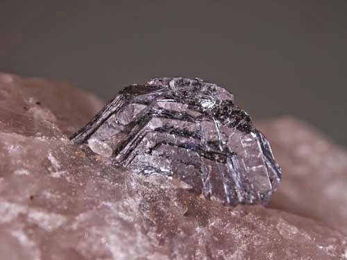
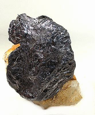
Schmandt and Jacobsen’s findings build on a discovery reported in March in the journal Nature in which scientists discovered a piece of the mineral ringwoodite inside a diamond brought up from a depth of 400 miles by a volcano in Brazil. That tiny piece of ringwoodite — the only sample in existence from within the Earth — contained a surprising amount of water bound in solid form in the mineral.

“Whether or not this unique sample is representative of the Earth’s interior composition is not known, however,” Jacobsen said. “Now we have found evidence for extensive melting beneath North America at the same depths corresponding to the dehydration of ringwoodite, which is exactly what has been happening in my experiments.”

For years, Jacobsen has been synthesizing ringwoodite, colored sapphire-like blue, in his Northwestern lab by reacting the green mineral olivine with water at high-pressure conditions. (The Earth’s upper mantle is rich in olivine.) He found that more than one percent of the weight of the ringwoodite’s crystal structure can consist of water — roughly the same amount of water as was found in the sample reported in the Nature paper.

“The ringwoodite is like a sponge, soaking up water,” Jacobsen said. “There is something very special about the crystal structure of ringwoodite that allows it to attract hydrogen and trap water. This mineral can contain a lot of water under conditions of the deep mantle.”

For the study reported in Science, Jacobsen subjected his synthesized ringwoodite to conditions around 400 miles below the Earth’s surface and found it forms small amounts of partial melt when pushed to these conditions. He detected the melt in experiments conducted at the Advanced Photon Source of Argonne National Laboratory and at the National Synchrotron Light Source of Brookhaven National Laboratory.

Jacobsen uses small gem diamonds as hard anvils to compress minerals to deep-Earth conditions. “Because the diamond windows are transparent, we can look into the high-pressure device and watch reactions occurring at conditions of the deep mantle,” he said. “We used intense beams of X-rays, electrons and infrared light to study the chemical reactions taking place in the diamond cell.”

Jacobsen’s findings produced the same evidence of partial melt, or magma, that Schmandt detected beneath North America using seismic waves. Because the deep mantle is beyond the direct observation of scientists, they use seismic waves — sound waves at different speeds — to image the interior of the Earth.

“Seismic data from the USArray are giving us a clearer picture than ever before of the Earth’s internal structure beneath North America,” Schmandt said. “The melting we see appears to be driven by subduction — the downwelling of mantle material from the surface.”

The melting the researchers have detected is called dehydration melting. Rocks in the transition zone can hold a lot of H2O, but rocks in the top of the lower mantle can hold almost none. The water contained within ringwoodite in the transition zone is forced out when it goes deeper (into the lower mantle) and forms a higher-pressure mineral called silicate perovskite, which cannot absorb the water. This causes the rock at the boundary between the transition zone and lower mantle to partially melt.

“When a rock with a lot of H2O moves from the transition zone to the lower mantle it needs to get rid of the H2O somehow, so it melts a little bit,” Schmandt said. “This is called dehydration melting.”

“Once the water is released, much of it may become trapped there in the transition zone,” Jacobsen added.

Just a little bit of melt, about one percent, is detectible with the new array of seismometers aimed at this region of the mantle because the melt slows the speed of seismic waves, Schmandt said.

Journal Reference:

B. Schmandt, S. D. Jacobsen, T. W. Becker, Z. Liu, K. G. Dueker. Dehydration melting at the top of the lower mantle. Science, 2014; 344 (6189): 1265 DOI: 10.1126/science.1253358

Note : The above story is based on materials provided by Northwestern University.

‘Pocket sauropod’ sheds light on giant’s evolution

Europasaurus holgeri skull reconstruction in A, left lateral; B, occipital; and C, dorsal views. Credit: Image courtesy of Taylor & Francis

In a new study published in Journal of Systematic Palaeontology presents a detailed description of the skull bones of a dwarf sauropod, together with an updated reconstruction of an adult Europasaurus skull.
At 40 metres long and 100 tonnes in weight, and with an exceptionally long neck and small head, the herbivorous sauropod dinosaurs were the largest animals ever to have walked the Earth. In 2006, fossil remains of a diminutive form of sauropod – Europasaurus, measuring only 6 metres long and weighing just 0.8 tonnes – were discovered at a quarry in northern Germany. The fossils from the quarry are the best sauropod remains ever discovered, since they include most bones of the skull, as well as different growth stages.

In a new study published in Journal of Systematic Palaeontology, Martin Sander, Professor of Vertebrate Paleontology at the Steinmann-Institute of Geology, Mineralogy and Paleontology of the University of Bonn, and colleagues present a detailed description of the skull bones of this dwarf sauropod, together with an updated reconstruction of an adult Europasaurus skull.

In the Late Jurassic, 150 million years ago, Europe was an archipelago, and most reptile fossils from the continent are those of marine species. The few dinosaur remains that have been found would have been washed into the sea from the islands of the archipelago. Europasaurus would have lived on one of these islands, evolving as a dwarf island species.

Earlier analysis of backbone remains had suggested the existence of two different types (sizes) of Europasaurus. The current study, in its extensive analysis of the skull remains, confirms this dimorphism.

There are several hypotheses for the dimophism observed in the Europasaurus remains. The two types could be examples of male and female sauropods. Another possibility is that populations from two different islands have been preserved in the quarry. A third theory is that the quarry has preserved two populations that were separated in time by several thousand years.

The study contributes to an understanding of the evolutionary dwarfing of Europasaurus, which in turn sheds light on the unique gigantism of sauropod dinosaurs. The fossils will continue to yield important insights into sauropod dinosaur evolution and biology for years to come, and researchers hope that new fossils will continue to be found at the quarry for many years to come.

Journal Reference:

Jean Sebastian Marpmann, José Luis Carballido, P. Martin Sander, Nils Knötschke. Cranial anatomy of the Late Jurassic dwarf sauropodEuropasaurus holgeri(Dinosauria, Camarasauromorpha): ontogenetic changes and size dimorphism. Journal of Systematic Palaeontology, 2014; 1 DOI: 10.1080/14772019.2013.875074

Note : The above story is based on materials provided by Taylor & Francis.

Montroydite

Montroydite Locality: Terlingua District, Brewster Co., Texas, USA Photo Copyright © 2003 Robert O. Meyer

Chemical Formula: HgO
Locality: Terlingua, Texas, USA.
Name Origin: Named for Montroyd Sharp, an owner of the mercury deposit at Terlingua, Texas, USA.

History

Discovery date : 1903
Town of Origin : TERLINGUA, BREWSTER CO., TEXAS
Country of Origin : USA

Optical properties

Optical and misc. Properties:     Transparent to Translucent
Refractive Index : from 2,37 to 2,65
Axial angle 2V: LARGE

Physical Properties

Cleavage: {010} Perfect
Color:     Red, Brownish red, Brown.
Density: 11.2
Diaphaneity: Transparent to Translucent
Fracture: Sectile – Curved shavings or scrapings produced by a knife blade, (e.g. graphite).
Hardness: 1.5-2 – Talc-Gypsum
Luminescence: Non-fluorescent.
Luster: Adamantine
Magnetism: Nonmagnetic
Streak: reddish orange

Photos :

Montroydite Locality: Socrates Mine, Castle Rock Springs area, West Mayacmas District, Mayacmas Mts (Mayacamas Mts), Sonoma Co., California, USA Field of view: 5.6mm Photo Copyright © Marko Burkhardt
Montroydite Location: Terlingua, Brewster County, Texas, USA. Copyright: © Jeff Weissman

Chilean scientists make huge fossil find

Remains of ichthyosaur, which lived between the Triassic and Cretaceous periods, unearthed in Torres del Paine national park

Paleontologists have discovered nearly 50 entire ichthyosaur fossils in southern Chile, one of the best finds of its kind to date, they said.
The fossils of the dolphin-like creature were unearthed in the Torres del Paine national park, whose spiky peaks and brilliant turquoise lakes make it a magnet for trekkers and nature lovers.

Researchers said the marine reptiles, buried by rocks from the Tyndall glacier, lived between the Triassic and Cretaceous periods, which extended from 250m to 66m years ago.

“This great ichthyosaur cemetery, the way the remains are deposited, is unique,” Christian Salazar, paleontologist researcher and natural history museum curator, said.

“It’s the most recent great find in their history. That’s going to answer a lot of questions about how they became extinct, where they migrated to, how they lived,” he said.

The 46 fossils were found in about three months of excavating, Salazar added, and more were likely to be found.

Video :

The above story is based on materials provided by theguardian.com


How Earth avoided global warming, last time around

Credit: NASA

Geochemists have calculated a huge rise in atmospheric CO2 was only avoided by the formation of a vast mountain range in the middle of the ancient supercontinent, Pangea. This work is being presented to the Goldschmidt geochemistry conference in Sacramento, California.
Around 300 million years ago, plate tectonics caused the continents to aggregate into a giant supercontinent, known as “Pangea.” The sheer size of the continent meant that much of the land surface was far from the sea, and so the continent became increasingly arid due to lack of humidity. This aridity meant that rock weathering was reduced; normally, a reduction in rock weathering means that CO2 levels rise, yet in spite of this CO2 levels — which had been falling prior to the mountain formation- continued to drop, eventually undergoing the most significant drop in atmospheric CO2 of the last 500 million years. This phenomenon has remained unexplained, until now.

Now a group of French scientists from the CNRS in Toulouse have produced a model which seems to explain this contradiction. The period coincides with the rise of a vast series of mountains in the interior of Pangea, the “Hercynian” mountains.” These mountains arose in a wide belt, running from what is now the Appalachians, through to Ireland, South-Western England, through Paris and the Alps into Germany, and on further East.

According to team leader, Dr Yves Godderis (CNRS, Toulouse, France): “The formation of these mountains meant that the rock weathering, which was threatening to slow to a walk through much of the supercontinent, was able to continue. The steep slopes of these Hercynian mountains produced physical erosion. Occurring in a humid equatorial environment, this physical erosion promoted rock weathering and removing CO2 from the atmosphere.”

He continued, “We believe that it is this which led to the dramatic drop in atmospheric levels of CO2. We estimate that if it hadn’t been for the formation of the Hercynian mountains, the atmospheric CO2 levels would have reached around 25 times the pre-industrial level, meaning that CO2 levels would have reached around 7000 ppm (parts per million). Let me put that into a present-day context; the current atmospheric CO2 levels are around 400 ppm, so this means that we would have seen CO2 rise to a level around 17 times current levels. This would obviously have had severe effects on the environment of that time. But the formation of the mountains in fact contributed to the greatest fall in atmospheric CO2 in the last 500 million years.”

The team believes that even if the mountains had not formed and CO2 levels rose sharply, this would not have led to a runaway greenhouse effect as happened on Venus, because the increasing temperatures would have led to rocks being ultimately weathered, heat compensating for the scarcity of water. Rock weathering would have removed CO2 from the atmosphere, thus stopping the rising temperatures.

“So it would eventually have been self-correcting” said Dr Godderis, “but there’s no doubt that this would have stalled Earth’s temperature at a high level for a long, long time. The world would look very different today if these mountains had not developed when they did.

This is a new model which explains some of the events in the 80 million years following the start of the Carboniferous period, and of course the ideas need to be confirmed before we can be sure that the model is completely accurate. The take-home message is that the factors affecting atmospheric CO2 over geological periods of time are complex, and our understanding is still evolving.”

Note : The above story is based on materials provided by European Association of Geochemistry.

Montebrasite

Montebrasite with Albite Telirio claim, Linopolis, Divino das Laranjeiras, Doce valley, Minas Gerais, Brazil Size: 2.0 x 2.0 x 1.3 cm (thumbnail) © danweinrich

Chemical Formula: LiAl(PO4)(OH)
Locality: Montebras, Creuse, France.
Name Origin: Named for the locality in 1872.

History

Discovery date: 1871
Town of Origin : MONTEBRAS, SOUMANS, CREUSE
Country of Origin : FRANCE

Optical properties

Optical and misc. Properties : Transparent to Translucent
Refractive Index: from 1,57 to 1,62
Axial angle 2V: 81°30′

Physical Properties

Cleavage: {100} Perfect, {110} Good, {011} Distinct
Color:     Bluish, Colorless, Greenish, Greenish gray, Gray white.
Density: 3.027
Diaphaneity: Transparent to Translucent
Fracture: Brittle – Conchoidal – Very brittle fracture producing small, conchoidal fragments.
Hardness: 5.5-6 – Knife Blade-Orthoclase
Luster: Vitreous – Greasy
Streak: white

Photos :

Montebrasite 6.5×3.8×1.2 cm Fazenda Pomeroli, Linopolis District Divino das Laranjeiras, Minas Gerais Brazil Copyright © David K. Joyce Minerals
Montebrasite 6.2×2.2×0.7 cm Fazenda Pomeroli, Linopolis District Divino das Laranjeiras, Minas Gerais Brazil Copyright © David K. Joyce Minerals
Montebrasite Minas Gerais, Brazil Thumbnail, 12.9 mm x 7.7 mm ; 2.92 cts © irocks

Are Quebecers irrationally opposed to shale gas?

Quebecers are particularly hostile toward the development of shale gas, but this aversion is driven less by ‘not in my backyard’ (NIMBY) attitudes than ‘not in anyone’s backyard’ (NIABY), according to a comparative study of 2,500 Quebecers and Americans conducted by Éric Montpetit and Erick Lachapelle of the University of Montreal’s Department of Political Science. Professors Barry G. Rabe of the University of Michigan and Christopher P. Borick of Muhlenberg College co-led the study in the United States. Credit: University of Montreal

University study shows strong sense of egalitarianism skews perception of risks and benefits
Quebecers are particularly hostile toward the development of shale gas, but this aversion is driven less by ‘not in my backyard’ (NIMBY) attitudes than ‘not in anyone’s backyard (NIABY), according to a comparative study of 2,500 Quebecers and Americans conducted by Éric Montpetit and Erick Lachapelle of the University of Montreal’s Department of Political Science. Professors Barry G. Rabe of the University of Michigan and Christopher P. Borick of Muhlenberg College co-led the study in the United States.

The study, commissioned by Quebec’s Ministry of the Environment, has provided insight into why Quebecers oppose the development of shale gas so fiercely. According to the study, political-cultural traits are the source of bias in the perception of the issues. “The study was conducted among 1,500 Quebec respondents, a large proportion of whom were sampled from the Montérégie region, where there are shale gas development projects, and 1,000 respondents from two U.S. states, Michigan and Pennsylvania,” Montpetit explained. “Our findings showed that opposition is much stronger in Quebec than in the United States, and this is true across the province, regardless of where one lives. The main reason is not related to a lack of information or proximity to existing wells. Their aversion is rather due to the importance of political values that shape the public’s understanding of issues more generally.”

In the study, two values help explain differences in in public perception: egalitarianism and individualism. Egalitarians have high expectations regarding social justice and equality between citizens, while individualists value personal success. “We found that egalitarians are more likely to perceive risks related to hydraulic fracturing methods used to extract gas from shale, while individualists are more likely to perceive the benefits,” Montpetit said. “This is true in Quebec and the United States. That is to say, Quebecers are no less rational in their perceptions of the issue. The difference is that there are more egalitarians here than south of the border. This explains why opposition to shale gas is so strong in Quebec compared to what we find in the United States.”

The way journalists talk about the issues related to shale gas development has also played a role in perceptions. “There has been little coverage in the media about the fact that Quebecers are large gas consumers and that the gas is currently imported from Alberta. Developing this sector would allow us to be more independent in terms of energy. It is an important argument that has been mostly ignored,” Montpetit said. “Much discussion has focused on large multinationals from western Canada or abroad who come to explore and pay little in terms of royalities to the Quebec government.” This way of talking about shale gas resonates with egalitarian values. Egalitarians are sensitive to this type of discourse, which refers to issues of social justice and equality. “Egalitarians say ‘we pay for the cost of extraction, and the profits go into the pockets of big corporations, who are often from outside the province!’ This causes resentment, causing them to be more likely to be concerned about environmental risks.”

The problem is that we don’t exactly know about the possible adverse effects of shale gas development. “Studies from the U.S. have reported methane leaks in Pennsylvania, but in other places, like Arkansas, evidence is mixed. Soil, rock, and groundwater characteristics are very important for determining risks. In order to better evaluate these risks for Quebec, these characteristics must be known. But there has so fare been very little exploration in the province, which prevents us from knowing the real risks of shale gas extraction on our territory,” Montpetit said.

The study shows however that new information from a credible source would likely change opinions in the United States and Quebec. “A significant proportion of Quebec egalitarians would reduce their fears about the risks if the Office of Public Hearings on the Environment and credible scientists endorsed a report showing that the risks of shale gas extraction were low,” Montpetit said. “However, such a change in the perception of risks would be insufficient to transform the high degree of reluctance of Quebecers into majority support. Note that opposition in Quebec toward shale gas extraction is currently at 70%. The main reason for this opposition is the great fear associated with potential risks. Credible sources would reduce this fear, but opposition would remain above 50%. On the other hand, in the United States, particularly in Pennsylvania, opinion is almost equally divided between those in favour and those against. A reassuring study about the risks of shale gas extraction would therefore have greater impact in Pennsylvania than in Quebec.”

Note : The above story is based on materials provided by University of Montreal

Newly discovered paddle prints show how ancient sea reptiles swam

Print impressions (lower slab) and the mould. Photograph taken within minutes of uncovering a new trackway, showing the imprint moulds on the overlying bed bottom and the imprints on the top of bed 107. The animal was moving from left to right. Credit: © Chengdu Center of China Geological Survey.

Trackways formed on an ancient seabed have shed new light on how nothosaurs, ancient marine reptiles that lived during the age of the dinosaurs, propelled themselves through water. The evidence is described by a team from Bristol and China in Nature Communications today.
During the Mesozoic, 252-66 million years ago, the seas were ruled by a variety of marine reptiles. One of the earliest groups were the nothosaurs, voracious semi-aquatic hunters with elongate bodies and paddle-like limbs. They were the top predators of the Triassic coasts, some 245 million years ago.

Their mode of swimming has long been debated: did they row themselves along with a back-and-forth motion of their limbs, or did they ‘fly’ underwater, sweeping their forepaddles in a figure-eight motion like a modern penguin?

Scientists from the University of Bristol and colleagues in China studied trackways formed on an ancient seabed which were recently discovered in Yunnan, southwest China. The tracks consist of slots in the mud arranged in pairs, and in long series of ten to fifty that follow straight lines and sweeping curves.

The size and spacing of the paired markings indicate that they were created by the forelimbs of nothosaurs, representing animals ranging in size from over 3 metres to less than a metre in length.

They demonstrate that that these reptiles moved over the seafloor by rowing their forelimbs in unison, the first direct evidence of how these creatures propelled themselves in the water.

Two types of nothosaurs, the large Nothosaurus and the diminutive Lariosaurus, known from complete fossil skeletons from the Triassic of southern China, are the likely trackmakers.

Professor Qiyue Zhang from Chengdu Center of China Geological Survey, leader of the research, said: “We interpret the tracks as foraging trails. The nothosaur was a predator, and this was a smart way to feed. As its paddles scooped out the soft mud, they probably disturbed fishes and shrimps, which it snapped up with needle-sharp teeth.”

The tracks come from localities around Luoping in Yunnan, a well known site of exceptional fossil preservation that has yielded thousands of exquisite fossils of sea creatures, and occasional plants and small terrestrial animals blown in from the nearby islands.

Professor Michael Benton from the University of Bristol, one of the co-authors of the research, said: “When I first saw the site, I couldn’t believe the amazing quality of the fossils. It’s quite unusual to find skeletons of marine reptiles such as the nothosaurs so close to evidence of their tracks.”

Luoping and other sites in South China are shedding light on the recovery of life from the devastating Permo-Triassic mass extinction event which wiped out more than 90 per cent of all species on Earth. Nothosaurs and other marine reptiles were new members of the recovering ecosystems.

Co-author Professor Shixue Hu, also from Chengdu Center of China Geological Survey, said: “Here we see a detailed snapshot of how life was within 8 million years of the mass extinction. It took all that time for Earth to settle down from the cataclysm, and the arrival of these large, complex marine predators shows us the ecosystems had finally rebuilt themselves, and life could be said to have recovered from the crisis.”

Journal Reference:

Qiyue Zhang, Wen Wen, Shixue Hu, Michael J. Benton, Changyong Zhou, Tao Xie, Tao Lü, Jinyuan Huang, Brian Choo, Zhong-Qiang Chen, Jun Liu, Qican Zhang. Nothosaur foraging tracks from the Middle Triassic of southwestern China. Nature Communications, 2014; 5 DOI: 10.1038/ncomms4973

Note : The above story is based on materials provided by University of Bristol.

Monazite

Monazite-(Ce) Locality: Contacto vein, Siglo XX mine, Llallagua, Bustillo Province, Potos Department, Bolivia Specimen Size: 7.1 x 6.4 x 4.0 cm (small cabinet) Largest crystal: 0.6 cm. © minclassics

Chemical Formula: (Ce,La,Nd,Th)(PO4)
Locality:     Mars Hill, Madison County, North Carolina.
Name Origin: From the Greek monazeis – “to be alone” in allusion to its isolated crystals and their rarity when first found.
Monazite is a reddish-brown phosphate mineral containing rare earth metals. It occurs usually in small isolated crystals. There are at least four different kinds of monazite, depending on relative elemental composition of the mineral:

  • monazite-Ce (Ce, La, Pr, Nd, Th, Y)PO4
  • monazite-La (La, Ce, Nd, Pr)PO4
  • monazite-Nd (Nd, La, Ce, Pr)PO4
  • monazite-Sm (Sm, Gd, Ce, Th)PO4

The elements in parentheses are listed in the order in which they are in relative proportion within the mineral: lanthanum is the most common rare earth in monazite-La, and so forth. Silica, SiO2, will be present in trace amounts, as well as small amounts of uranium and thorium. Due to the alpha decay of thorium and uranium, monazite contains a significant amount of helium, which can be extracted by heating.

Monazite is an important ore for thorium, lanthanum, and cerium. It is often found in placer deposits. India, Madagascar, and South Africa have large deposits of monazite sands. The deposits in India are particularly rich in monazite. It has a hardness of 5.0 to 5.5 and is relatively dense, about 4.6 to 5.7 g/cm3.

Optical properties

Optical and misc. Properties: Translucent
Refractive Index: from 1,78 to 1,84
Axial angle 2V : ~12°

Physical Properties

Cleavage: {001} Distinct, {100} Indistinct
Color: Brown, Colorless, Greenish, Gray white, Yellow.
Density: 4.8 – 5.5, Average = 5.15
Diaphaneity: Subtransparent to subtranslucent
Fracture: Conchoidal – Fractures developed in brittle materials characterized by smoothly curving surfaces, (e.g. quartz).
Hardness: 5-5.5 – Apatite-Knife Blade
Luminescence: Non-fluorescent.
Luster: Adamantine – Resinous
Streak: grayish white

Photos :

Monazite-(Ce) Locality: Contacto vein, Siglo XX mine, Llallagua, Bustillo Province, Potos Department, Bolivia Specimen Size: 5.2 x 3.2 x 2.4 cm (small cabinet) Largest crystal: 0.7 cm. © minclassics
Monazite-(Ce) Buenopolis, Minas Gerais, Brazil Size: 1.5 x 1.2 x 1.0 cm (thumbnail) © danweinrich
Monazite-(Ce) Locality: Contacto vein, Siglo XX mine, Llallagua, Bustillo Province, Potos Department, Bolivia Specimen Size: 3.6 x 2.3 x 1.8 cm (miniature) Largest crystal: 1.1 cm. © minclassics

New permafrost is forming around shrinking Arctic lakes, but will it last?

As the climate changes and the permafrost thaws Twelvemile Lake has started receding very rapidly. Thirty years ago the band of yellow shrubs and muddy shoreline would have been underwater. The lake is now 5 metres or 15 ft shallower than it would have been then. — at Twelvemile Lake. Credit: Image courtesy of McGill University

Researchers from McGill and the U.S. Geological Survey, more used to measuring thawing permafrost than its expansion, have made a surprising discovery. There is new permafrost forming around Twelvemile Lake in the interior of Alaska. But they have also quickly concluded that, given the current rate of climate change, it won’t last beyond the end of this century.
Twelvemile Lake, and many others like it, is disappearing. Over the past thirty years, as a result of climate change and thawing permafrost, the lake water has been receding at an alarming rate. It is now 5 metres or 15 feet shallower than it would have been three decades ago. This is a big change in a very short time.

As the lake recedes, bands of willow shrubs have grown up on the newly exposed lake shores over the past twenty years. What Martin Briggs from the U.S. Geological Survey and Prof. Jeffrey McKenzie from McGill’s Dept. of Earth and Planetary Science have just discovered is that the extra shade provided by these willow shrubs has both cooled and dried the surrounding soil, allowing new permafrost to expand beneath them.

The researchers were initially very excited by this find. But after analyzing the thickness of the new permafrost and projecting how it will be affected by continued climate change and the expected rise in temperature in the Arctic of 3°C, they arrived at the conclusion that the new permafrost won’t last beyond the end of the century.

Journal Reference:

Martin A. Briggs, Michelle A. Walvoord, Jeffrey M. McKenzie, Clifford I. Voss, Frederick D. Day-Lewis, John W. Lane. New permafrost is forming around shrinking Arctic lakes, but will it last? Geophysical Research Letters, 2014; 41 (5): 1585 DOI: 10.1002/2014GL059251

Note : The above story is based on materials provided by McGill University.

Earth is around 60 million years older than previously thought — and so is the moon, new research finds

Relative sizes of Earth and moon. Credit: © Antony McAulay / Fotolia

Work presented today at the Goldschmidt Geochemistry Conference in Sacramento, California shows that the timing of the giant impact between Earth’s ancestor and a planet-sized body occurred around 40 million years after the start of solar system formation. This means that the final stage of Earth’s formation is around 60 million years older than previously thought.
Geochemists from the University of Lorraine in Nancy, France have discovered an isotopic signal which indicates that previous age estimates for both the Earth and the Moon are underestimates. Looking back into “deep time” it becomes more difficult to put a date on early Earth events. In part this is because there is little “classical geology” dating from the time of the formation of the Earth — no rock layers, etc. So geochemists have had to rely on other methods to estimate early Earth events. One of the standard methods is measuring the changes in the proportions of different gases (isotopes) which survive from the early Earth.

Guillaume Avice and Bernard Marty analysed xenon gas found in South African and Australian quartz, which had been dated to 3.4 and 2.7 billion years respectively. The gas sealed in this quartz is preserved as in a “time capsule,” allowing Avice and Marty to compare the current isotopic ratios of xenon, with those which existed billions of years ago. Recalibrating dating techniques using the ancient gas allowed them to refine the estimate of when the Earth began to form. This allows them to calculate that the Moon-forming impact is around 60 million years (+/- 20 m. y.) older than had been thought.

Previously, the time of formation of the Earth’ s atmosphere had been estimated at around 100 million years after the solar system formation. As the atmosphere would not have survived the Moon-forming impact, this revision puts the age up to 40 million years after the solar sytem formation (so around 60 million years older than previously thought).

According to Guillaume Avice: “It is not possible to give an exact date for the formation of the Earth*. What this work does is to show that the Earth is older than we thought, by around 60 my.

“The composition of the gases we are looking at changes according the conditions they are found in, which of course depend on the major events in Earth’s history. The gas sealed in these quartz samples has been handed down to us in a sort of “time capsule.” We are using standard methods to compute the age of the Earth, but having access to these ancient samples gives us new data, and allows us to refine the measurement.”

The xenon gas signals allow us to calculate when the atmosphere was being formed, which was probably at the time the Earth collided with a planet-sized body, leading to the formation of the Moon. Our results mean that both the Earth and the Moon are older than we had thought.”

Bernard Marty added “This might seem a small difference, but it is important. These differences set time boundaries on how the planets evolved, especially through the major collisions in deep time which shaped the solar system.”

*The oldest rocks of the solar system have been dated to 4,568 my ago, so the Earth is younger than that.

Note : The above story is based on materials provided by European Association of Geochemistry.

Molybdenite

Gmelinite-(Na), Molybdenite 1.7×1.8×1.3 cm Mont Saint-Hilaire Quebec, Canada Copyright © David K. Joyce Minerals

Chemical Formula: MoS2
Locality: Common world wide occurrences.
Name Origin: Greek, molybdos = “lead.”

Molybdenite is a mineral of molybdenum disulfide, MoS2. Similar in appearance and feel to graphite, molybdenite has a lubricating effect that is a consequence of its layered structure. The atomic structure consists of a sheet of molybdenum atoms sandwiched between sheets of sulfur atoms. The Mo-S bonds are strong, but the interaction between the sulfur atoms at the top and bottom of separate sandwich-like tri-layers is weak, resulting in easy slippage as well as cleavage planes. Molybdenite crystallizes in the hexagonal crystal system as the common polytype 2H and also in the trigonal system as the 3R polytype.

Occurrence

Molybdenite occurs in high temperature hydrothermal ore deposits. Its associated minerals include pyrite, chalcopyrite, quartz, anhydrite, fluorite, and scheelite. Important deposits include the disseminated porphyry molybdenum deposits at Questa, New Mexico and the Henderson and Climax mines in Colorado. Molybdenite also occurs in porphyry copper deposits of Arizona, Utah, and Mexico.

The element rhenium is always present in molybdenite as a substitute for molybdenum, usually in the parts per million (ppm) range, but often up to 1–2%. High rhenium content results in a structural variety detectable by X-ray diffraction techniques. Molybdenite ores are essentially the only source for rhenium. The presence of the radioactive isotope rhenium-187 and its daughter isotope osmium-187 provides a useful geochronologic dating technique.

Optical properties

Optical and misc. Properties : Opaque
Reflective Power: 20,9-44,4% (580)

Physical Properties

Cleavage: {0001} Perfect
Color:     Black, Lead gray, Gray.
Density: 5.5
Diaphaneity: Opaque
Fracture: Sectile – Curved shavings or scrapings produced by a knife blade, (e.g. graphite).
Hardness: 1 – Talc
Luminescence: Non-fluorescent.
Luster: Metallic
Magnetism: Nonmagnetic
Streak: greenish gray

Photos :

Molybdenite Wutong Mine, Wuzhou Prefecture, Guangxi, China Specimen weight:10 gr. Crystal size:10 mm Overall size: 22mm x 22 mm x 10 mm © minservice
Molybdenite 9.9×6.3×6.5 cm Moly Hill Mine Riviere Heva Quebec, Canada Copyright © David K. Joyce Minerals
Molybdenite Crown Point Mine, Chelan County, Washington, USA Small Cabinet, 9 x 6.4 x 4.1 cm © irocks

Geologists confirm oxygen levels of ancient oceans

Earth’s landscape, as it may have looked more than 2.5 billion years ago. Credit: From a painting by Peter Sawyer, The Smithsonian Institute; Courtesy of Syracuse University

Geologists in the College of Arts and Sciences have discovered a new way to study oxygen levels in Earth’s oldest oceans.

Zunli Lu and Xiaoli Zhou, an assistant professor and Ph.D. student, respectively, in the Department of Earth Sciences, are part of an international team of researchers whose findings have been published by the journal Geology (Geological Society of America, 2014). Their research approach may have important implications for the study of marine ecology and global warming.

“More than 2.5 billion years ago, there was little to no oxygen in the oceans, as methane shrouded the Earth in a haze,” says Lu, a member of Syracuse University’s Low-Temperature Geochemistry Research Group. “Organisms practicing photosynthesis eventually started to overpower reducing chemical compounds [i.e., electron donors], and oxygen began building up in the atmosphere. This period has been called the Great Oxidation Event.”

Using a novel approach called iodine geochemistry, Lu, Zhou and their colleagues have confirmed the earliest appearance of dissolved oxygen in the ocean’s surface waters.

Central to their approach is iodate, a form of iodine that exists only in oxygenated waters. When iodate is detected in carbonate rocks in a marine setting, Lu and company are able to measure the elemental ratio of iodine to calcium. This measurement, known as a proxy for ocean chemistry, helps them figure out how much oxygen has dissolved in the water.

“Iodine geochemistry enables us to constrain oxygen levels in oceans that have produced calcium carbonate minerals and fossils,” says Lu, who developed the proxy. “What we’ve found in ancient rock reinforces the proxy’s reliability. Already, we’re using the proxy to better understand the consequences of ocean deoxygenation, due to rapid global warming.”

In addition to Lu and Zhou, the article was co-authored by Dalton S. Hardistry, a graduate student at the University of California, Riverside; Noah J. Planavsky, assistant professor of geology and geophysics at Yale University; Andrey Bekker, assistant professor of geological sciences at the University of Manitoba (Canada); Pascal Philippot, professor of physics at the University of Denis Diderot in Paris (France); and Timothy W. Lyons, professor of biogeochemistry at UC Riverside.

Journal Reference:

D. S. Hardisty, Z. Lu, N. J. Planavsky, A. Bekker, P. Philippot, X. Zhou, T. W. Lyons. An iodine record of Paleoproterozoic surface ocean oxygenation. Geology, 2014; DOI: 10.1130/G35439.1

Note : The above story is based on materials provided by Syracuse University.

Dark side of the moon: 55-year-old mystery solved

Far side of the moon: this is a composite image of the lunar farside taken by the Lunar Reconnaissance Orbiter in June 2009, note the absence of dark areas. Credit: NASA

The Man in the Moon appeared when meteoroids struck Earth-facing side of the moon creating large flat seas of basalt that we see as dark areas called maria. But no “face” exists on farside of the moon and now, Penn State astrophysicists think they know why.
“I remember the first time I saw a globe of the moon as a boy, being struck by how different the farside looks,” said Jason Wright, assistant professor of astrophysics. “It was all mountains and craters. Where were the maria? It turns out it’s been a mystery since the fifties.”

This mystery is called the Lunar Farside Highlands Problem and dates back to 1959, when the Soviet spacecraft Luna 3 transmitted the first images of the “dark” side of the moon back to Earth. It was called the dark side because it was unknown, not because sunlight does not reach it. Researchers immediately noticed that fewer “seas” or maria existed on this portion of the moon that always faces away from Earth.

Wright, Steinn Sigurdsson, professor of astrophysics and Arpita Roy, graduate student in astronomy and astrophysics, and lead author of the study, realized that the absence of maria, which is due to a difference in crustal thickness between the side of the moon we see and the hidden side, is a consequence of how the moon originally formed. The researchers report their results in today’s (June 9) Astrophysical Journal Letters.

The general consensus on the moon’s origin is that it probably formed shortly after Earth and was the result of a Mars-sized object hitting Earth with a glancing, but devastating impact. This Giant Impact Hypothesis suggests that the outer layers of Earth and the object were flung into space and eventually formed the moon.

“Shortly after the giant impact, Earth and the moon were very hot,” said Sigurdsson.

Earth and the impact object did not just melt; parts of them vaporized, creating a disk of rock, magma and vapor around Earth.

“The moon and Earth loomed large in each others skies when they formed, ” said Roy.

The geometry was similar to the rocky exoplanets recently discovered very close to their stars, said Wright. The moon was 10 to 20 times closer to Earth than it is now, and the researchers found that it quickly assumed a tidally locked position with the rotation time of the moon equal to the orbital period of the moon around Earth. The same real estate on the moon has probably always faced Earth ever since. Tidal locking is a product of the gravity of both objects.

The moon, being much smaller than Earth cooled more quickly. Because Earth and the moon were tidally locked from the beginning, the still hot Earth — more than 2500 degrees Celsius — radiated towards the near side of the moon. The far side, away from the boiling Earth, slowly cooled, while Earth-facing side was kept molten creating a temperature gradient between the two halves.

This gradient was important for crustal formation on the moon. The moon’s crust has high concentrations of aluminum and calcium, elements that are very hard to vaporize.

“When rock vapor starts to cool, the very first elements that snow out are aluminum and calcium,” said Sigurdsson.

Aluminum and calcium would have preferentially condensed in the atmosphere of the cold side of the moon because the nearside was still too hot. Thousands to millions of years later, these elements combined with silicates in the moon’s mantle to form plagioclase feldspars, which eventually moved to the surface and formed the moon’s crust, said Roy. The farside crust had more of these minerals and is thicker.

The moon has now completely cooled and is not molten below the surface. Earlier in its history, large meteoroids struck the nearside of the moon and punched through the crust, releasing the vast lakes of basaltic lava that formed the nearside maria that make up the man in the moon. When meteoroids struck the farside of the moon, in most cases the crust was too thick and no magmatic basalt welled up, creating the dark side of the moon with valleys, craters and highlands, but almost no maria.

Journal Reference:

Arpita Roy et al. Earthshine on a Young Moon: Explaining the Lunar Farside Highlands. Astrophysical Journal Letters., June 2014 DOI: 10.1088/2041-8205/788/2/L42

Note : The above story is based on materials provided by Penn State.

Mimetite

Mimetite Hat Yai, Hat Yai District, Songkhla Province, Thailand Specimen weight:82 gr. Crystal size:to 0,75 cm Overall size:6,5 x 5 x 2,2 cm © minservice

Chemical Formula: Pb5(AsO4)3Cl
Locality: Treue Freundschaft Mine, Johanngeorgenstadt, Erzgebirge, Saxony, Germany.
Name Origin: From the Greek mimethes – “imitator” , because of its resemblance to pyromorphite.

Mimetite, whose name derives from the Greek Μιμητής mimetes, meaning “imitator”, is a lead arsenate chloride mineral (Pb5(AsO4)3Cl) which forms as a secondary mineral in lead deposits, usually by the oxidation of galena and arsenopyrite. The name is a reference to mimetite’s resemblance to the mineral pyromorphite. This resemblance is not coincidental, as mimetite forms a mineral series with pyromorphite (Pb5(PO4)3Cl) and with vanadinite (Pb5(VO4)3Cl). Notable occurrences are Mapimi, Durango, Mexico and Tsumeb, Namibia.

History

Discovery date : 1832

Optical properties

Optical and misc. Properties : Subtransparent to translucent

Physical Properties

Cleavage: {1011} Imperfect
Color:     White, Yellow, Orange, Brown, Red.
Density: 7.1 – 7.24, Average = 7.17
Diaphaneity: Subtransparent to translucent
Fracture: Brittle – Conchoidal – Very brittle fracture producing small, conchoidal fragments.
Hardness: 3.5-4 – Copper Penny-Fluorite
Luminescence:     Fluorescent, Short UV=orange, Long UV=orange.
Luster: Adamantine – Resinous
Streak: white

Photos :

Mimetite Ojuela Mine, Mapimi, Durango, Mexico Small Cabinet, 8.5 x 4.5 x 2.7 cm © irocks
Mimetite Bilbao Mine, La Blanca, Ojo Caliente, Zacatecas, Mexico ex. Consie & Dalton Prince Small Cabinet, 7 x 5.5 x 4.5 cm © irocks
Mimetite Grube Haus Baden, Sehringen, Baden-Württemberg, Germany Specimen weight:118 gr. Crystal size:to 0,4 cm Overall size: 70mm x 42 mm x 33 mm © minservice

Of dinosaurs and mathematics

Artistic rendering of Leptoceratops, a likely relative of Serendipaceratops arthurcclarkei by Peter Trusler. Credit: OIST

Dinosaurs and mathematics do not seem like an obvious pair, but for Professor Robert Sinclair and his Mathematical Biology Unit, they are a logical match. Sinclair was part of a team that recently published a paper in Alcheringa: An Australasian Journal of Palaeontology that reexamined the classification of a dinosaur bone found in Australia. Using his expertise in mathematics, Sinclair was able to help the paleontologists reclassify a single arm bone as belonging to a dinosaur family previously believed not to have existed in the Southern Hemisphere. This research may lead to revisions in the current thinking about how continents were connected in the ancient world.

The bone in question, an ulna, or arm bone, was found in southern Australia. The researchers named this new species of dinosaur Serendipaceratops arthurcclarkei, and classified it as belonging to the Neoceratopsia family, which includes the famous dinosaur Triceratops. Not long after that paper was published, another research group published a paper saying that the bone could not be ceratopsian, partly because that family of dinosaurs existed only in the Northern Hemisphere and the land masses had already split, therefore there was no way that a bone from that family could be found in Australia. One caveat to this logic is that the data used to determine when the continents split is based on fossil data. “It becomes a chicken and egg scenario,” says Sinclair. If the data used to establish a theory is then refuted by finding something unexpected, that theory should be challenged, which is not an easy thing to do.

This is where Sinclair can use mathematics to provide solid evidence for one theory or another. He is interested in using mathematics to solve difficult problems in fields of research where current methodologies are not sufficient. He was attracted to paleontology for this reason, particularly in his native Australia. After an invitation to speak at OIST, Dr. Thomas Rich, one of the Australian paleontologists on the paper, asked Sinclair for help in showing that the bone he had analyzed belonged to Ceratopsia.

Sinclair went about investigating whether the dimensions and characteristics of the bone matched other members of the Ceratopsia family, or whether they matched a different family. Sinclair said the challenge was to “use mathematics in a field where it is not commonly used or well understood and utilize it in a way that is understandable to those in the field.” First he had to find a characteristic that could be measured on the bone in question and the same type of bone in other species and families of dinosaurs, in this case, the flatness of the bone. He had to mathematically account for variability in the bones since fossils tend to become broken or deformed over time. Some paleontologists were still skeptical of what the mathematics really meant. This is where the hard work began, and Sinclair had to find other measurements to make and used several different mathematical techniques to show that they all reached the same conclusion.

In the end, he showed mathematical data of three different types in order to convince certain paleontologists that the bone in question belonged to the Ceratopsia family. The driving point for Sinclair is using mathematics to tackle difficult questions when conventional methods in the field are not sufficient. His statistical analysis, combined with other analyses provided by the co-authors, was convincing enough to put the bone back into the Ceratopsia family.

Sinclair says he is excited about people finding more dinosaur bones in Australia to see how it challenges the current thinking about what did and did not exist on the continent. As for his other endeavors, he looks forward to working in new fields and figuring out the “dance of what you would do as a mathematician and what is accepted in that community.” With that goal in mind, it is easy to see how dinosaurs and mathematics formed a logical pair for Sinclair.

Note : The above story is based on materials provided by Okinawa Institute of Science and Technology – OIST.

Echoes of ancient Earth identified by scientists?

Earth and galaxy (stock image). The currently favored theory says that the Moon was formed 4.5 billion years ago, when Earth collided with a Mars-sized mass, which has been given the name “Theia.” A group of scientists now believe that they have identified a sign that only part of Earth melted, and that an ancient part still exists within Earth’s mantle. Credit: © Tryfonov / Fotolia

A group of scientists believe that a previously unexplained isotopic ratio from deep within Earth may be a signal from material from the time before Earth collided with another planet-sized body, leading to the creation of the Moon. This may represent the echoes of the ancient Earth, which existed prior to the proposed collision 4.5 billion years ago. This work is being presented at the Goldschmidt conference in Sacramento, California.
The currently favored theory says that the Moon was formed 4.5 billion years ago, when Earth collided with a Mars-sized mass, which has been given the name “Theia.” According to this theory, the heat generated by the collision would have caused the whole planet to melt, before some of the debris cooled and spun off to create the Moon.

Now however, a group of scientists from Harvard University believe that they have identified a sign that only part of Earth melted, and that an ancient part still exists within Earth’s mantle.

According to lead researcher Associate Professor Sujoy Mukhopadhyay (Harvard):

“The energy released by the impact between Earth and Theia would have been huge, certainly enough to melt the whole planet. But we believe that the impact energy was not evenly distributed throughout the ancient Earth. This means that a major part of the impacted hemisphere would probably have been completely vaporized, but the opposite hemisphere would have been partly shielded, and would not have undergone complete melting.”

The team has analyzed the ratios of noble gas isotopes from deep within Earth’s mantle, and has compared these results to isotope ratios closer to the surface. The found that 3He to 22Ne ratio from the shallow mantle is significantly higher than the equivalent ratio in the deep mantle.

Professor Mukhopadhyay commented, “This implies that the last giant impact did not completely mix the mantle and there was not a whole mantle magma ocean.”

Additional evidence comes from analysis of the 129-Xenon to 130-Xenon ratio. It is known that material brought to the surface from the deep mantle (via mantle plumes) has a lower ratio than that normally found nearer the surface, for example in the basalts from mid-ocean ridges. Since 129-Xenon is produced by radioactive decay of 129-Iodine, these xenon isotopes put a time stamp on the formation age of the ancient parcel of mantle to within the first 100 million years of Earth’s history.

Professor Mukhopadhyay continued “The geochemistry indicates that there are differences between the noble gas isotope ratios in different parts of Earth, and these need to be explained. The idea that a very disruptive collision of Earth with another planet-sized body, the biggest event in Earth’s geological history, did not completely melt and homogenize Earth challenges some of our notions on planet formation and the energetics of giant impacts. If the theory is proven correct, then we may be seeing echoes of the ancient Earth, from a time before the collision.”

Commenting, Professor Richard Carlson (Carnegie Institute of Washington), Past President of the Geochemical Society said:

“This exciting result is adding to the observational evidence that important aspects of Earth’s composition were established during the violent birth of the planet and is providing a new look at the physical processes by which this can occur.”

Note : The above story is based on materials provided by European Association of Geochemistry.

Millerite

Millerite 3.9×2.7×2.1 cm Sterling Mine Antwerp New York, USA Copyright © David K. Joyce Minerals

Chemical Formula: NiS
Locality: St. Louis, Missouri and Keokuk, Kansas.
Name Origin: Named after the English mineralogist, William Hallowes Miller (1801-1880)

Millerite is a nickel sulfide mineral, NiS. It is brassy in colour and has an acicular habit, often forming radiating masses and furry aggregates. It can be distinguished from pentlandite by crystal habit, its duller colour, and general lack of association with pyrite or pyrrhotite.

Occurrence

Millerite is found as a metamorphic replacement of pentlandite within the Silver Swan nickel deposit, Western Australia, and throughout the many ultramafic serpentinite bodies of the Yilgarn Craton, Western Australia, generally as a replacement of metamorphosed pentlandite.

It is commonly found as radiating clusters of acicular needle-like crystals in cavities in sulfide rich limestone and dolomite or in geodes. It is also found in nickel-iron meteorites, such as CK carbonaceous chondrites.

Millerite was discovered by Wilhelm Haidinger in 1845 in the coal mines of Wales. It was named for British mineralogist William Hallowes Miller. The mineral is quite rare in specimen form, and the most common source of the mineral is the in Halls Gap area of Lincoln County, Kentucky in the United States.

History

Discovery date : 1845
Town of Origin: JOACHIMSTHAL, BOHEME
Country of Origin : TCHEQUIE

Optical properties

Optical and misc. Properties :  Opaque
Reflective Power : 54,8-57,2% (580)

Physical Properties

Cleavage: {1011} Perfect, {0112} Perfect
Color:     Bronze, Greenish gray, Gray, Brass yellow.
Density: 5.5
Diaphaneity: Opaque
Fracture: Uneven – Flat surfaces (not cleavage) fractured in an uneven pattern.
Hardness: 3-3.5 – Calcite-Copper Penny
Luminescence: Non-fluorescent.
Luster: Metallic
Magnetism: Magnetic after heating
Streak: greenish black

Photos:

Millerite 2.5×2.3×1.8 cm Sterling Mine Antwerp New York, USA Copyright © David K. Joyce Minerals
Millerite 3.2×2.8×2.6 cm Thompson Open Pit Thompson Manitoba, Canada Copyright © David K. Joyce Minerals
Millerite Gap Mine, Bart Township, Lancaster Co., Pennsylvania, USA Size: 6.0 x 3.5 x 1.0 cm (small cabinet) © danweinrich

Related Articles