back to top
27.8 C
New York
Wednesday, April 9, 2025
Home Blog Page 319

Scientists cast doubt on theory of what triggered Antarctic glaciation

This is a physiographic map of the present-day Scotia Sea, Drake Passage and adjacent land masses. The white arrows show the present path of the several branches of the deep Antarctic Circumpolar Current (ACC) centered on its core. The area of study in the central Scotia Sea (CSS) is shown by the black box to the south of South Georgia island (SG). The volcano symbols mark the active South Sandwich volcanic arc (SSA). (WSS = western Scotia Sea; ESS = eastern Scotia Sea)Credit: University of Texas at Austin

A team of U.S. and U.K. scientists has found geologic evidence that casts doubt on one of the conventional explanations for how Antarctica’s ice sheet began forming. Ian Dalziel, research professor at The University of Texas at Austin’s Institute for Geophysics and professor in the Jackson School of Geosciences, and his colleagues report the findings today in an online edition of the journal Geology.

The Antarctic Circumpolar Current (ACC), an ocean current flowing clockwise around the entire continent, insulates Antarctica from warmer ocean water to the north, helping maintain the ice sheet. For several decades, scientists have surmised that the onset of a complete ACC played a critical role in the initial glaciation of the continent about 34 million years ago.

Now, rock samples from the central Scotia Sea near Antarctica reveal the remnants of a now-submerged volcanic arc that formed sometime before 28 million years ago and might have blocked the formation of the ACC until less than 12 million years ago. Hence, the onset of the ACC may not be related to the initial glaciation of Antarctica, but rather to the subsequent well-documented descent of the planet into a much colder “icehouse” glacial state.

“If you had sailed into the Scotia Sea 25 million years ago, you would have seen a scattering of volcanoes rising above the water,” says Dalziel. “They would have looked similar to the modern volcanic arc to the east, the South Sandwich Islands.”

Using multibeam sonar to map seafloor bathymetry, which is analogous to mapping the topography of the

his is a reconstruction of the Scotia Sea area 25 million years ago, showing volcanoes of the ancestral South Sandwich arc (ASSA). They are now submerged, but were active at that time and possibly emergent. They may have blocked the onset of the Antarctic Circumpolar Current. (NSR = North Scotia Ridge; SSR = South Scotia Ridge; SG = South Georgia island)Credit: University of Texas at Austin

land surface, the team identified seafloor rises in the central Scotia Sea. They dredged the seafloor at various points on the rises and discovered volcanic rocks and sediments created from the weathering of volcanic rocks. These samples are distinct from normal ocean floor lavas and geochemically identical to the presently active South Sandwich Islands volcanic arc to the east of the Scotia Sea that today forms a barrier to the ACC, diverting it northward.
Using a technique known as argon isotopic dating, the researchers found that the samples range in age from about 28 million years to about 12 million years. The team interpreted these results as evidence that an ancient volcanic arc, referred to as the ancestral South Sandwich arc (ASSA), was active in the region during that time and probably much earlier. Because the samples were taken from the current seafloor surface and volcanic material accumulates from the bottom up, the researchers infer that much older volcanic rock lies beneath.

Combined with models of how the seafloor sinks vertically with the passage of time, the team posits that the ASSA originally rose above sea level and would have blocked deep ocean currents such as the ACC.

Two other lines of evidence support the notion that the ACC didn’t begin until less than 12 million years ago. First, the northern Antarctic Peninsula and southern Patagonia didn’t become glaciated until less than approximately 12 million years ago. And second, certain species of microscopic creatures called dinoflagellates that thrive in cold polar water began appearing in sediments off southwestern Africa around 11.1 million years ago, suggesting colder water began reaching that part of the Atlantic Ocean.

Note : The above story is reprinted from materials provided by University of Texas at Austin

Dinosaurs, Diets and Ecological Niches: Study Shows Recipe for Success

Dr. Jordan Mallon in the museum’s fossil collections with three of the skulls he examined for his study on niche partitioning. Front to back: Lambeosaurus clavinitelis (a hadrosaur), Chasmosaurus belli, and Styracosaurus albertensis, both ceratopsids (horn-faced dinosaurs). (Credit: Dan Smythe © Canadian Museum of Nature)

A new study by a Canadian Museum of Nature scientist helps answer a long-standing question in palaeontology — how numerous species of large, plant-eating dinosaurs could co-exist successfully over geological time.

Dr. Jordan Mallon, a post-doctoral fellow at the museum, tackled the question by measuring and analyzing characteristics of nearly 100 dinosaur skulls recovered from the Dinosaur Park Formation in Alberta, Canada. The specimens now reside in major fossil collections across the world, including the collections of the Canadian Museum of Nature.

The work was undertaken as part of his doctoral thesis at the University of Calgary under the supervision of Dr. Jason Anderson.

Mallon’s results, published in the July 10, 2013 issue of the open-access journal PLOS ONE, indicate that these megaherbivores (all weighing greater than 1,000 kg) had differing skull characteristics that would have allowed them to specialize in eating different types of vegetation. The results support a concept known as niche partitioning, which dates to the 19th-century studies of Charles Darwin and came into its own in the 1950s with the development of the science of ecology.

The Dinosaur Park Formation is between 76.5 and 75 million years old and is known for its rich concentration of dinosaur remains. The rock unit has yielded nearly 20 species of megaherbivores from the Late Cretaceous period. Of these, six species would have coexisted at any one time, including two types of ankylosaurs (tank-like armoured dinosaurs), two types of hadrosaurs (duck-billed dinosaurs), and two types of ceratopsids (horn-faced dinosaurs).

Dr. Jordan Mallon in the museum’s fossil collections with three of the skulls he examined for his study on niche partitioning. Front to back: Lambeosaurus clavinitelis (a hadrosaur), Chasmosaurus belli, and Styracosaurus albertensis, both ceratopsids (horn-faced dinosaurs).

Modern megaherbivores include elephants, giraffes, hippos and rhinos. “Today’s megaherbivore communities are not nearly as diverse as those from the Late Cretaceous of Alberta, and most other fossil communities also pale by comparison. So the question is: how does an environment support so many of these large herbivores at once?” asks Mallon.

Mallon tested two competing hypotheses. The first is that availability of food was not a limiting factor in species survival. Plants may have been either super-abundant, so the megaherbivores did not have to compete for food, or the dinosaurs’ metabolisms were relatively low, so the environment could support more species relative to a fauna comprised entirely of high-metabolic animals.

The second hypothesis is that the available food resources were limiting and that niche partitioning came into play; in other words, there weren’t that many plants to go around so that the species had to share available food sources by specializing on different types of vegetation.

“If niche partitioning was in effect, then you would expect to see various dietary adaptations among the coexisting dinosaur species, ” explains Mallon. “So you would look for differences in the shapes of the skull, in the teeth, and in the beaks that might reflect adaptations for feeding on diverse plants or plant parts. ” These differences, for example, would reflect whether a dinosaur was adapted to feeding on soft or hard plant tissues.

Until Mallon’s study, neither of these hypotheses had been rigorously tested with such a large sample size. For each of the nearly 100 dinosaur skulls he studied, Mallon measured 12 characteristics that are known to relate to diet in modern animals. These include depth of the jaw, angle of the beak, size of muscle insertions, and length of the tooth row. “We can apply those same functional and mechanical principles to dinosaurs to see what they might tell us about niche partitioning,” he explains.

Styracosaurus albertensis, a ceratopsid (horn-faced dinosaur), was one of the many skulls studied by Dr. Jordan Mallon for his study on niche partitioning. This specimen is in the museum’s collections in Gatineau, Quebec.

Not unexpectedly, differences were found between the three major groups (ankylosaurs, hadrosaurs and ceratopsids). But more striking were the subtle yet significant differences within each of the three groups that were probably related to feeding. “We found those differences that were previously suspected but never demonstrated, ” explains Mallon.

As an example, the palaeontologist suggests that ankylosaurs probably specialized on eating ferns, because they stood low to the ground, and their wide beaks would have allowed them to feed efficiently on abundant, relatively low-nutrient plants. However, within this group, the family known as nodosaurids (clubless ankylosaurs) had more efficient jaw mechanics that might have enabled them to include tougher plants in their diets. In contrast, ceratopsids had skulls that suggest they were adapted to feeding on mid-sized shrubs, while the taller hadrosaurs were less picky and would have fed on anything within reach.

Although different species came and went, the same ecological roles were filled over the 1.5 million year span of the Dinosaur Park Formation. “This tells us that niche partitioning was a viable strategy for the coexistence of these animals,” adds Mallon. “The study provides further evidence to explain why dinosaurs were one of the most successful groups of animals to live on this planet.”

The study was funded by an NSERC Alexander Graham Bell Canada Graduate Scholarship, Alberta Innovates Technology Futures graduate student scholarship, Queen Elizabeth II scholarship, and a research grant from the Jurassic Foundation. The dinosaur specimens examined reside in the collections of the Canadian Museum of Nature (Ottawa), Royal Ontario Museum (Toronto), Royal Tyrrell Museum of Palaeontology (Drumheller, Alberta), University of Alberta (Edmonton), American Museum of Natural History (New York), Field Museum (Chicago), Yale Peabody Museum (New Haven, Connecticut), National Museum of Natural History (Washington), and Natural History Museum (London).

Note : The above story is reprinted from materials provided by Canadian Museum of Nature. 

Earth’s Core Affects Length of Day

The form of core motions giving rise to variations in Earth’s length of day. (Credit: Image courtesy of University of Liverpool)

Researchers studied the variations and fluctuations in the length of day over a one to 10 year period between 1962 and 2012

Research at the University of Liverpool has found that variations in the length of day over periods of between one and 10 years are caused by processes in Earth’s core.
Earth rotates once per day, but the length of this day varies. A year, 300million years ago, lasted about 450 days and a day would last about 21 hours.

Length of day increases

As a result of the slowing down of Earth’s rotation the length of day has increased.

The rotation of Earth on its axis, however, is affected by a number of other factors — for example, the force of the wind against mountain ranges changes the length of the day by plus or minus a millisecond over a period of a year.

Professor Richard Holme, from the School of Environmental Sciences, studied the variations and fluctuations in the length of day over a one to 10 year period between 1962 and 2012. The study took account of the effects on Earth’s rotation of atmospheric and oceanic processes to produce a model of the variations in the length of day on time scales longer than a year.

Professor Holme said: “The model shows well-known variations on decadal time scales, but importantly resolves changes over periods between one and 10 years.

“Previously these changes were poorly characterised; the study shows they can be explained by just two key signals, a steady 5.9 year oscillation and episodic jumps which occur at the same time as abrupt changes in the Earth’s magnetic field, generated in the Earth’s core.

He added: “This study changes fundamentally our understanding of short-period dynamics of the Earth’s fluid core. It leads us to conclude that the Earth’s lower mantle, which sits above the Earth’s outer core, is a poor conductor of electricity giving us new insight into the chemistry and mineralogy of the Earth’s deep interior.”

The research was conducted in partnership with the Université Paris Diderot and is published in Nature.

Note : The above story is reprinted from materials provided by University of Liverpool.

How Early Earth Kept Warm Enough to Support Life

An artist’s conception of the Earth during the late Archean, 2.8 billion years ago. Weak solar radiation requires the Earth have increased greenhouse gas amounts to remain warm. CU-Boulder doctoral student Eric Wolf Wolf and CU-Boulder Professor Brian Toon use a three-dimensional climate model to show that the late Archean may have maintained large areas of liquid surface water despite a relatively weak greenhouse. With carbon dioxide levels within constraints deduced from ancient soils, the late Archean may have had large polar ice caps but lower latitudes would have remained temperate and thus hospitable to life. The addition of methane allows the late Archean to warmed to present day mean surface temperatures. (Credit: Charlie Meeks)

Solving the “faint young sun paradox” — explaining how early Earth was warm and habitable for life beginning more than 3 billion years ago even though the sun was 20 percent dimmer than today — may not be as difficult as believed, says a new University of Colorado Boulder study

In fact, two CU-Boulder researchers say all that may have been required to sustain liquid water and primitive life on Earth during the Archean eon 2.8 billion years ago were reasonable atmospheric carbon dioxide amounts believed to be present at the time and perhaps a dash of methane. The key to the solution was the use of sophisticated three-dimensional climate models that were run for thousands of hours on CU’s Janus supercomputer, rather than crude, one-dimensional models used by almost all scientists attempting to solve the paradox, said doctoral student Eric Wolf, lead study author.

“It’s really not that hard in a three-dimensional climate model to get average surface temperatures during the Archean that are in fact moderate,” said Wolf, a doctoral student in CU-Boulder’s atmospheric and oceanic sciences department. “Our models indicate the Archean climate may have been similar to our present climate, perhaps a little cooler. Even if Earth was sliding in and out of glacial periods back then, there still would have been a large amount of liquid water in equatorial regions, just like today.”

Evolutionary biologists believe life arose on Earth as simple cells roughly 3.5 billion years ago, about a billion years after the planet is thought to have formed. Scientists have speculated the first life may have evolved in shallow tide pools, freshwater ponds, freshwater or deep-sea hydrothermal vents, or even arrived on objects from space.

A cover article by Wolf and CU-Boulder Professor Brian Toon on the topic appears in the July issue of Astrobiology.

Scientists have been trying to solve the faint young sun paradox since 1972, when Cornell University scientist Carl Sagan — Toon’s doctoral adviser at the time — and colleague George Mullen broached the subject. Since then there have been many studies using 1-D climate models to try to solve the faint young sun paradox — with results ranging from a hot, tropical Earth to a “snowball Earth” with runaway glaciation — none of which have conclusively resolved the problem.

“In our opinion, the one-dimensional models of early Earth created by scientists to solve this paradox are too simple — they are essentially taking the early Earth and reducing it to a single column atmospheric profile,” said Toon. “One-dimensional models are simply too crude to give an accurate picture.”

Wolf and Toon used a general circulation model known as the Community Atmospheric Model version 3.0 developed by the National Center for Atmospheric Research in Boulder and which contains 3-D atmosphere, ocean, land, cloud and sea ice components. The two researchers also “tuned up” the model with a sophisticated radiative transfer component that allowed for the absorption, emission and scattering of solar energy and an accurate calculation of the greenhouse effect for the unusual atmosphere of early Earth, where there was no oxygen and no ozone, but lots of CO2 and possibly methane.

The simplest solution to the faint sun paradox, which duplicates Earth’s present climate, involves maintaining roughly 20,000 parts per million of the greenhouse gas CO2 and 1,000 ppm of methane in the ancient atmosphere some 2.8 billion years ago, said Wolf. While that may seem like a lot compared to today’s 400 ppm of CO2 in the atmosphere, geological studies of ancient soil samples support the idea that CO2 likely could have been that high during that time period. Methane is considered to be at least 20 times more powerful as a greenhouse gas than CO2 and could have played a significant role in warming the early Earth as well, said the CU researchers.

There are other reasons to believe that CO2 was much higher in the Archean, said Toon, who along with Wolf is associated with CU’s Laboratory for Atmospheric and Space Physics. The continental area of Earth was smaller back then so there was less weathering of the land and a lower release of minerals to the oceans. As a result there was a smaller conversion of CO2 to limestone in the ocean. Likewise, there were no “rooted” land plants in the Archean, which could have accelerated the weathering of the soils and indirectly lowered the atmospheric abundance of CO2, Toon said.

Another solution to achieving a habitable but slightly cooler climate under the faint sun conditions is for the Archean atmosphere to have contained roughly 15,000 to 20,000 ppm of CO2 and no methane, said Wolf. “Our results indicate that a weak version of the faint young sun paradox, requiring only that some portion of the planet’s surface maintain liquid water, may be resolved with moderate greenhouse gas inventories,” the authors wrote in Astrobiology.

“Even if half of Earth’s surface was below freezing back in the Archean and half was above freezing, it still would have constituted a habitable planet since at least 50 percent of the ocean would have remained open,” said Wolf. “Most scientists have not considered that there might have been a middle ground for the climate of the Archean.

“The leap from one-dimensional to three-dimensional models is an important step,” said Wolf. “Clouds and sea ice are critical factors in determining climate, but the one-dimensional models completely ignore them.”

Has the faint young sun paradox finally been solved? “I don’t want to be presumptuous here,” said Wolf. “But we show that the paradox is definitely not as challenging as was believed over the past 40 years. While we can’t say definitively what the atmosphere looked like back then without more geological evidence, it is certainly not a stretch at all with our model to get a warm early Earth that would have been hospitable to life.”

“The Janus supercomputer has been a tremendous addition to the campus, and this early Earth climate modeling project would have impossible without it,” said Toon. The researchers estimated the project required roughly 6,000 hours of supercomputer computation time, an effort equal to about 10 years on a home computer.

The study was funded by two NASA grants and by the National Science Foundation, which supports CU-Boulder’s Janus supercomputer used for the study.

Note :  The above story is reprinted from materials provided by University of Colorado at Boulder.

New idea tackles Earth core puzzle

Lying 5,000km beneath our feet, the core is beyond the reach of direct investigation

Scientists have proposed a radical new model for the make-up of the Earth’s core.The study may explain a longstanding puzzle about the most inaccessible part of our planet.

It suggests that differences between the east and west hemispheres of the core are explained by the way iron atoms pack together.
Details appear in the journal Scientific Reports.

Lying more than 5,000km beneath our feet, at the centre of the Earth, the core is beyond the reach of direct investigation. Broadly speaking, it consists of a solid sphere of metal sitting within a liquid outer core.

The inner core started to solidify more than a billion years ago. It has a radius of about 1,220km, but is growing by about 0.5mm each year.

But the stuff that the core is made from remains a longstanding unresolved problem.

Clues come from the speeds that seismic waves generated by earthquakes pass through the core.

These tell us its density and elasticity, but the precise arrangement of iron atoms forming the crystalline core controls these numbers.

How those atoms are arranged remains unclear, since the conditions of extreme pressure and temperature at the core cannot easily be replicated in the laboratory.

Seismic data indicate that the western and eastern hemispheres of Earth’s inner core differ, and this has led some to suggest that the core was once subjected to an impulse – presumably from the collision of a space rock or planetoid which shook the whole Earth.

The core, it is suggested, is constantly moving sideways. As it does, the front side is melting and the rear side crystallising, but the core is held centrally by gravity.

With all these seismic complexities, the link between the crystal structure and the geophysical observations has yet to be resolved.

In Scientific Reports, Maurizio Mattesini from the Complutense University of Madrid, Spain, and colleagues propose a novel possibility for the structure of the core: that it is composed of mixtures of different iron arrangements distinguished by the way their atoms pack together.

By comparing seismic data from over one thousand earthquakes across the globe with quantum mechanical models for the properties of iron, they suggest that seismic variations directly reflect variations in the iron structure.

They propose that the eastern and western sides of the core differ in the extent of mixing of these distinct structures, and suggest their results account for the dynamic eastward drift of the core through time.

Their complicated picture of the core contrasts with earlier suggestions of a more uniform mineralogy. It has yet to incorporate the effects of minor amounts of other elements in the iron alloy actually thought to be there.

But Dr Arwen Deuss, a seismologist from the University of Cambridge, commented: “This is a step in the right direction, directly comparing seismology with mineral physical properties.” She added that it should eventually provide a better understanding of the birth and evolution of our planet.

Note : The above story is reprinted from materials provided by Simon Redfern For BBC News

Evidence That Elemental Fluorine Occurs in Nature

Antozonite or “Stinkspat” (Credit: Photo: Dr. Rupert Hochleitner, Mineralogische Staatssammlung München)

Fluorine is the most reactive chemical element. That is why it is not found in nature in its elemental form, but only in compounds, such as fluorite — that was the accepted scientific doctrine so far. A special fluorite, the “fetid fluorite” or “antozonite,” has been the subject of many discussions for nearly 200 years.

This mineral emits an intensive odor when crushed. Now, for the first time, scientists from the Technische Universitaet Muenchen (TUM) and the Ludwig-Maximilians-University Munich (LMU) have successfully identified natural elemental fluorine in this fluorspar.

They report their results in the international edition of the scientific journal Angewandte Chemie.

Fluorine is the most reactive of all chemical elements and calls for extremely careful handling. It is so aggressive that glass laboratory instruments cannot resist it and even bricks burn when exposed to fluorine gas. Yet elemental fluorine has numerous industrial applications including corrosion prevention or fuel tank diffusion barriers and it is used for the production of sulphur hexafluoride, which serves as insulating material in high voltage switches.

Because of its extreme properties, until now chemists were convinced that fluorine cannot occur in nature in its elemental form, but only as a fluoride ion, for instance in minerals such as fluorite (CaF2), also known as fluorspar. A certain variety of it, the so-called “fetid fluorite” or “antozonite” from the “Maria” mine in Woelsendorf in the Upper Palatinate (Germany), has been an object of contention in science for some 200 years. When crushed, it emits an unpleasant, pungent smell.

A number of eminent chemists, among them Friedrich Woehler (1800-1882) and Justus von Liebig (1803-1873), proposed various substances to explain the odor. Over the years, scientists resorted to olfactory tests, chemical analyses and complex mass spectrometer studies — coming to very different conclusions. Next to elemental fluorine, substances like iodine, ozone, phosphorus compounds, arsenic, sulphur, selenium, chlorine, hypochlorous acid and hydrofluorocarbons were made responsible for the smell. Direct evidence that this fluorspar has inclusions of fluorine and that the gas does not form during crushing was lacking hitherto.

Now, finally, a scientific team led by Florian Kraus, head of the Fluorine Chemistry Work Group at the Department of Chemistry of the Technische Universitaet Muenchen, and by Joern Schmedt auf der Guenne, head of the Emmy-Noether Work Group for Solid State NMR at the Department of Chemistry of the Ludwig-Maximilians-University Munich, have succeeded in directly proving the presence of fluorine in “antozonite” beyond any doubt. Using 19F-NMR spectroscopy, they were able to identify the fluorine “in-situ,” i.e. non-destructively in its natural environment, and thereby put an end to the long discussions about the cause for the odor of “stinking fluorspar.”

“It is not surprising that chemists doubted the existence of elemental fluorine in fetid fluorite,” explain the researchers. “The fact that elemental fluorine and calcium, which would normally react with each other at once, are found here side by side is indeed hard to believe.” However, in the case of “antozonite” there are very special conditions: The elemental fluorine is generated through minute uranium inclusions in the mineral, which constantly emit ionizing radiation and thus split the fluorite into calcium and elemental fluorine. The fluorine remains in minute inclusions, separated from the calcium by the non-reactive fluorite and thus retains its elemental form. The ionizing radiation also leads to the formation of calcium clusters, which give “antozonite” its dark color.

Note : The above story is reprinted from materials provided by Technische Universitaet Muenchen.

Earthquakes make gold veins in an instant

Veins of gold, such as this one trapped in quartz and granite, may deposit when the high-pressure water in which they were dissolved suddenly vaporises during an earthquake. Credit: Shutterstock

Scientists have long known that veins of gold are formed by mineral deposition from hot fluids flowing through cracks deep in Earth’s crust. But a study published today in Nature Geoscience1 has found that the process can occur almost instantaneously — possibly within a few tenths of a second.
The process takes place along ‘fault jogs’ — sideways zigzag cracks that connect the main fault lines in rock, says first author Dion Weatherley, a seismologist at the University of Queensland in Brisbane, Australia.

When an earthquake hits, the sides of the main fault lines slip along the direction of the fault, rubbing against each other. But the fault jogs simply open up. Weatherley and his co-author, geochemist Richard Henley at the Australian National University in Canberra, wondered what happens to fluids circulating through these fault jogs at the time of the earthquake.

What their calculations revealed was stunning: a rapid depressurization that sees the normal high-pressure conditions deep within Earth drop to pressures close to those we experience at the surface.

For example, a magnitude-4 earthquake at a depth of 11 kilometres would cause the pressure in a suddenly opening fault jog to drop from 290 megapascals (MPa) to 0.2 MPa. (By comparison, air pressure at sea level is 0.1 MPa.) “So you’re looking at a 1,000-fold reduction in pressure,” Weatherley says.

Flash in the pan

When mineral-laden water at around 390 °C is subjected to that kind of pressure drop, Weatherley says, the liquid rapidly vaporizes and the minerals in the now-supersaturated water crystallize almost instantly  — a process that engineers call flash vaporization or flash deposition. The effect, he says, “is sufficiently large that quartz and any of its associated minerals and metals will fall out of solution”.

Eventually, more fluid percolates out of the surrounding rocks into the gap, restoring the initial pressure. But that doesn’t occur immediately, and so in the interim a single earthquake can produce an instant (albeit tiny) gold vein.

Big earthquakes will produce bigger pressure drops, but for gold-vein formation, that seems to be overkill. More interesting, Weatherley and Henley found, is that even small earthquakes produce surprisingly big pressure drops along fault jogs.

“We went all the way to magnitude –2,” Weatherley says — an earthquake so small, he adds, that it involves a slip of only about 130 micrometres along a mere 90 centimetres of the fault zone. “You still get a pressure drop of 50%,” he notes.

That, Weatherley adds, might be one of the reasons that the rocks in gold-bearing quartz deposits are often marbled with a spider web of tiny gold veins. “You [can] have thousands to hundreds of thousands of small earthquakes per year in a single fault system,” he says. “Over the course of hundreds of thousands of years, you have the potential to precipitate very large quantities of gold. Small bits add up.”

Weatherley says that prospectors might be able to use remote sensing techniques to find new gold deposits in deeply buried rocks in which fault jogs are common. “Fault systems with lots of jogs can be places where gold can be distributed,” he explains.

But Taka’aki Taira, a seismologist at the University of California, Berkeley, thinks that the finding might have even more scientific value. That’s because, in addition to showing how quartz deposits might form in fault jogs, the study reveals how fluid pressure in the jogs rebounds to its original level — something that could affect how much the ground moves after the initial earthquake.

“As far as I know, we do not yet incorporate fluid-pressure variations into estimates of aftershock probabilities,” Taira says. “Integrating this could improve earthquake forecasting.”


Note: The above post is reprinted from materials provided by Nature. The original article was written by Richard A. Lovett.

OpenStereo

OpenStereo is an open source, cross-platform software for structural geology analysis.

The software is written in Python, a high-level, cross-platform programming language and the GUI is designed with wxPython, which provide a consistent look regardless the OS. Numeric operations (like matrix and linear algebra) are performed with the Numpy module and all graphic capabilities are provided by the Matplolib library, including on-screen plotting and graphic exporting to common desktop formats (emf, eps, ps, pdf, png, svg).
OpenStereo is released under the GNU General Public License v.3.

An abstract about the software was presented at the AGU 2010 Fall Meeting. A ful paper is being prepared for publication.

Screenshots

Main interface. Left panel: file tree Right panel: tabs for each operation (stereonet, rose diagram, statistics and histogram)

Table of Contents

Rose diagram tab. Full rose (360 deg). The highlighted file (left panel) is the one being ploted.
Statistics tab (1). The descriptive statistics are for the highlighted file. The text can be copied to the clipboard or save as a txt file. 2-axis (modified Flinn) diagram on the right. The color (and the symbols) are the same as those selected for the poles of the file.
Grid. Equal-area (Schmidt) projection.

Download :

Windows binaries (version 0.1.2f)
Python source code (version 0.1.2f)

More Info :  Instituto de Geociências – Universidade de São Paulo

After millennia of mining, copper nowhere near ‘peak’

A former copper mine in Andalucia, Spain is currently seeking regulatory approval to recommence production. Credit: ThinkStock

New research shows that existing copper resources can sustain increasing world-wide demand for at least a century, meaning social and environmental concerns could be the most important restrictions on future copper production.
Researchers from Monash University have conducted the most systematic and robust compilation and analysis of worldwide copper resources to date. Contrary to predictions estimating that supplies of this important metal would run out in around 30 years, the research has found there are plenty of resources within the reach of current technologies.

The database, published in two peer-reviewed papers, was compiled by Dr Gavin Mudd and Zhehan Weng from Environmental Engineering and Dr Simon Jowitt from the School of Geosciences. It is based on mineral resource estimates from mining companies and includes information vital for carbon and energy-use modelling, such as the ore grade of the deposits.

Dr Jowitt said the database could change the industry’s understanding of copper availability.

“Although our estimates are much larger than any previously available, they’re a minimum. In fact, figures for resources at some mining projects have already doubled or more since we completed the database,” Dr Jowitt said.

“Further, the unprecedented level of detail we’ve presented will likely improve industry practice with respect to mineral resource reporting and allow more informed geological exploration.”

Dr Mudd said the vast volumes of available copper meant the mining picture was far more complex than merely stating there were ‘x’ years of supply left.

“Workers’ rights, mining impacts on cultural lands, issues of benefit sharing and the potential for environmental degradation are already affecting the viability of copper production and will increasingly come into play,” Dr Mudd said.

Despite examples like the Ok Tedi mine in Papua New Guinea, where mining has continued despite widespread environmental degradation that has affected thousands of residents, non-economic factors have constrained some mining operations and the researchers believe this will become increasingly important in the near future. An example is the Pebble copper-gold project in Alaska, which after more than a decade still doesn’t have the necessary approvals due to the environmental and cultural concerns of nearby residents.

“Pressingly, we need to acknowledge that with existing copper resources we’re not just going to be dealing with the production of a few million tonnes of tailings from mining a century ago; we are now dealing with a few billion tonnes or tens of billions of tonnes of mine waste produced during modern mining,” Dr Mudd said.

The researchers will now undertake detailed modelling of the life cycles and greenhouse gas impacts of potential copper production, and better assessment of future environmental impacts of mining.

They will also create similar databases for other metals, such as nickel, uranium, rare earths, cobalt and others, in order to paint a comprehensive picture of worldwide mineral availability.

Note : The above story is reprinted from materials provided by Monash University.

Mars had an oxygen-rich atmosphere four billion years ago

Scientists inferred the presence of oxygen in the atmosphere by comparing Martian meteorites with data from rocks examined by Nasa’s Spirit Mars rover. Image: Nasa

Mars had an oxygen-rich atmosphere more than a billion years before the Earth, say scientists. An examination of meteorites and rocks on the planet suggests that oxygen was affecting the Martian surface four billion years ago.
On Earth, oxygen did not build up to appreciable quantities in the atmosphere for at least another 1.5bn years.

The researchers compared Martian meteorites that have crashed onto the Earth with data from rocks examined by Nasa’s Spirit Mars rover. Differences in their composition can best be explained by an abundance of oxygen early in Martian history.

Spirit was exploring an ancient part of Mars containing rocks more than 3.7bn years old. The rocks bear the hallmarks of early exposure to oxygen before being “recycled” – drawn into shallow regions of the planet’s interior and then spewed out in volcanic eruptions.

Volcanic Martian meteorites, on the other hand, originate from deeper within the planet where they would be less affected by oxygen. The meteorites travel to Earth after being flung into space by massive eruptions or impacts.

The new research, published in the journal Nature, has implications for the possibility of past life on Mars. On early Earth, the atmosphere was gradually filled with free oxygen by photosynthesising microbes. Scientists call this the Great Oxygenation Event.

The link between oxygen and life on Mars is less certain. Oxygen could have been produced biologically, or by a chemical reaction in the atmosphere.

Lead scientist Professor Bernard Wood of Oxford University said: “The implication is that Mars had an oxygen-rich atmosphere at a time, about 4,000 million years ago, well before the rise of atmospheric oxygen on Earth around 2,500 million years ago.

“As oxidation is what gives Mars its distinctive colour, it is likely that the ‘red planet’ was wet, warm and rusty billions of years before Earth’s atmosphere became oxygen-rich.”

Note : The above story is reprinted from materials provided by Press Association

Ancient Jigsaw Puzzle of Past Supercontinent Revealed

Image from video. The coloured polygons represent different geological units that have been mapped (and inferred) by geologists over many years. These geological units formed before the continents broke apart, so we can use their position to put the “jigsaw pieces” back together again. Many other reconstructions do not use the geological boundaries to match the continental “jigsaw pieces” back together – so they don’t align properly. (Credit: Image courtesy of University of Royal Holloway London)

A new study published today in the journal Gondwana Research, has revealed the past position of the Australian, Antarctic and Indian tectonic plates, demonstrating how they formed the supercontinent Gondwana 165 million years ago.

Researchers from Royal Holloway University, The Australian National University and Geoscience Australia, have helped clear up previous uncertainties on how the plates evolved and where they should be positioned when drawing up a picture of the past.

Dr Lloyd White from the Department of Earth Sciences at Royal Holloway University said: “The Earth’s tectonic plates move around through time. As these movements occur over many millions of years, it has previously been difficult to produce accurate maps of where the continents were in the past.

“We used a computer program to move geological maps of Australia, India and Antarctica back through time and built a ‘jigsaw puzzle’ of the supercontinent Gondwana. During the process, we found that many existing studies had positioned the plates in the wrong place because the geological units did not align on each plate.”

The researchers adopted an old technique used by people who discovered the theories of continental drift and plate tectonics, but which had largely been ignored by many modern scientists.

“It was a simple technique, matching the geological boundaries on each plate. The geological units formed before the continents broke apart, so we used their position to put this ancient jigsaw puzzle back together again,” Dr White added.

“It is important that we know where the plates existed many millions of years ago, and how they broke apart, as the regions where plates break are often where we find major oil and gas deposits, such as those that are found along Australia’s southern margin.”

Video :

Note : The above story is reprinted from materials provided by University of Royal Holloway London.

Grand Canyon at least 70 Million Years Old

A new study from the University of Colorado Boulder and the California Institute of Technology has analyzed mineral grains from the bottom of the western Grand Canyon. The findings indicate that the canyon was largely carved out about 70 million years ago, putting it in a time when dinosaurs were around and might have peeked over the rim.
CU-Boulder Assistant Professor Rebecca Flowers says that this new research, using a dating method that exploits the radioactive decay of uranium and thorium atoms to helium atoms in a phosphate mineral known as apatite, pushes back the accepted formation date of Arizona’s Grand Canyon by more than 60 million years.

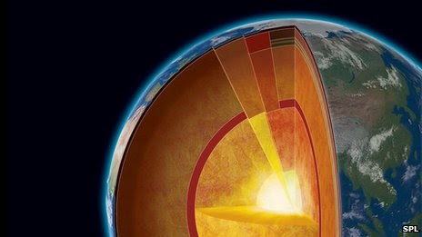
During the carving of the Grand Canyon, the mineral grains cooled and moved closer to the surface, locking the helium atoms away inside the grains. Topography influences temperature variations at shallow levels beneath the Earth’s surface, and the thermal history recorded by the apatite grains allowed Flowers and her team to infer how much time had passed since there was significant natural excavation of the Grand Canyon.

“If you can document cooling through temperatures only a few degrees warmer than the earth’s surface, you can learn about canyon formation,” says Kenneth Farley, who is chair of the Division of Geological and Planetary Sciences at the California Institute of Technology.

“Our research implies that the Grand Canyon was directly carved to within a few hundred meters of its modern depth by about 70 million years ago,” said Flowers.

According to Alicia Chang of the Associated Press (AP), the age and evolution of the Grand Canyon causes significant controversy among scientists, with a variety of data suggesting the Grand Canyon has had a complicated history. This evidence also suggests the modern canyon might not have been carved all at the same time. Different segments of the canyon may have formed separately before coalescing into the Grand Canyon visitors see today.

In a previous study published in 2008, Flowers and colleagues revealed that parts of the eastern Grand Canyon likely developed some 55 million years ago. Before it eroded to its current depth, that segment of the canyon’s bottom was above the height of the current rim.

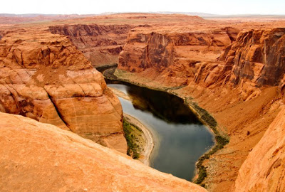
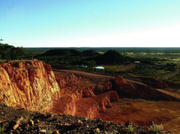
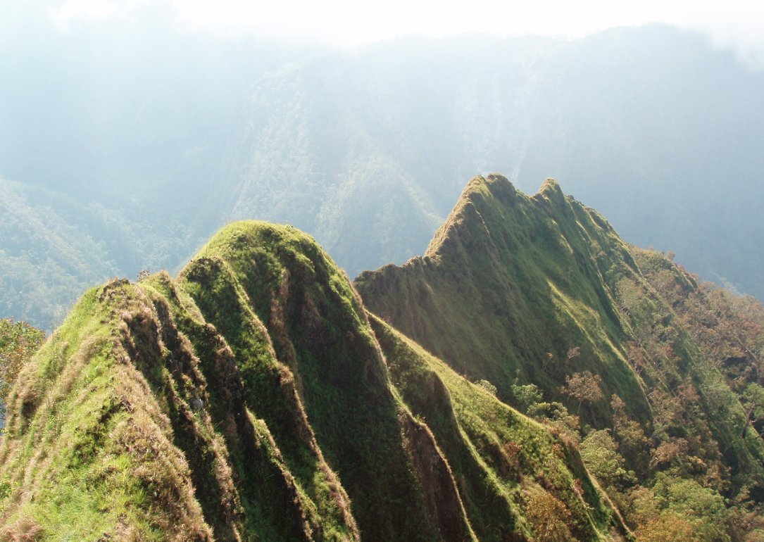
The steeply sided Grand Canyon is over a mile deep in places and about 280 miles long with a width of up to 18 miles wide in certain locations. More than 5 million people visit the geographic wonder every year. The Grand Canyon was carved, in large part, by an ancestral waterway of the Colorado River that was flowing in the opposite direction millions of years ago.

“An ancient Grand Canyon has important implications for understanding the evolution of landscapes, topography, hydrology and tectonics in the western U.S. and in mountain belts more generally,” said Flowers.

Flowers says that whether individual apatite crystals retain or lose helium is a function of temperatures in the rocks of Earth’s crust. If the temperatures of the apatite grains are below 86F, all of the helium is retained. Conversely, if the temperatures reach over 158F, all of the helium is lost.

“The main thing this technique allows us to do is detect variations in the thermal structure at shallow levels of the Earth’s crust,” she said. “Since these variations are in part induced by the topography of the region, we obtained dates that allowed us to constrain the timeframe when the Grand Canyon was incised.”

Past experiments used only the amount of helium produced in the radioactive decay of apatite grains to date samples. Flowers and Farley, however, also analyzed the spatial distribution of helium atoms near the margin of individual apatite crystals in order to take their uranium/thorium/helium dating technique to a more sophisticated level.

In recent years, a number of studies have reported various ages for the Grand Canyon, with the most popular theory placing the age at 5 million to 6 million years based on the age of the gravel washed downstream by the ancestral Colorado River. A 2008 study, however, estimated the age to be some 17 million years old based on dating mineral deposits inside of caves carved in the canyon walls.

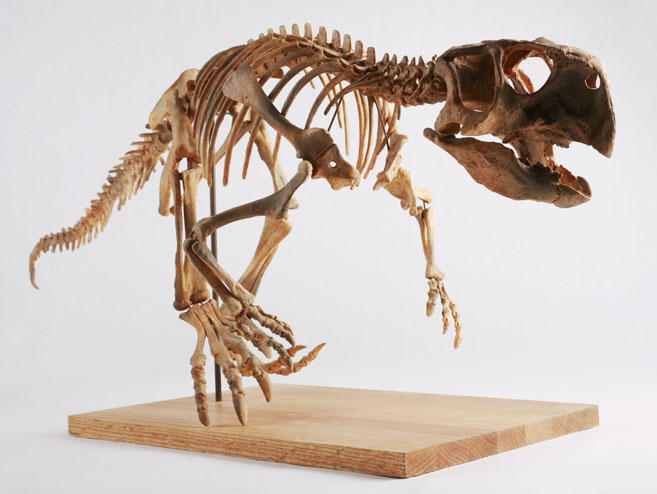
Paleontologists believe that dinosaurs were wiped out when a giant asteroid collided with Earth some 65 million years ago, in a so-called “extinction event.” The collision resulted in huge clouds of dust that blocked the sun from reaching Earth’s surface, cooling the planet and killing most plants and animals.

Geologists have redoubled their efforts, according to Flowers, because of the wide numbers of theories, dates and debates regarding the age of the Grand Canyon.

“There has been a resurgence of work on this problem over the past few years because we now have some new techniques that allow us to date rocks that we couldn’t date before,” Flowers said.

The dating research for this current study was performed at CalTech, however, Flowers has recently set up her own lab at CU-Boulder capable of conducting uranium/thorium/helium dating.

“If it were simple, I think we would have solved the problem a long time ago,” said Flowers. “But the variety of conflicting information has caused scientists to argue about the age of the Grand Canyon for more than 150 years. I expect that our interpretation that the Grand Canyon formed some 70 million years ago is going to generate a fair amount of controversy, and I hope it will motivate more research to help solve this problem.”

The team hopes to continue their research, moving from “when” to “how” the canyon was formed, claiming the genesis of the canyon has important implications for understanding the evolution of many geological features in the western United States. This would include the features’ tectonics and topography.

“Our major scientific objective is to understand the history of the Colorado Plateau–why does this large and unusual geographic feature exist, and when was it formed,” says Farley. “A canyon cannot form without high elevation–you don’t cut canyons in rocks below sea level. Also, the details of the canyon’s incision seem to suggest large-scale changes in surface topography, possibly including large-scale tilting of the plateau.”

AP’s Chang reports that not everyone is convinced by the findings of Flowers and Farley’s study, however. The study ignores a mountain of evidence pointing to a geologically young landscape, the critics contend, giving rise to doubts about the technique used to date the team’s samples.

Karl Karlstrom, University of New Mexico in Albuquerque geologist, calls the notion of the Grand Canyon being 70 million years old “ludicrous.” Most scientists agree that though the exposed rocks are ancient, the Canyon was forged relatively recently in geologic time through tectonic uplift.

The oldest gravel and sediment that washed downstream date to about 6 million years ago, making it hard for most scientists to imagine an ancient Grand Canyon, especially since there are no signs of older deposits. Geologists are always happy to have new methods of dating, however, Karlstrom thinks the newest efforts are highly inaccurate. It defies logic that a fully formed canyon would sit unchanged for tens of millions of years without undergoing further erosion, Karlstrom protests.

Richard Young, geologist at the State University of New York at Geneseo, suggested an entirely different scenario to Chang; that of a cliff in the place of the ancient Grand Canyon.

According to Young, Flowers “wants to have a canyon there. I want to have a cliff there. Obviously, one of us can’t be right.”

There might be a middle ground, suggested Utah State University geologist Joel Pederson to Chang. Older canyons in the region were cut by rivers flowing in the opposite direction of the Colorado River. Perhaps, he says, a good portion of the Grand Canyon was chiseled by these smaller rivers and the younger Colorado finished the job.

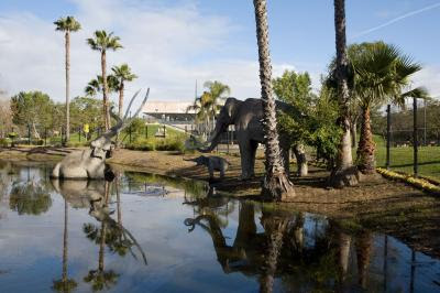
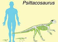
If Flowers and Farley are right, however, and the Canyon existed when dinosaurs roamed, it would be a much different environment than today because the climate at that time was more tropical. Smaller tyrannosaurs, horned and dome-headed dinosaurs and duckbills patrolled the American West.

University of Maryland paleontologist Thomas Holtz told Chang that the dinosaurs would not see “the starkly beautiful desert of today, but an environment with more lush vegetation”

The results of this study were recently published online in the journal Science Express.

Note : The above story is reprinted from materials provided by April Flowers for redOrbit

Fossil insect traces reveal ancient climate, entrapment, and fossilization

The La Brea Tar Pits is the only constantly active, urban excavation site in the world.Credit: Page Museum at the La Breat Tar Pits

Table of Contents

Fossil insect traces reveal ancient climate, entrapment, and fossilization at La Brea Tar Pits

Scientists use live insect colonies and forensic entomology to determine

LOS ANGELES — The La Brea Tar Pits have stirred the imaginations of scientists and the public alike for

This image shows a horse sesamoid (foot bone) riddled with insect damage. The bone, between 33,000-36,000 years old, is housed at the Page Museum at the La Brea Tar Pits. Credit: Page Museum at the La Brea Tar Pits

over a century. But the amount of time it took for ancient animals to become buried in asphalt after enduring their gruesome deaths has remained a mystery. Recent forensic investigations, led by Anna R. Holden of the Natural History Museum of Los Angeles County (NHM) and colleagues, reveal new insights into fossilization and the prevailing climate at the Rancho La Brea Tar Pits toward the end of the last Ice Age. The paper, entitled “Paleoecological and taphonomic implications of insect-damaged Pleistocene vertebrate remains from Rancho La Brea, southern California,” will be published in the journal PLoS One on July 3, 2013. 

The first step was to identify the insect traces. Holden and colleagues determined that different larval beetles were responsible for the exceptionally preserved traces on the bones of ancient mammals. By identifying those traces and researching the biology of the trace-maker, the team was able to pinpoint the climatic conditions and the minimum number of days it took for some of the carcasses to become submerged in the entrapping asphalt. Even after 10,000-60,000 years, the traces provide clear evidence that submergence took at least 17-20 weeks and occurred during warm to hot weather. 

Holden conducted the study with paleontologist Dr. John M. Harris, Chief Curator of the Page Museum at the La Brea Tar Pits, and Robert M. Timm, from Kansas University, who manages a dermestid beetle colony for research specimen preparation. They fed bones to insect colonies and used forensic entomology to decipher fossil insect traces. Because the insects that made the fossil traces still live today, the team was able to link the climate restrictions of these culprits to late Ice Age environmental conditions. “These are rare and precious fossils because they provide a virtual snapshot of a natural drama that unfolded thousands of years ago in Los Angeles,” Holden said.

Aside from adding to the documented list of insects that eat bone, research by Holden et al. also sheds light

 This is an exterior view of one of the asphalt seeps at the La Brea Tar Pits. Credit: Page Museum at the La Brea Tar Pits

on the conditions under which such insects will feed, and why mammalian herbivores offer a great setting for larval development. Although carnivorans vastly outnumber the amount of mammalian herbivorans excavated from the tar pits, no insect damage was found on their bones. The team believes that the thicker skin surrounding mammalian herbivore feet dried out and provided a stable, protected, and humid sub-environment complete with the right balance of tendons, muscle and fat for dermestid and tenebrionid larvae.

These unique specimens, housed at the Page Museum, were recovered from multiple asphalt deposits from excavations that took place over the last century and continue today. “Most people associate the tar pits with research on saber-toothed cats and mammoths.” Holden said. “But we show that the insects offer some the most valuable clues for our ongoing efforts to reconstruct Los Angeles’s prehistoric environment.”

Note : The above story is reprinted from materials provided by Natural History Museum of Los Angeles County

Playa Deposits

Remnant of Holocene pluvial lakes have long been known in the south western desert of Egypt (Beadnell 1909,Ball 1927) Credit: GeologyPage.com

Playa,  also called pan, flat, or dry lake,  flat-bottom depression found in interior desert basins and adjacent to coasts within arid and semiarid regions, periodically covered by water that slowly filtrates into the ground water system or evaporates into the atmosphere, causing the deposition of salt, sand, and mud along the bottom and around the edges of the depression.

Playas are among the flattest known landforms. Their slopes are generally less than 0.2 metre per kilometre. When filled with only a few centimetres of water, many kilometres of surface may be inundated. It is the process of inundation that develops and maintains the near-perfect flatness so characteristic of these arid-region landforms.

Playas occupy the flat central basins of desert plains. They require interior drainage to a zone where evaporation greatly exceeds inflow. When flooded, a playa lake forms where fine-grained sediment and salts concentrate. Terminology is quite confused for playas because of many local names. A saline playa may be called a salt flat, salt marsh, salada, salar, salt pan, alkali flat, or salina. A salt-free playa may be termed a clay pan, hardpan, dry lake bed, or alkali flat. In Australia and South Africa small playas are generally referred to as pans. The low-relief plains of these lands contrast with the mountainous deserts of North America, resulting in numerous small pans instead of immense playas. The terms takyr, sabkha, and kavir are applied in Central Asia, Saudi Arabia, and Iran, respectively.

Saline flats are specialized forms located adjacent to large bodies of water, as, for example, along coasts, lakeshores, and deltas. They flood during storms, either with surface runoff or with surges from the nearby body of water. The saline crusts of saline flats are quite similar to those that develop in playas.

Physical characteristics

Enclosed basins of salt and clay accumulation may originate from numerous causes. Tectonic causes include faulting, as in the East African Rift Valley and Death Valley, and warping, as in Lake Eyre in Australia, Lake Chad in central Africa, and Shaṭṭ al-Jarīd (Chott Djerid) in Tunisia. Wind deflation can produce shallow basins with downwind dunes, as in southeastern Australia. Even very large basins, such as the Qattara Depression of Egypt, have been ascribed to deflation. Local cataclysmic disruptions of drainage (e.g., volcanism, landslides, and meteorite impacts) may produce playas in desert regions.

Modern playa surfaces are not passive receptors of sediment as they were once believed to be. They serve as important sources of dust and salts, which are blown to the surrounding uplands. Complex assemblages of minerals and sediments occur on the playa surfaces. These directly reflect their environment of deposition and may be used to interpret ancient environmental conditions.

Modern playa surfaces are not passive receptors of sediment as they were once believed to be. They serve as important sources of dust and salts, which are blown to the surrounding uplands. Complex assemblages of minerals and sediments occur on the playa surfaces. These directly reflect their environment of deposition and may be used to interpret ancient environmental conditions.

Two broad classes of playas may be defined on the basis of past histories. One type develops from the desiccation of a former lake. Sediments in such a playa are primarily lacustrine, rather than derived from modern depositional processes. The second type of playa has no paleolacustrine heritage. Small salt pans in South Africa, called vokils, are of this type.

The supply of material, basin depth, and duration of accumulation all contribute to variations in the thickness of playa deposits. Very thick playa sequences may have alternating layers of lacustrine clays and salt beds. The former generally reflect periods of high floodwater runoff into the closed basins, perhaps induced by higher rainfall (so-called pluvial periods). Saline sediments or pure evaporite beds reflect arid climatic phases. The precise climatic interpretation of paleolacustrine playa sequences, however, can be problematic.

Role of flooding and groundwater

Playas affected by occasional surface floods are usually dry. Their surfaces consist of silt and clay deposited by the floodwaters that enter closed basins during the occasional flow events. Salts develop as ponded floodwater in the centre of such a basin gradually evaporates. Water also can be supplied to closed basins by groundwater flow. In basins dominated by groundwater inputs, sediment influxes are minimized, and saline crusts dominate. Moist areas may persist as groundwater flows to the lowest portion of playas. Very large playas may exhibit dry, sediment-dominated sections and moist, salt-dominated sections.

Saline minerals

 The salt deposits of a salt pan are zoned like bathtub rings, with less-soluble sulfates and carbonates at the outer margin and highly soluble sodium chloride (table salt) at the centre. The crystallization of these salts can be compared with the evaporation of brine in a dish. The first precipitates from the evaporating brine are calcium carbonate (CaCO3) and magnesium carbonate (MgCO3). These form the outer “bathtub ring.” The next ring consists of sulfates of calcium and sodium (CaSO4 and Na2SO4, respectively). If sufficient calcium is present, gypsum (CaSO4·2H2O) will form. If less calcium is present, thenardite (Na2SO4) and sodium carbonate (Na2CO3) may be deposited. The last remaining brines of exceptionally high salinity precipitate highly soluble chlorides of sodium, calcium, magnesium, and potassium.

Another kind of zoning occurs in saline playas with respect to the hydration of different minerals. Dehydrated minerals, such as anhydrite (CaSO4), occur on surface areas protected against flooding and in wet saline areas.

Some playas also contain exotic minerals. The Death Valley playa is famous for borate minerals, including borax (Na2B4O7·10H2O) and Meyerhofferite (Ca2B6O11·7H2O).

Surface relief and structures

Surface properties of playas depend on sediments (sand, silt, and clay) and salts. Near-surface groundwater may give rise to evaporite crusts formed by rigorous evaporative concentration. Thick salts may form rugged crusts, as at Devil’s Golf Course in Death Valley. Regular flooding of evaporative layers may form a very smooth surface, as at Bonneville Salt Flats in Utah. For thick, soluble crusts, dissolution may occur during fluctuations of a high water table. Solution cavities in the crust can produce a salt karst topography.

The muds deposited on playas are subject to drying and shrinking. The amount of volume change varies with the clay minerals present. Smectite clays experience the greatest shrinkage on drying. The presence of salts enhances the effect, since deposition and crystallization of salts in the cracks creates a polygonal network of salt wedges.

Some clay-rich playas have experienced unusually deep drying and sediment contraction during prolonged droughts. Giant desiccation polygons formed under these conditions are as large as 90 metres across. Individual cracks more than one metre wide and 15 metres deep have been observed.

Geomorphic evolution

Impact of climatic change

Playas are exceptionally sensitive to environmental change. They have been most profoundly influenced by changes in hydrologic regimen induced by the climatic variations of the Quaternary Period (i.e., the past 2.6 million years). All have experienced episodes of expanded lake levels in the past. Such predecessors are often called pluvial lakes, thereby implying periods of increased rainfall. It is also possible, however, that lakes could have expanded because of other factors, including increased groundwater inflow and/or decreased evaporation/transpiration.

Paleolake chronologies

Modern geochronologic techniques, such as radiocarbon dating, permit the comparison of fluctuations in the paleolakes that were predecessors to many modern playas. In northern Africa lakes were at a moderately high level from 30,000 to 22,000 years ago. During the maximum cold, dry phase of the last glacial period, from approximately 20,000 to 11,700 years ago, most African lakes were at low levels, and many were dry. From 10,000 to 8,000 years ago, lakes rose to maximum high levels. Lake Chad expanded to the size of the modern Caspian Sea. Small volume lakes, however, are more sensitive to climatic change, recording higher frequency oscillations in the hydrologic balance. Since about 4,000 years ago, the north African lakes have fallen to the range of their modern lows.

Pluvial lakes in the southwestern United States, including Lake Lahontan in western Nevada and the lakes of eastern California draining to Death Valley, seem to have achieved their most recent high levels between 14,000 and 11,000 years ago. The period from 30,000 to 24,000 years ago was marked by low lake levels. Another low was reached about 7,000 years ago. Many of the lakes of the southwestern United States, however, seem to have been not quite in phase with one another.

Effects of wind action

Playas and saline flats are particularly susceptible to wind action. Clays and salts form crusts that curl and flake upon drying. The flakes and curls are readily deflated, and these wind-eroded sediments are then deposited leeward of the playas and saline flats from which they were removed. This process is increasingly recognized as a source of dust hazard, as studies around Owens Lake, California, and in western China have shown.

In Australia many playas have large transverse crescentic foredunes on their leeward side. Because of their silt and clay composition, these features are sometimes called clay dunes. In Australia they are known as lunettes. James M. Bowler, an Australian Quaternary stratigrapher, produced a precise chronology of playa development and associated eolian activity in the desert of western New South Wales, Australia. There, numerous small lakes reached their maximum extent 32,000 years ago, approximately coincident with the age of the first human remains in Australia. From about 26,000 years ago, the lakes fell to low levels. Playas formed roughly 16,000 years ago at a time when eolian activity peaked. High lakes again occurred about 9,000 to 5,000 years ago, but playas were reestablished after that.

The present association of playas, lunettes, and linear dunes in the Australian deserts may imply a causative association. C.R. Twidale proposed that the linear dunes developed as lee-side accumulations of sand trapped by the growth of lunettes. Climatic change is critical to the association.

Photo :

Note : The above story is reprinted from materials provided by Victor R. Baker ” Regents Professor of Geosciences and of Planetary Sciences; University of Arizona”
Image Credit : © GeologyPage.com

Shimmering Water Reveals Cold Volcanic Vent in Antarctic Waters

The image, taken by SHRIMP, shows the small relict chimney (around two meters high) found on the seafloor at Hook Ridge at a depth of around 1,200 meters. Emanating hydrothermal fluid is visible as shimmering water. Image courtesy of the National Oceanography Centre, Southampton. (Credit: Image courtesy of National Oceanography Centre, Southampton)

The location of an underwater volcanic vent, marked by a low-lying plume of shimmering water, has been revealed by scientists at the National Oceanography Centre, Southampton.Writing in the journal PLOS ONE the researchers describe how the vent, discovered in a remote region of the Southern Ocean, differs from what we have come to recognise as “classic” hydrothermal vents. Using SHRIMP, the National Oceanography Centre’s high resolution deep-towed camera platform, scientists imaged the seafloor at Hook Ridge, more than 1,000 metres deep.
The study, funded by the Natural Environment Research Council (NERC), aimed to build on our knowledge of how deep-sea creatures associated with hydrothermal activity evolve and migrate between different regions.

Hydrothermal vents are like hot springs, spewing jets of water from the seafloor out into the ocean. The expelled water, if hot enough, is rich in dissolved metals and other chemicals that can nourish a host of strange-looking life, via a process called “chemosynthesis.” The hot water, being more buoyant than the surrounding cold seawater, rises up like a fountain or “plume,” spreading the chemical signature up and out from the source.

The Hook Ridge vent, however, was found to lack the high temperatures and alien-like creatures that we now associate with hot hydrothermal vents. Instead there was a low-lying plume of shimmering water, caused by differences relative to the surrounding seawater in certain properties, such as salinity.

“Geochemical measurements of the water column provided evidence of slightly reducing, localised plumes close to the seafloor at Hook Ridge,” said Dr Alfred Aquilina, lead author and former research fellow at University of Southampton Ocean and Earth Science, which is based at the centre.

“We therefore went in with sled-mounted cameras towed behind the Royal Research Ship James Cook and saw shimmering water above the seafloor, evidence of hydrothermal fluid seeping through the sediment.”

So why were there no strange creatures around the vent? The team investigated this particular area of the deep-sea because prior measurements of the water column above Hook Ridge detected chemical changes consistent with a hydrothermal plume. On investigation, there was also a small relict “chimney” of precipitated minerals on the seafloor, which suggests that the hydrothermal fluid flowing from the vent was once warmer.

The researchers therefore propose that hydrothermal activity at Hook Ridge is too irregular to provide the vital chemicals that support chemosynthetic life.

Dr Aquilina explained why this was an important finding: “This region was investigated because hydrothermal systems in this part of the Southern Ocean may potentially act as stepping stones for genetic material migrating between separate areas in the world ocean,” he said.

“The more hydrothermal vents we can find and investigate, the more we can understand about the evolution and dispersal of the creatures that live off the chemicals expelled in these dark, deep environments.”

The work was carried out as part of the ChEsSO project, which investigates chemosynthetic environments and associated ecosystems south of the Polar Front. Co-authors are from the University of Southampton Ocean and Earth Science and the National Oceanography Centre.

Note : The above story is reprinted from materials provided by National Oceanography Centre.

Geological Study Explains Mystery of Australian Opal Fields

Alaric opal mine is located within the weathered sandstone and mudstone of the Winton Formation, Queensland. Opalized horizon corresponds to a flat pre-late Paleocene paleosurface, buried underneath Cenozoic sediments (P. F. Rey, 2013)

Australia produces over 90 percent of the world’s supply of opal. “Before this we did not know its origin, why it forms at such shallow depths or why it can be found in central Australia and almost nowhere else on Earth,” Prof Rey said.

“The formation of Australian opal was due to an extraordinary episode of acidic weathering, during the drying out of the central Australian landscape.”

These processes occurred when the Eromanga sea, a vast body of water covering 60 percent of Australia, extending from Coober Pedy to the Carpentaria Basin and across to Lightning Ridge, started retreating.

“Between 100 and 97 million years ago this sea came to cover a much smaller area. This meant the previously inundated central Australian landscape started drying out and acidic weathering happened on a massive scale when pyrite minerals released sulfuric acid,” Prof Rey explained.

Acidic weathering of the type that took place in Central Australia is unique on Earth at that scale, covering an estimated 1.3 million sq. km, but it has been described at the surface of Mars.

“The United States and the European community have invested billions of dollars to send orbiters and rovers to Mars in the hope of finding extra-terrestrial life but Central Australia offers a unique natural laboratory where potential Martian bio-geological processes could be studied,” concluded Prof Rey, who reported the findings in a paper in the Australian Journal of Earth Sciences.

Reference:
Bibliographic information: P. F. Rey. 2013. Opalisation of the Great Artesian Basin (central Australia): an Australian story with a Martian twist. Australian Journal of Earth Sciences: An International Geoscience Journal of the Geological Society of Australia, vol. 60, no. 3; DOI: 10.1080/08120099.2013.784219

Exploring dinosaur growth

Cluster of six juvenile Psittacosaurus from the Lower Cretaceous of Lujiatun, Liaoning Province, China. The cluster contains six aligned juvenile specimens. Bone histology indicates that specimens 2-6 were two years old at time of death, whereas specimen 1 was three years old. Image by © Institute of Vertebrate Paleontology and Paleoanthropology, Beijing

Tracking the growth of dinosaurs and how they changed as they grew is difficult. Using a combination of biomechanical analysis and bone histology, palaeontologists from Beijing, Bristol, and Bonn have shown how one of the best-known dinosaurs switched from four feet to two as it grew.
Psittacosaurus, the ‘parrot dinosaur’ is known from more than 1000 specimens from the Cretaceous, 100 million years ago, of China and other parts of east Asia.  As part of his PhD thesis at the University of Bristol, Qi Zhao, now on the staff of the Institute for Vertebrate Paleontology in Beijing, carried out the intricate study on bones of babies, juveniles and adults.

Dr Zhao said: “Some of the bones from baby Psittacosaurus were only a few millimetres across, so I had to
handle them extremely carefully to be able to make useful bone sections.  I also had to be sure to cause as little damage to these valuable specimens as possible.”

With special permission from the Beijing Institute, Zhao sectioned two arm and two leg bones from 16 individual dinosaurs, ranging in age from less than one year to 10 years old, or fully-grown.  He did the intricate sectioning work in a special palaeohistology laboratory in Bonn, Germany,

Skeletal reconstructions of hatchling, juvenile and adult individuals (left to right) showing inferred postural change, from quadrupedal to bipedal, with 178-cm-tall man for scale Image by © Institute of Vertebrate Paleontology and Paleoanthropology, Beijing

The one-year-olds had long arms and short legs, and scuttled about on all fours soon after hatching.  The bone sections showed that the arm bones were growing fastest when the animals were ages one to three years.  Then, from four to six years, arm growth slowed down, and the leg bones showed a massive growth spurt, meaning they ended up twice as long as the arms, necessary for an animal that stood up on its hind legs as an adult.

Professor Xing Xu of the Beijing Institute, one of Dr Zhao’s thesis supervisors, said: “This remarkable study, the first of its kind, shows how much information is locked in the bones of dinosaurs.  We are delighted the study worked so well, and see many ways to use the new methods to understand even more about the astonishing lives of the dinosaurs.”

Professor Mike Benton of the University of Bristol, Dr Zhao’s other PhD supervisor, said: “These kinds of studies can also throw light on the evolution of a dinosaur like Psittacosaurus.  Having four-legged babies and juveniles suggests that at some time in their ancestry, both juveniles and adults were also four-legged, and Psittacosaurus and dinosaurs in general became secondarily bipedal.”

The paper is published today in Nature Communications.

Note : The above story is reprinted from materials provided by University of Bristol

How ‘Parrot Dinosaur’ Switched from Four Feet to Two as It Grew

A Psittacosaurus skeleton cast in the permanent collection of The Children’s Museum of Indianapolis. (Credit: Photo by Michelle Pemberton, via Wikimedia Commons (Creative Commons license))

Tracking the growth of dinosaurs and how they changed as they grew is difficult. Using a combination of biomechanical analysis and bone histology, palaeontologists from Beijing, Bristol, and Bonn have shown how one of the best-known dinosaurs switched from four feet to two as it grew.

Psittacosaurus, the ‘parrot dinosaur’ is known from more than 1000 specimens from the Cretaceous, 100 million years ago, of China and other parts of east Asia. As part of his PhD thesis at the University of Bristol, Qi Zhao, now on the staff of the Institute for Vertebrate Paleontology in Beijing, carried out the intricate study on bones of babies, juveniles and adults.

Dr Zhao said: “Some of the bones from baby Psittacosaurus were only a few millimetres across, so I had to handle them extremely carefully to be able to make useful bone sections. I also had to be sure to cause as little damage to these valuable specimens as possible.”

With special permission from the Beijing Institute, Zhao sectioned two arm and two leg bones from 16 individual dinosaurs, ranging in age from less than one year to 10 years old, or fully-grown. He did the intricate sectioning work in a special palaeohistology laboratory in Bonn, Germany,

The one-year-olds had long arms and short legs, and scuttled about on all fours soon after hatching. The bone sections showed that the arm bones were growing fastest when the animals were ages one to three years. Then, from four to six years, arm growth slowed down, and the leg bones showed a massive growth spurt, meaning they ended up twice as long as the arms, necessary for an animal that stood up on its hind legs as an adult.

Professor Xing Xu of the Beijing Institute, one of Dr Zhao’s thesis supervisors, said: “This remarkable study, the first of its kind, shows how much information is locked in the bones of dinosaurs. We are delighted the study worked so well, and see many ways to use the new methods to understand even more about the astonishing lives of the dinosaurs.”

Professor Mike Benton of the University of Bristol, Dr Zhao’s other PhD supervisor, said: “These kinds of studies can also throw light on the evolution of a dinosaur like Psittacosaurus. Having four-legged babies and juveniles suggests that at some time in their ancestry, both juveniles and adults were also four-legged, and Psittacosaurus and dinosaurs in general became secondarily bipedal.”

Note : The above story is reprinted from materials provided by University of Bristol.

River deep, mountain high – new study reveals clues to lifecycle of worlds iconic mountains

Very steep topography in East Timor. The evolution of this mountain range is dominated by ongoing feedbacks between landslides and river erosion. Credit: Mike Sandiford

Scientists have discovered the reasons behind the lifespan of some of the world’s iconic mountain ranges.

The study conducted by the University of Melbourne, Australia, and Aarhus University, Denmark, has revealed that interactions between landslides and erosion, caused by rivers, explains why some mountain ranges exceed their expected lifespan.

Co-author Professor Mike Sandiford of the School of Earth Sciences at the University of Melbourne said the study had answered the quandary as to why there was fast erosion in active mountain ranges in the Himalayas and slow erosion in others such as the Great Dividing Range in Australia or the Urals in Russia.

“We have shown that links between landslides and rivers are important in maintaining erosion in active or ancient mountain ranges,” he said.

“This study is a great insight into the origins and topography of our globe’s mountainous landscape.”

Mountain ranges are expected to erode away in the absence of tectonic activity but several ranges, such as the Appalachians in the US and the Urals in Russia, have been preserved over several hundred million years.

Co-author, Professor David Egholm from Aarhus University said the new model study published in Nature today provided a plausible mechanism for the preservation of tectonically inactive mountain ranges.

“Computational simulations performed for the study revealed that variations in mountain erosion may relate to a coupling between river incision and landslides,” he said.

Researchers said rivers can cut through bedrock and this process is thought to be the major factor in controlling mountain erosion, however, the long-term preservation of some mountains is at odds with some of the underlying assumptions regarding river erosion rates in current models of river-based landscape evolution.

The study revealed landslides affected river erosion rates in two ways. Large landslides overwhelm river transport capacity and can protect the riverbed from further erosion; conversely, landslides also deliver abrasive agents to the streams, thereby accelerating erosion.

Feedback between these processes can help to stabilize the rates of erosion and increase the lifespan of mountains, the authors said.

Note: The above story is reprinted from materials provided by The University of Melbourne

Location of Upwelling in Earth’s Mantle Discovered to Be Stable

This is a diagram showing a slice through the Earth’s mantle, cutting across major mantle upwelling locations beneath Africa and the Pacific. Credit: C. Conrad (UH SOEST)

A study published in Nature today shares the discovery that large-scale upwelling within Earth’s mantle mostly occurs in only two places: beneath Africa and the Central Pacific. More importantly, Clinton Conrad, Associate Professor of Geology at the University of Hawaii — Manoa’s School of Ocean and Earth Science and Technology (SOEST) and colleagues revealed that these upwelling locations have remained remarkably stable over geologic time, despite dramatic reconfigurations of tectonic plate motions and continental locations on the Earth’s surface. “For example,” said Conrad, “the Pangaea supercontinent formed and broke apart at the surface, but we think that the upwelling locations in the mantle have remained relatively constant despite this activity.”

Conrad has studied patterns of tectonic plates throughout his career, and has long noticed that the plates were, on average, moving northward. “Knowing this,” explained Conrad, “I was curious if I could determine a single location in the Northern Hemisphere toward which all plates are converging, on average.” After locating this point in eastern Asia, Conrad then wondered if other special points on Earth could characterize plate tectonics. “With some mathematical work, I described the plate tectonic ‘quadrupole’, which defines two points of ‘net convergence’ and two points of ‘net divergence’ of tectonic plate motions.”

When the researchers computed the plate tectonic quadruople locations for present-day plate motions, they found that the net divergence locations were consistent with the African and central Pacific locations where scientists think that mantle upwellings are occurring today. “This observation was interesting and important, and it made sense,” said Conrad. “Next, we applied this formula to the time history of plate motions and plotted the points — I was astonished to see that the points have not moved over geologic time!” Because plate motions are merely the surface expression of the underlying dynamics of the Earth’s mantle, Conrad and his colleagues were able to infer that upwelling flow in the mantle must also remain stable over geologic time. “It was as if I was seeing the ‘ghosts’ of ancient mantle flow patterns, recorded in the geologic record of plate motions!”
Earth’s mantle dynamics govern many aspects of geologic change on the Earth’s surface. This recent discovery that mantle upwelling has remained stable and centered on two locations (beneath Africa and the Central Pacific) provides a framework for understanding how mantle dynamics can be linked to surface geology over geologic time. For example, the researchers can now estimate how individual continents have moved relative to these two upwelling locations. This allows them to tie specific events that are observed in the geologic record to the mantle forces that ultimately caused these events.

More broadly, this research opens up a big question for solid earth scientists: What processes cause these two mantle upwelling locations to remain stable within a complex and dynamically evolving system such as the mantle? One notable observation is that the lowermost mantle beneath Africa and the Central Pacific seems to be composed of rock assemblages that are different than the rest of the mantle. Is it possible that these two anomalous regions at the bottom of the mantle are somehow organizing flow patterns for the rest of the mantle? How?

“Answering such questions is important because geologic features such as ocean basins, mountains belts, earthquakes and volcanoes ultimately result from Earth’s interior dynamics,” Conrad described. “Thus, it is important to understand the time-dependent nature of our planet’s interior dynamics in order to better understand the geological forces that affect the planetary surface that is our home.”

The mantle flow framework that can be defined as a result of this study allows geophysicists to predict surface uplift and subsidence patterns as a function of time. These vertical motions of continents and seafloor cause both local and global changes in sea level. In the future, Conrad wants to use this new understanding of mantle flow patterns to predict changes in sea level over geologic time. By comparing these predictions to observations of sea level change, he hopes to develop new constraints on the influence of mantle dynamics on sea level.

Note: The above story is reprinted from materials provided by University of Hawaii at Manoa, via EurekAlert!, a service of AAAS.

Related Articles