back to top
27.8 C
New York
Monday, October 7, 2024
Home Blog Page 39

Jurassic Park in eastern Morocco: Paleontology of the Kem Kem Group

Predators abound on land, in the air and in water some 95 million years on the shores of northern Africa -- as shown by the abundant fossils in the Kem Kem region. Large herbivores, such as the long-necked sauropod Rebbachisaurus, could have been hunted or scavenged by several large predators. Credit: Artwork by Davide Bonadonna
Predators abound on land, in the air and in water some 95 million years on the shores of northern Africa — as shown by the abundant fossils in the Kem Kem region. Large herbivores, such as the long-necked sauropod Rebbachisaurus, could have been hunted or scavenged by several large predators. Credit: Artwork by Davide Bonadonna

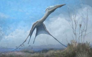
The Kem Kem beds in Morocco are famous for the spectacular fossils found there, including at least four large-bodied non-avian theropods, several large-bodied pterosaurs and crocodilians.

Now, in a new geology and paleontology monograph, that reveals much more about the famous Kem Kem beds in Morocco, Dr. Nizar Ibrahim from the University of Detroit Mercy, Prof. Paul Sereno from the University of Chicago, and a team of international scholars from the United States, Europe and Morocco, have put together a comprehensive story that is published in the open-access journal ZooKeys.

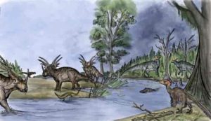
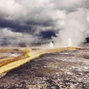
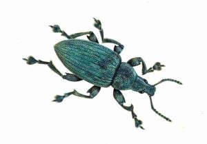
The aim of the new research is to provide the international community with an in-depth review of the rocks and fossils of the region. It reviews the geology and paleontology of this famous but surprisingly understudied area, describing and formally naming the strata and summarizing all of the preserved life forms, from fragile plants and insects to massive dinosaurs. The monograph also paints a picture of life as it once was some 95 million years ago by describing the paleoenvironments of the region, and the unusual predator-dominated fauna.

In 1996 Prof. Sereno and colleagues introduced the informal term “Kem Kem beds” for this fossil-rich escarpment. In this monograph, the authors review the original tri-level proposal for the region by French geologist Choubert (his informal “trilogie mésocretacée”) and propose the Kem Kem Group for the entire package of rock with two new names for the dinosaur-bearing layers based on the richest fossil sites, the Gara Sbaa and Douira formations.

The region is famous for the prodigious fossils found in all of these units, many derived from commercial fossil collecting, which obscures the precise location and level of the specimens. The monograph is the first work to pinpoint where many of the most important finds were made. Over the last 25 years in particular, paleontologists have brought to light a diverse array of new vertebrate fossils including at least four large-bodied non-avian theropods, several large-bodied pterosaurs, crocodilians, turtles and an array of sharks and bony fish.

To put a comprehensive story together on the Kem Kem, the authors of the monograph visited collections of Kem Kem fossils around the world and led many expeditions to the region. Fossil and geological data reviewed in the monograph is derived from a number of different sources. A University of Chicago-led major expedition in 1995 generated a wealth of geological and paleontological data, as did later expeditions involving teams from the University College Dublin, the University of Portsmouth, the Faculté des Sciences Aïn Chock, the Muséum national d’Histoire naturelle, the University Cadi Ayyad, the Museo Civico di Storia Naturale (Milan), and the University of Detroit Mercy.

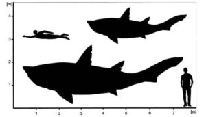
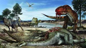
One of the key features of the Kem Kem assemblage is the presence of several large-bodied theropods, a group of dinosaurs that includes all of the meat-eaters. Most famous among these from the Kem Kem include the sail-backed Spinosaurus and the sabre-toothed Carcharodontosaurus.

Most fossils in the Kem Kem region are discovered as isolated fragmentary pieces weathered from sandstones. Only four partial dinosaur skeletons or skulls have been recovered, which include the long-necked sauropod Rebbachisaurus garasbae and the theropods Deltadromeus agilis, Carcharodontosaurus saharicus and Spinosaurus aegyptiacus. These Kem Kem theropods are among the largest known dinosaurian predators on record reaching adult body lengths in excess of 12 meters.

“Given the continued input of new specimens and the continuing expansion of paleontological research, we predict that diversity in the Kem Kem Group will increase substantially in the coming decades. Based on our review of existing collections, this increase will include scores of taxa from the pond locality Oum Tkout including nonvertebrates, such as plants, insects, and ostracods, as well as an array of actinopterygian fish. We also anticipate a continuing trickle of new terrestrial vertebrates that will be named on better-preserved specimens that are diagnostic at present only at the familial level, including turtles and various kinds of archosaurs. As nearly half of the reptilian families listed are indeterminate, better-preserved specimens will offer future opportunities to recognize new reptilian genera,” share the authors.

“In summary, the Kem Kem assemblage of non-vertebrates and vertebrates is likely to continue to show dramatic increase in diversity in the coming decades. Nonetheless, the array of taxa currently known, which extends from plants across a range of aquatic and terrestrial vertebrates, is sufficiently mature to allow a summary of the vertebrate assemblage and a discussion of its paleoecological context,” conclude the researchers.

In his earlier research, a famous paleontologist from the University of Chicago Prof. Paul Sereno has described many outstanding dinosaur discoveries, including new Cretaceous crocodilians from the Sahara and two new fanged vegetarian dinosaur dwarfs (called heterodontosaurids).

Reference:
Nizar Ibrahim, Paul C. Sereno, David J. Varricchio, David M. Martill, Didier B. Dutheil, David M. Unwin, Lahssen Baidder, Hans C. E. Larsson, Samir Zouhri, Abdelhadi Kaoukaya. Geology and paleontology of the Upper Cretaceous Kem Kem Group of eastern Morocco. ZooKeys, 2020; 928: 1 DOI: 10.3897/zookeys.928.47517

Note: The above post is reprinted from materials provided by Pensoft Publishers.

Giant teenage shark from the dinosaur era

Hypothetical outlines of †Ptychodus showing the minimum and maximum size estimations for the sub-adult specimen from Spain.
Hypothetical outlines of †Ptychodus showing the minimum and maximum size estimations for the sub-adult specimen from Spain. (© Patrick L. Jambura)

In 1996, palaeontologists found skeletal remains of a giant shark at the northern coast of Spain, near the city Santander. Here, the coast comprises meter high limestone walls that were deposited during the Cretaceous period, around 85 million years ago, when dinosaurs still roamed the world. Scientists from the University of Vienna examined this material now and were able to assign the remains to the extinct shark family, Ptychodontidae, a group that was very specious and successful in the Cretaceous but suddenly vanished mysteriously before the infamous end-Cretaceous extinction event.

Shark vertebrae are rare in the fossil record, but precious

Ptychodontid sharks are mainly known from their teeth, which are flattened and allowed them to crush hard-shelled prey, like bivalves or ammonites, similar to some of today’s ray species. However, the find of Spain consists only of parts of the vertebral column and placoid scales (teeth-like scales), which are much rarer than teeth in the fossil record.

In contrast to teeth, shark vertebrae bear important information about a species’ life history, such as size, growth and age, which are saved as growth rings inside the vertebra, like in the stem of trees. Statistical methods and the comparison with extant species, allowed the scientists to decode these data and reconstruct the ecology of this enigmatic shark group.

Ptychodontid sharks grew big and old

“Based on the model, we calculated a size of 4-7m and an age of 30 years for the examined shark. Astonishing about this data is the fact that this shark was not yet mature when it died despite its rather old age.” states Patrick L. Jambura, lead author of the study. Sharks follow an asymptotic growth curve, meaning that they grow constantly until maturation and after that, the growth curve flattens resulting from a reduced growth rate. “However, this shark doesn’t show any signs of flattenings or inflections in the growth profile, meaning that it was not mature, a teenager if you want. This suggests that these sharks even grew much larger (and older)!”

The study suggests that ptychodontid sharks grew very slow, matured very late, but also showed high longevity and reached enormous body sizes. “This might have been a main contributor to their success, but also, eventually, demise.”

Do modern sharks face a similar fate?

Many living sharks, like the whale shark or the great white shark, show very similar life history traits, a combination of low recruitment and late maturation, which makes them vulnerable to anthropogenic threats, like overfishing and pollution.

“It might be the case that similar to today’s sharks, ptychodontid sharks faced changes in their environment, to which they could not adapt quick enough and, ultimately, led to their demise before even dinosaurs went extinct. However, unlike in the Cretaceous period, it is up to us now, to prevent this from happening to modern sharks again and to save the last survivors of this ancient and charismatic group of fishes!”

Reference:
Patrick L. Jambura, Jürgen Kriwet. Articulated remains of the extinct shark Ptychodus (Elasmobranchii, Ptychodontidae) from the Upper Cretaceous of Spain provide insights into gigantism, growth rate and life history of ptychodontid sharks. PLOS ONE, 2020; 15 (4): e0231544 DOI: 10.1371/journal.pone.0231544

Note: The above post is reprinted from materials provided by University of Vienna.

New tsunami risk identified in Indonesia

Credit: Geological Society

A team of scientists led by Heriot-Watt University has identified a potential new tsunami risk in Indonesia by mapping below the seabed of the Makassar Strait.

The team says their findings mean that coastal communities currently without tsunami warning systems or mitigation systems could be at risk.

This includes the proposed site of the new Indonesian capital on the island of Borneo.

The researchers used seismic data to map underneath the seafloor of the Makassar Strait, a narrow seaway between the islands of Borneo and Sulawesi.

They found evidence of 19 ancient submarine landslides. Submarine landslides have triggered tsunami waves before, such as the 2018 event on Sulawesi in Indonesia, although most tsunamis are caused by large earthquakes.

Dr. Rachel Brackenridge, now at University of Aberdeen, said: “We found evidence of submarine landslides happening over 2.5million years.

“They happened every 160,000 years or so and ranged greatly in size.

“The largest of the landslides comprised 600 km3 of sediment, while the smallest we identified were five km3.

“There will be many smaller events that we have yet to identify.”

Dr. Brackenridge explained how they identified the ancient landslides.

“Seismic data allows us to image the subsurface. The different characteristics of rocks below the seabed allow us to reconstruct the conditions they were deposited in.

“We can see a layered and orderly seabed, then there are huge bodies of sediment that appear chaotic.

“We can tell from the internal characteristics that these sediments have spilled down a slope in a rapid, turbulent manner. It’s like an underwater avalanche.”

The researchers say that the strong ocean current that flows through the Makassar Strait could be behind the prehistoric events and any potential submarine landslides.

Dr. Uisdean Nicholson, who led the research at Heriot-Watt University, said: “The Makassar Strait is an important oceanic gateway. It’s through there the main branch of the Indonesian Throughflow transports water—over 10 million cubic metres a second—from the Pacific to the Indian Ocean.

“The current acts as a conveyor belt, transporting sediment from the Mahakam Delta and dumping it on the upper continental slope to the south, making the seabed steeper, weaker and more likely to collapse.

“We estimate the largest, tsunamigenic events—those that displace 100 km3—occurred every 500,000 years.

“Indonesia has mitigation and early warning measures in place in different parts of the country, but not the area that would be affected by a tsunami wave generated from these landslides.

“This includes the cities of Balikpapan and Samarinda, which have a combined population of over 1.6 million people.

“Such an event could be concentrated and amplified by Balikpapan Bay, the site selected for the new capital city of Indonesia.

“Our next step is to quantify the risk in this area by building various numerical models of landslide events and tsunami generation.

“This could help us predict a threshold size that causes dangerous tsunamis and help inform any mitigation strategies.

“We also plan to visit the coastal areas of Kalimantan to look for physical evidence for historic or prehistoric tsunamis, to test the model outcomes and further improve our understanding of this hazard.”

Professor David Tappin of the British Geological Survey and UCL was involved in the study, and is working on the Sulawesi tsunami, which struck the opposite side of the Makassar Strait in September 2018.

Professor Tappin said: “The new study on submarine landslides is important in demonstrating that the tsunami hazard in this region of Indonesia is possibly greater than previously thought, but more research is necessary to confirm this.”

Professor Ben Sapiie from Institut Teknologi Bandung, Indonesia, said: “This research enriches the Indonesian geological and geophysical communities’ knowledge about sedimentation and landslide hazards in the Makassar Strait. The future of earth sciences research is using an integrated, multi-scientific approach with international collaborators.”

Dr. Nicholson recently identified ancient submarine landslides near the Falkland Islands in a separate research project.

Reference:
Rachel E. Brackenridge et al. Indonesian Throughflow as a preconditioning mechanism for submarine landslides in the Makassar Strait, Geological Society, London, Special Publications (2020). DOI: 10.1144/SP500-2019-171

Note: The above post is reprinted from materials provided by Heriot-Watt University.

Excessive rain triggered 2018 Kīlauea volcano eruption, study finds

Lava streaming from an active vent during the 2018 eruption of Kīlauea Volcano
Lava streaming from an active vent during the 2018 eruption of Kīlauea Volcano. Credit: U.S. Geological Survey

Excessive and sustained rainfall triggered the 2018 eruption of Kīlauea volcano in Hawaii, according to researchers at the University of Miami (UM) Rosenstiel School of Marine and Atmospheric Science. The researchers suggest that local rainfall patterns may contribute significantly to the timing and frequency of the eruption at Kīlauea and perhaps at other volcanoes.

In a new study, published in the journal Nature, UM Rosenstiel School scientists Jamie Farquharson and Falk Amelung showed that the eruption was likely initiated by prolonged, and at times extreme, rainfall in the months leading up to the event.

“We knew that changes in the water content in the Earth’s subsurface can trigger earthquakes and landslides. Now we know that it can also trigger volcanic eruptions,” said Falk Amelung, professor of geophysics at the UM Rosenstiel School and coauthor of the study. “Under pressure from magma, wet rock breaks easier than dry rock. It is as simple as that.”

The long-lived eruption of Kīlauea, one of Hawaii’s most active volcanoes, entered an extraordinary new phase on May 3, 2018, throwing incandescent lava nearly two hundred feet in the air and spewing lava over 13 square miles across the well-populated east coast of Hawaii’s Big Island. The unprecedented eruption, which destroyed hundreds of homes, involved the collapse of the summit caldera before it ceased four months later in September 2018.

Using a combination of ground-based and satellite measurements of rainfall, Farquharson and Amelung modelled the fluid pressure within the volcano’s edifice over time—a factor that can directly influence the tendency for mechanical failure in the subsurface, ultimately driving volcanic activity.

The team’s results highlight that fluid pressure was at its highest in almost half a century immediately prior to the eruption, which they propose facilitated magma movement beneath the volcano. Their hypothesis also explains why there was no widespread uplift at the volcano in the months prior.

“An eruption happens when the pressure in the magma chamber is high enough to break the surrounding rock and the magma travels to the surface,” said Amelung. “This pressurization causes inflation of the ground by tens of centimeters. As we did not see any significant inflation in the year prior to the eruption we started to think about alternative explanations.”

While small steam explosions and volcanic earthquakes have been linked to rainfall infiltration at other volcanoes in the past, this is the first time that this mechanism has been invoked to explain deeper magmatic processes.

“Interestingly, when we investigate Kīlauea’s historical eruption record, we see that magmatic intrusions and recorded eruptions are almost twice as likely to occur during the wettest parts of the year,” said Jamie Farquharson, a postdoctoral researcher at the UM Rosenstiel School and lead author of the study.

The authors highlight that if this process can be detected at Kīlauea, then it is likely to occur elsewhere as well.

“Having established the evidence for rainfall-triggered eruptions at Kīlauea, it will be fascinating to investigate other volcanoes,” said Farquharson. “If we can identify regions of the globe where this kind of coupling between rainfall and volcanism exists, it could go a long way towards advanced warning of associated volcanic hazards.”

“It has been shown that the melting of ice caps in Iceland led to changes of volcanic productivity,” said Farquharson. “As ongoing climate change is predicted to bring about changes in rainfall patterns, we expect that this may similarly influence patterns of volcanic activity.”

“This study was only possible thanks to a number of Earth-observing satellites,” said Amelung. “We obtained precipitation information from a joint mission between NASA and the Japanese Space Exploration Agency and ground deformation observations from a mission of the European Space Agency.”

The study, titled “Extreme rainfall triggered the 2018 rift eruption at Kīlauea Volcano,” by Farquharson and Amelung from the UM Rosenstiel School of Marine and Atmospheric Science, was published April 22, 2020 in the journal Nature.

Reference:
Extreme rainfall triggered the 2018 rift eruption at Kīlauea Volcano, Nature (2020). DOI: 10.1038/s41586-020-2172-5

Note: The above post is reprinted from materials provided by University of Miami.

Researchers offer glimpse into dinosaur ecosystems

About 75 million years ago, southern Alberta was a lush and warm coastal floodplain rich in plant and animal life, similar to Louisiana’s environment today. Credit: Luke Dickey // Special to Western News

By casting an eye into the daily lives of dinosaurs millions of years in the past, Western researchers may be helping humanity get a glimpse of its future.

Seventy-five-million years ago, North America was divided into western and eastern landmasses by a shallow inland sea. The west was home to an extremely rich diversity of dinosaurs; it has been a mystery as to how so many big animals co-existed in such a small area.

Researchers have proposed that diversity was maintained by dividing up the landscape and food sources. For example, horned dinosaurs (ceratopsians) may have stuck to coastal areas, while duck-billed dinosaurs (hadrosaurs) preferred more inland habitats.

This idea remained untested, however, as researchers cannot directly observe dinosaur behavior and ecosystems.

To solve this conundrum, a team including Western researchers has now compared the compositions of stable isotopes in fossil teeth from these dinosaurs.

Stable isotopes are naturally occurring varieties of chemical elements (like carbon or oxygen) that do not change into other elements over time. When animals consume food and water, the stable isotopes of the elements that make up those resources are passed to the animal’s tissues, including tooth enamel.

The stable carbon and oxygen isotope compositions of these herbivorous dinosaurs were measured using various methods. The primary approach was laser gas chromatography isotope ratio mass spectrometry conducted at Western’s Laboratory for Stable Isotope Science (LSIS) by Anthropology professor Fred Longstaffe, Western research scientist Li Huang and project lead Thomas Cullen of the Field Museum.

“This approach allowed us to analyze very small samples and, because of that, extend the science of isotope ecology back into the time of the dinosaurs,” said Longstaffe, Canada Research Chair in Stable Isotope Science. “Normally, my isotope ecology work is focused on Ice Age animals and the reasons for their disappearance or survival. To attempt to reach back much deeper to the time when the dinosaurs lived was both challenging and exciting.”

The study, “Large-scale stable isotope characterization of a Late Cretaceous dinosaur-dominated ecosystem,” was recently published in the journal Geology.

The researchers compared results for numerous individuals of each dinosaur species to those of other animals in this ancient ecosystem. While multiple ecological patterns are evident in the results, and differences found in some species, the stable carbon and oxygen isotope ranges for large herbivorous dinosaurs were found to strongly overlap, providing direct evidence against the habitat use hypothesis.

“Measuring the ratios of the different isotopes of elements such as carbon or oxygen in tissues like tooth enamel gives us a unique window into the diet and habitat of an animal who has been extinct for millions of years,” Cullen said.

“Dinosaurs lived in a weird world: broad-leafed and flowering plants were much less common; it was warm enough in high latitudes to support crocodilians; carbon dioxide in the atmosphere was higher than it is today; and there was little to no ice at the poles.

“It’s not like anything we, as humans, have any direct experience with—but it may be the direction we are headed. It’s critical that we understand how ecosystems and environments function under those sorts of conditions so we can better prepare ourselves for the future.”

The new study is one of the largest ever conducted on a dinosaur ancient ecosystem, involving more than 350 isotopic measurements from 17 different species whose fossils had all accumulated in a single ancient wetland deposit. Even more uniquely, the authors combined this information with measurements from 16 living species that the team previously sampled from a modern coastal wetland in Louisiana.

About 75 million years ago, southern Alberta was a lush and warm coastal floodplain rich in plant and animal life, similar to Louisiana’s environment today.

Reference:
T.M. Cullen et al. Large-scale stable isotope characterization of a Late Cretaceous dinosaur-dominated ecosystem, Geology (2020). DOI: 10.1130/G47399.1

Note: The above post is reprinted from materials provided by University of Western Ontario.

New study takes the pulse of a sleeping supervolcano

This model shows how iron- and magnesium-rich magma (green) is formed at great depth and can move along the outer edges of the large Altiplano-Puna magma body (APMB)(red) to gradually force its way up to the surface during a volcanic eruption. Eruptions with such lava are uncommon and provide a unique insight into the processes that take place deep inside the Earth under the Andes. Credit: Osvaldo Gonzalez Maurel

Under the volcanoes in the Andes where Chile, Argentina and Bolivia meet, there is a gigantic reservoir of molten magma. For several million years, it has been there without fully solidifying or causing a supervolcanic eruption. Geologists have long wondered how this is possible. Researchers from Uppsala University, among others, have now discovered that the secret may be hidden tributaries of hot magma from inside the Earth.

The study is published in the journal Scientific Reports.

“Huge volcanic eruptions from so-called supervolcanoes are very unusual, but when they happen they are extremely devastating. It’s incredibly important for volcanologists to clarify what keeps this sleeping giant alive and what can cause it to awaken,” says Valentin Troll, Professor of Petrology at the Department of Earth Sciences at Uppsala University.

The giant so-called Altiplano-Puna magma body is estimated to contain 500,000 cubic kilometers of molten and semimolten magma. In order to provide a picture of how much volume is involved, it can be said that the entire island of Gran Canaria would fit inside — more than ten times over. The last really large volcanic eruption here occurred 4 million years ago and was the last in a series of very large explosive eruptions that began 10 million years ago. Some of them can be classified as supervolcanic eruptions.

In order to look for answers as to how the magma could stay molten for millions of years, the researchers studied lavas that were ejected from the magma reservoir during smaller volcanic eruptions after the last major eruption. The chemical composition of such material can provide an indication of how a magma reservoir works, how far down from inside the Earth the material originates, how long it remained in the reservoir and what different processes the magma underwent before it was ejected by the volcano.

In this case, the researchers wants to find out if new magma forces its way into the reservoir and therefore needed to find material that, after forming in the Earth’s mantle, was not affected by interaction with the magma that was already in the reservoir.

“This was a demanding task. Under these particular volcanoes in the Central Andes is the Earth’s thickest crust, 70 kilometers thick, which means that the magma is given many chances to change and react with the material it comes into contact with when it forces its way up to the surface,” says Frances Deegan, a researcher at Uppsala University.

The researchers therefore searched several years for lava that was as “original” as possible. Finally, they found what they were looking for. They have now analyzed the composition of the oxygen isotopes in their samples to find out how lavas were formed and where they originate from. The results showed that the lavas came from deep within the Earth and that they represent the material that feeds the volcanoes of the Central Andes, keeping them alive.

This new knowledge is important to understanding how large, complex volcanoes work.

“Supervolcanic eruptions can cause gigantic disasters. The last one that happened on the Earth was Toba’s super eruption in Indonesia 73,000 years ago and it is considered to have almost led to the extinction of mankind. Even if we can’t prevent a super eruption from happening, it would be smart to use the time until the next eruption to learn as much as possible to increase the chances for our communities to survive such an event,” says Valentin Troll.

Reference:
Osvaldo González-Maurel, Frances M. Deegan, Petrus le Roux, Chris Harris, Valentin R. Troll, Benigno Godoy. Constraining the sub-arc, parental magma composition for the giant Altiplano-Puna Volcanic Complex, northern Chile. Scientific Reports, 2020; 10 (1) DOI: 10.1038/s41598-020-63454-1

Note: The above post is reprinted from materials provided by Uppsala University.

New study finds connection between fault roughness and the magnitude of earthquakes

Fault
Credit: McGill University

A new study led by McGill University has found that tectonic plates beneath the Earth’s surface can show varying degrees of roughness and could help explain why certain earthquakes are stronger than others.

Earthquakes happen when the rocks beneath the Earth’s surface break along geological fault lines and slide past each other. The properties of these faults—such as the roughness of their surface—can have an influence on the size of seismic events, however their study has been challenging because they are buried deep beneath the Earth’s surface.

In order to have a better understanding of the characteristics of these faults, researchers from McGill University, the University of California Santa Cruz and Ruhr University Bochum in Germany used high-resolution seismic reflection data to map and measure the roughness of 350 km2 of a plate boundary fault located off the Pacific coast of Costa Rica.

“We already knew that the roughness of a fault was an important factor, but we did not know how rough faults in the subsurface truly are, nor how variable the roughness is for a single fault,” says James Kirkpatrick, a professor in McGill’s Department of Earth and Planetary Sciences.

Rougher surfaces of faults may explain earthquake magnitude

In a recently published study in Nature Geoscience, Kirkpatrick and his colleagues were able to show that some parts of the studied fault have a rougher surface than others.

Historically, the earthquakes that have occurred in this part of the world have been moderately large (M7) and Kirkpatrick, who is also the study’s first author, believes the rough patches they found might be the reason why.

“These rough patches are stronger and more resistant to earthquake slip,” he says. “The historical record of earthquakes is relatively short, so we can’t say with certainty that larger ones have not occurred. Future seismic events in the area, which will be recorded with modern equipment, should help us determine if they show the same limited magnitude.”

Kirkpatrick and his colleagues also hope to apply their methods to other subduction zones where similar geophysical data is available to start to evaluate whether their conclusions are generally applicable.

“This connection between the fault roughness and earthquake magnitude might one day help us understand the size and style of earthquakes most likely to occur a given fault.”

Reference:
James D. Kirkpatrick et al, Subduction megathrust heterogeneity characterized from 3D seismic data, Nature Geoscience (2020). DOI: 10.1038/s41561-020-0562-9

Note: The above post is reprinted from materials provided by McGill University.

Planet Earth. and You!

Planet Earth. and You!

Online Geology Courses : Earthquakes, volcanoes, mountain building, ice ages, landslides, floods, life evolution, plate motions—all of these phenomena have interacted over the vast expanses of deep time to sculpt the dynamic planet that we live on today. Planet Earth presents an overview of several aspects of our home, from a geological perspective. We begin with earthquakes—what they are, what causes them, what effects they have, and what we can do about them. We will emphasize that plate tectonics—the grand unifying theory of geology—explains how the map of our planet’s surface has changed radically over geologic time, and why present-day geologic activity—including a variety of devastating natural disasters such as earthquakes—occur where they do. We consider volcanoes, types of eruptions, and typical rocks found there. Finally, we will delve into the processes that produce the energy and mineral resources that modern society depends on, to help understand the context of the environment and sustainability challenges that we will face in the future.

Offered by: University of Illinois at Urbana-Champaign

The University of Illinois at Urbana-Champaign is a world leader in research, teaching and public engagement, distinguished by the breadth of its programs, broad academic excellence, and internationally renowned faculty and alumni. Illinois serves the world by creating knowledge, preparing students for lives of impact, and finding solutions to critical societal needs.

What you will learn from this course

Orientation

You will become familiar with the course, your classmates, and our learning environment. The orientation will also help you obtain the technical skills required for the course.

Week 1: Earthquakes!

In the lectures for this week, we will consider what an earthquake is, how it occurs, how we can record and measure its size, and what we can do to mitigate damage. Our first weekly assignment consists of reporting your own experience with earthquakes (if any). The Week 1 Lab gives you a chance to work with seismograms, locate an earthquake epicenter, and determine magnitude. Finally, the Week 1 Discussion addresses the balance between risks from quakes and costs of preventive measures.

Week 2: Plate Tectonics

In the early twentieth century, publication of the hypothesis on continental drift caused an uproar that soon died down. Data collected in mid-century led geologists to reconsider the idea that continents could move. During the 1960s and 1970s, old ideas were reworked into what is now called the theory of plate tectonics. As we will see, this robust theory encompasses many geological phenomena that appear to be unrelated at first glance: earthquakes and volcanoes, but also ice ages, fossils, and mountains. Today, plate tectonics provides an overarching framework for interpreting the Earth. We study its details in Week 2, but we will return to this theory again and again throughout the rest of this course.

Week 3: Volcanoes!

This week, you will learn how and where rocks can melt, and what happens when molten material of various compositions bursts out of the ground. The lecture videos also cover different types of eruptions, as well as the rocks and mountains produced by them. In the lab, you will study details about the 1980 eruption of Mount St. Helens and the eruption of Mount Vesuvius in the year 79. The discussion forum gives you the opportunity to weigh risks to people living on or near volcanoes and what can be done to minimize damage and loss of life. The weekly assignment provides a place for you to share your own experiences with volcanoes or eruptions or, if you have never been near a volcano, your thoughts about such events.

Week 4: Rocks and Mineral Resources

As part of the Week 4 Assignment, you will take a close look at your daily surroundings to identify Earth resources. The video lectures for the week examine various aspects of finding, extracting, and using resources such as metals and stones. For the lab, you will utilize Google Earth to examine several mining sites around the world. In the discussion, you will weigh the pros and cons of mining operations, as many communities have had to do already. This week also includes peer grading discussions, as explained on the How Graded Discussions Work page. Finally, we provide an optional assignment for those who would like to identify some common minerals.

Week 5: Energy Resources

The video lectures for this week cover various aspects of energy usage by modern civilization, especially our utilization of fossil fuels. The Week 5 Lab sends you on a Google Earth tour of energy-producing sites around the world, places where both conventional and alternative forms of energy are being generated. The Week 5 Assignment gives you a chance to survey your own personal use of energy – where does it come from and how much do you use – and then to share the information with others in the class. During the Week 5 Discussion, you will consider the implications of how society uses the energy of fossil fuels and the implications for the local environment and global climate.

Enroll Now


The Science of the Solar System

The Science of the Solar System

Online Geology Courses : Learn about the science behind the current exploration of the solar system in this free class. Use principles from physics, chemistry, biology, and geology to understand the latest from Mars, comprehend the outer solar system, ponder planets outside our solar system, and search for habitability in our neighborhood and beyond. This course is generally taught at an advanced level assuming a prior knowledge of undergraduate math and physics, but the majority of the concepts and lectures can be understood without these prerequisites. In this Online Geology Courses The quizzes and final exam are designed to make you think critically about the material you have learned rather than to simply make you memorize facts. The class is expected to be challenging but rewarding.

Offered by: Caltech

Caltech is a world-renowned science and engineering research and education institution, where extraordinary faculty and students seek answers to complex questions, discover new knowledge, lead innovation, and transform our future. Caltech’s mission is to expand human knowledge and benefit society through research integrated with education. We investigate the most challenging, fundamental problems in science and technology in a singularly collegial, interdisciplinary atmosphere, while educating outstanding students to become creative members of society.

What you will learn from this course

  • Unit 1: Water on Mars (week 1)
  • Unit 1: Water on Mars (week 2)
  • Unit 1: Water on Mars (week 3)
  • Unit 2: The insides of giant planets (week 1)
  • Unit 2: The insides of giant planets (week 2)
  • Unit 3: Big questions from small bodies (week 1)
  • Unit 3: Big questions from small bodies (week 2)
  • Unit 4: Life in the solar system (week 1)
  • Unit 4: Life in the solar system and beyond (week 2)
  • Final exam

    Enroll Now   


The Dynamic Earth: A Course for Educators

The Dynamic Earth: A Course for Educators

The AMNH course The Dynamic Earth: A Course for Educators provides students with an overview of the origin and evolution of the Earth. Informed by the recently released Next Generation Science Standards, this course examines geological time scales, radiometric dating, and how scientists “read the rocks.” We will explore dramatic changes in the Earth over the last 4 billion years, including how the evolution of life on Earth has affected its atmosphere. In addition to looking at geology on a global scale, participants will take to their own backyards to explore and share their local geologic history. Course participants will bring their understanding of the dynamic Earth – along with content resources, discussion questions, and assignments – into their own teaching.

Offered by: American Museum of Natural History

The American Museum of Natural History is one of the world’s preeminent scientific, educational and cultural institutions. Since its founding in 1869, the Museum has advanced its global mission to discover, interpret, and disseminate information about human cultures, the natural world, and the universe through a wide-ranging program of scientific research, education, and exhibition.

What you will learn from this course

Introduction & The Mystery of Geologic Time

You will explore the ways scientists study the rock record to determine the geologic history of the Earth.

Evolution of the Atmosphere

You will learn how the evolution of photosynthetic life changed the concentration of oxygen in the oceans and atmosphere, and how this is reflected in the rock record. You will also become familiar with how the Next Generation Science Standards connect to this week’s content. Finally, you will complete a written assignment: an analysis of a local geologic feature.

Plate Tectonics: Mountain Building

You will learn how convection causes solid rock to flow in the Earth’s mantle and how the movement of the Earth’s tectonic plates forms mountains. You will also learn how to identify and address common student misconceptions about plate tectonics.

Plate Tectonics: Earthquakes

You will learn about earthquake risk. Using a multimedia teaching case about earthquake risk in Bangladesh, you will learn how scientists define and assess the risk from geologic events. You will also learn how to implement this or similar teaching cases with your students.

    Enroll Now   


Big History – From the Big Bang until Today

Big History - From the Big Bang until Today
Big History – From the Big Bang until Today

Welcome to this Big History course! In this course, renowned scientists and scholars from the University of Amsterdam and beyond will take you on a journey from the Big Bang until today while addressing key questions in their fields. After completing this journey you will have developed a better understanding of how you and everything around you became the way they are today. You will also have gained an understanding of the underlying mechanisms that have helped shape the history of everything and how they wil help shape the future. Last but not least, you will have developed the skill to use this knowledge to put smaller subjects into a bigger perspective with the aid of the little big history approach, which can help you develop some new ideas on these smaller subjects.

Offered by: University of Amsterdam

A modern university with a rich history, the University of Amsterdam

(UvA) traces its roots back to 1632, when the Golden Age school Athenaeum Illustre was established to train students in trade and philosophy. Today, with more than 30,000 students, 5,000 staff and 285 study programmes (Bachelor’s and Master’s), many of which are taught in English, and a budget of more than 600 million euros, it is one of the largest comprehensive universities in Europe. It is a member of the League of European Research Universities and also maintains intensive contact with other leading research universities around the world.

What you will learn from this course

  • Week 1: Introduction
    Cosmic History
  • Week 2: The History of Earth and Life
  • Week 3: Human History
  • Week 4: Wrap up

    Enroll Now   


Mountains 101

Mountains 101
Mountains 101

Mountains 101­­ is a broad and integrated overview of the mountain world. This 12-lesson course covers an interdisciplinary field of study focusing on the physical, biological, and human dimensions of mountain places in Alberta, Canada, and around the world. Specifically, we’ll study the geological origins of mountains, how they’re built-up and worn-down over time; we’ll learn about their importance for biodiversity and water cycles, globally and locally; we’ll explore their cultural significance to societies around the globe, and how that relationship has evolved over time; and we’ll learn how mountains are used, how they’re protected, and how today they’re experiencing rapid change in a warming climate.

At the end of each lesson, Mountains 101 will also provide learners with some smart tricks — Tech Tips — to safely enjoy time in the high alpine environment: from how to pick the best footwear for hiking to making smart decisions in avalanche terrain.

We’ll be delivering your online lessons from valley bottoms to mountaintops, from museums and labs, to alpine huts and other spectacular alpine sites, and we’ll do so with the help of a whole host of experts.

We invite you to join us for this online adventure!

Offered by: University of Alberta

UAlberta is considered among the world’s leading public research- and teaching-intensive universities. As one of Canada’s top universities, we’re known for excellence across the humanities, sciences, creative arts, business, engineering and health sciences.

What you will learn from this course

Lesson 1: Why Mountains Matter

In this introductory lesson, you will learn why mountain environments are relevant to people all around the globe. We’ll also define just what a “mountain” is in order to show why it is useful to think about mountains from various perspectives. TechTip: Your feet are your vehicle

Lesson 2: Origins

In Lesson 2, we discuss why mountains are located where they are. How did they get there? We’ll explore the physical origins of mountains, theories of mountain building, and how our changing ideas about mountains and their genesis have shaped our engagement with them. TechTip: Dress for success

Lesson 3: Climate

Mountains influence climate and weather at both global and local scales. In Lesson 3, we will examine how elevation affects atmospheric processes, and discuss an ecological manifestation of mountain climate: the alpine tree line. TechTip: What goes in your pack?

Lesson 4: Bodies at Altitude

Lesson 4 explores some of the physiological responses that allow humans to visit higher altitudes, as well as the unique genetic adaptations that permit long-time exposure to the world’s high places. TechTip: Stay found – preparation

Lesson 5: Water Towers

Lesson 5 focuses on mountain hydrology. We’ll discuss the ways that water moves through the mountain landscape, how water shapes and changes mountain landscapes, and we’ll introduce some hazards associated with water, such as glacial lake outburst floods. TechTip: Stay found – in the field

Lesson 6: Glaciers

Lesson 6 focuses exclusively on glaciers, their physical composition and processes, how they form and move, and how they modify the landscape. We’ll also examine how our changing understandings of glaciers have shaped the ways people have engaged with mountain landscapes over the past few centuries. TechTip: Stay safe – from falling

Lesson 7: Imagination

In Lesson 7, we examine some of the ways people have imagined mountains throughout time, and try to place those ideas and attitudes in their respective cultural contexts. Appreciating the diversity of views – their reception in oral traditions, art, literature, architecture, and other cultural forms – gives us some context for the more dominant ways we think about and celebrate mountains today. TechTip: Stay safe – winter challenges

Lesson 8: Hazards

Mountain hazards are the focus of Lesson 8, specifically snow avalanches, landslides, and volcanoes. We will examine the physical processes that lead to instability in mountain landscapes and consider how risks associated with hazards can be managed. TechTip: Stay safe – avalanche safety (know before you go)

Lesson 9: Mountain Biodiversity and Adaptations of Plants

In this Lesson 9, we discuss the ecological and evolutionary processes that account for the remarkable biodiversity of species living in mountain environments. Then, we explore some of the unique adaptations that plants have for coping with extreme conditions, including cold, intense solar radiation, and short growing seasons. TechTip: Go farther – camping

Lesson 10: Animal Adaptations

Animals living in mountains have evolved morphological, behavioural, and physiological adaptations to survive under extreme conditions. In Lesson 10, we will focus on how several species deal with the cold and conclude with a peek at the adaptations of fish living in mountain lakes. TechTip: Go farther – cooking

Lesson 11: Use and Preservation

How are mountains used? How are they preserved? In Lesson 11, we examine the often conflicting demands of using mountains, and preserving and managing the integrity of mountain environments, cultures and economies. TechTip: Go softly – mountain ethics

Lesson 12: Future Mountains

In Lesson 12, we will look forward and consider some possible future scenarios for mountains. How is our changing climate affecting these places? What are the indicators of change? What lessons can we learn from the past and present to inform decisions for tomorrow?

    Enroll Now   


Mahogany tree family dates back to last hurrah of the dinosaurs

Manchestercarpa vancouverensis. Credit: Brian Atkinson

You might own something made from mahogany like furniture, paneling or a musical instrument.

Mahogany is a commercially important wood, valued for its hardness and beauty. The United States is the world’s top importer of the tropical timber from leading producers like Peru and Brazil. Unfortunately, mahogany is harvested illegally a lot of the time.

For science, mahogany is important, too — the fossil presence of the mahogany family is a telltale of where tropical forests once stood. Until recently, paleobotanists had only found evidence the mahogany family extended back to the Paleocene (about 60 million years ago).

Now, a new paper written by University of Kansas researcher Brian Atkinson in the American Journal of Botany shows the mahogany family goes back millions of years more, to the last hurrah of the dinosaurs, the Cretaceous.

“For understanding when many of the different branches of the tree of life evolved, we’re primarily dependent on the fossil record,” said Atkinson, an assistant professor of ecology & evolutionary biology and curator in the Biodiversity Institute’s Division of Paleobotany. “In this case, Meliaceae, the mahogany family, is an ecologically and economically important group of trees. A lot of researchers have used this group as a study system to better understand the evolution of tropical rainforests. This work is the first definitive evidence that the tropically important trees were around during the Cretaceous period, when we first start to see the modernization of ecosystems and modern groups of plants.”

Atkinson’s new work pushes back the fossil record for Meliaceae by 15 to 20 million years, the Campanian stage of the Late Cretaceous, from between 72-79 million years ago. The well-preserved mahogany specimen Atkinson analyzed was discovered just off Vancouver Island in Canada.

“The rock that contained the specimen was collected by a local fossil collector, Graham Beard, who is the director of the Qualicum Beach Museum of Natural History,” Atkinson said. “He collected it years ago, but I was actually interested in the rock that has this fossil in it for something else. And as I kept preparing this rock, more for the other fossils were in there, this thing showed up by surprise. So, it was kind of found by accident.”

To pinpoint the fossil’s identity, Atkinson carefully studied the structure of the fossilized fruit and also analyzed phylogenetic information to figure out its relationship to other species in the mahogany family.

“I combined the molecular data from living representatives of the mahogany family with the morphology of the fossil, as well as the morphology of living species,” he said. “And then I subjugated that combined dataset to phylogenetic analyses, which allows us to reconstruct evolutionary relationships. Based on this analysis, we found the fossil is closely related to this genus called Melia, which is living today.”

The KU researcher gave the oldest-known mahogany fossil the scientific name Manchestercarpa vancouverensis — the species name signifies where the specimen was discovered, and the genus is named after an esteemed colleague in the field.

“I named it after a prolific paleobotanist who’s really improved our understanding of the evolution of flowering plants through the fossil record,” Atkinson said. “So, I named it in honor of Steve Manchester, who’s at the University of Florida Museum of Natural History.”

While it’s noteworthy that Atkinson has pushed back the origin story of mahogany, he stressed it also helps improve our understanding of the rate of early flowering plant evolution and, in turn, our grasp of larger modern ecosystems.

“They’re our most diverse group of plants on Earth, and so there’s a whole lot to explore,” he said. “And there are some cool things you can do methodologically that you might not be able to do with other groups of plants. I can really ask some exciting paleontological and general evolutionary questions with this group.”

Reference:
Brian A. Atkinson. Fossil evidence for a Cretaceous rise of the mahogany family. American Journal of Botany, 2020; 107 (1): 139 DOI: 10.1002/ajb2.1416

Note: The above post is reprinted from materials provided by University of Kansas.

Heavy iron isotopes leaking from Earth’s core

Earth, core, mantle
Earth’s Interior

Earth’s molten core may be leaking iron, according to researchers who analyzed how iron behaves inside our planet.

The boundary between the liquid iron core and the rocky mantle is located some 1,800 miles (2,900 km) below Earth’s surface. At this transition, the temperature drops by more than a thousand degrees from the hotter core to the cooler mantle.

The new study suggests heavier iron isotopes migrate toward lower temperatures — and into the mantle — while lighter iron isotopes circulate back down into the core. (Isotopes of the same element have different numbers of neutrons, giving them slightly different masses.) This effect could cause core material infiltrating the lowermost mantle to be enriched in heavy iron isotopes.

“If correct, this stands to improve our understanding of core–mantle interaction,” said Charles Lesher, lead author, professor emeritus of geology at UC Davis and professor of earth system petrology at Aarhus University in Denmark.

Leaky at the core

Understanding the physical processes operating at the core–mantle boundary is important for interpreting seismic images of the deep mantle, as well as modeling the extent of chemical and thermal transfer between the deep Earth and surface of our planet, Lesher said.

Lesher and his colleagues analyzed how iron isotopes move between areas of different temperatures during experiments conducted under high temperature and pressure. Their findings can explain why there are more heavy iron isotopes in mantle rocks than in chondrite meteorites, the primordial material from the early solar system, Lesher said.

“If true, the results suggest iron from the core has been leaking into the mantle for billions of years,” he said.

Computer simulations performed by the research team show this core material can even reach the surface, mixed with and transported by hot, upwelling mantle plumes. Some lavas erupted at oceanic hot spots such as Samoa and Hawaii are enriched in heavy iron isotopes, which Lesher and the team propose could be a signature of a leaky core.

The study was published April 6 in the journal Nature Geoscience.

This research was funded by the National Science Foundation, the Niels Bohr Professorship in Geoscience from the Danish National Research Foundation, and The Natural Sciences and Engineering Research Council of Canada.

Reference:
Charles E. Lesher, Juliane Dannberg, Gry H. Barfod, Neil R. Bennett, Justin J. G. Glessner, Daniel J. Lacks, James M. Brenan. Iron isotope fractionation at the core–mantle boundary by thermodiffusion. Nature Geoscience, 2020; DOI: 10.1038/s41561-020-0560-y

Note: The above post is reprinted from materials provided by University of California – Davis. Original written by Becky Oskin.

A new tool to predict volcanic eruptions

Geysers in Yellowstone National Park attest to the presence of a supervolcano, which is currently dormant. An eruption of this explosive volcano would impact the entire planet. Credit: © P.H. Barry

Earth’s atmosphere is made up of 78% nitrogen and 21% oxygen, a mixture that is unique in the solar system. The oxygen was produced by some of the first living organisms. But where did the nitrogen come from? Did it escape from Earth’s mantle through volcanic activity?

To try to answer these questions, Jabrane Labidi, a CNRS researcher at the Institut de Physique du Globe de Paris (CNRS/IPGP/IGN) and his colleagues collected samples of gas from several volcanic sites on our planet.

Their study, published on 16 March 2020 in the journal Nature, shows that nitrogen from magma formed within the mantle does not have the same isotopic composition as atmospheric nitrogen, implying that the latter does not come from degassing of the mantle.

However, the team were able to use these measurements to identify, in geysers, fumaroles and other phenomena involving volcanic gases, the contribution of the atmosphere (in the form of heated rainwater) and that of Earth’s mantle (magmatic gas): for instance, small amounts of magmatic gas were detected in geysers in Yellowstone National Park, indicating renewed activity. This highly precise data could therefore help to predict future volcanic eruptions.

Samples continue to be collected at Yellowstone, and more sampling will be carried out in fumaroles on the Mayotte islands, near which a new submarine volcano recently emerged.

As for the origin of atmospheric nitrogen, it remains a mystery… for now.

Reference:
Hydrothermal 15N15N abundances constrain the origins of mantle nitrogen, Nature (2020). DOI: 10.1038/s41586-020-2173-4

Note: The above post is reprinted from materials provided by CNRS.

Is the Earth’s inner core oscillating and translating anomalously?

The inner core is likely composed of the hexagonal close packed phase of iron and located at the center of the Earth at pressures between 329 and 364 GPa and temperatures of ~5000 to ~6000 K. Credit: Ehime University

A theoretical mineral physics approach based on the ab initio methods was adopted to determine the viscosity of hexagonal, close-packed iron at the extreme pressures and temperatures corresponding to the Earth’s inner core. The results are found to deny geophysical observations of large fluctuations in the inner core rotation rate. The obtained viscosity also rules out inner core translation and provides support that the dynamics of the inner core may be governed by solid-state convection.

The Earth’s inner core, hidden 5150 km below our feet, is primarily composed of solid iron and is exposed to pressures between 329 and 364 GPa (which are ~3.3 to 3.6 million times that of atmospheric pressure) and temperatures of ~5000 to ~6000 K (Image 1). Seismological observations previously revealed that the velocity of seismic waves produced by earthquakes depend strongly on their direction when traveling through the inner core, a phenomenon known as “seismic anisotropy.” This is due to the alignment of the iron crystals, something that may be caused by deformation inside the inner core. More specific variations in seismic anisotropy between the eastern and western hemisphere of the inner core have also been reported. Other seismic studies furthermore suggest “distinct fluctuations in the inner core rotation rate” with respect to that of the Earth’s crust and mantle. Although previous geodynamic modelings predict that the hemispherical asymmetry of the seismic anisotropy structure can be explained by “a translational motion of the inner core” and that variations in the length of a day can be explained by the gravitational coupling between the mantle and a weak inner core, the causes and mechanisms of these enigmatic features remain unclear because their modelings rely on the poorly constrained “viscous strength” of iron at the extreme conditions of the Earth’s center.

The viscosity of the materials depends on the way iron crystals undergo plastic deformation in response to a mechanical stress, and deformation mechanisms called “creep” are generally expected under high-temperature and small stress conditions. Creep of solid crystals is generally accommodated by the motion of imperfect arrangements of atoms in the crystal structures called “lattice defects” and is particularly limited by “atomic diffusion” under the conditions of the inner core. Such conditions impose technical difficulties on laboratory experiments making measurements of the inner core viscosity currently impossible. Instead, Dr. Sebastian Ritterbex, a post-doctoral researcher, and Prof. Taku Tsuchiya from the Geodynamics Research Center, Ehime University, applied atomic scale computer simulations based on quantum mechanics theory, called “the ab initio methods,” to quantify atomic diffusion in hexagonal close packed (hcp) iron, the most likely phase of iron stable in the inner core.

This theoretical mineral physics approach can compute electronic properties and chemical bondings highly accurately and thus is quite powerful in investigating material properties in extreme conditions which are difficult to handle by experiments. In this study, the technique was applied to compute iron self-diffusion through energetics of the formation and migration of point defects. Results are applied to macroscopic models of intracrystalline plasticity to compute the rate-limiting creep behavior of hcp iron numerically. The modeling provides evidence that the viscosity of hcp iron is lower than postulated in the previous geophysical modelings and determined by the transport of shear through the crystal lattice, a plastic deformation mechanism known as “dislocation creep”, which can lead to the formation of crystallographic preferred orientations. This suggests that plastic flow of hcp iron might indeed contribute to the crystal alignment and thus the seismic anisotropy in the inner core.

The results shed new light on the enigmatic properties of the inner core. The researchers demonstrate that the low viscosity of hcp iron derived from the theoretical mineral physics approach is consistent with a strong coupling between the inner core and mantle compatible with geophysical observations of small fluctuations in the inner core rotation rate. The results furthermore predict that the inner core is too weak to undergo translational motion, meaning that the hemispherical asymmetric structure is likely to have another, yet unknown, origin. Instead, mechanical stresses of tens of Pa are sufficient to deform hcp iron by dislocation creep at extremely low strain rates, comparable to the candidate forces able to drive inner core convection. The associated viscosity is not a constant but instead depends on the mechanical stress applied to the inner core, a behavior known as “non-Newtonian rheology.” This nonlinear deformation behavior is therefore expected to govern the dynamics of the Earth’s inner core.

In the future, more quantitative modelings using the viscous properties of hcp iron obtained in this study could enhance the understanding of the Earth’s inner core.

The study is published in Scientific Reports.

Reference:
Sebastian Ritterbex et al. Viscosity of hcp iron at Earth’s inner core conditions from density functional theory, Scientific Reports (2020). DOI: 10.1038/s41598-020-63166-6

Note: The above post is reprinted from materials provided by Ehime University .

International study sheds new light on the transformation of the Earth’s crust

The early Earth was hotter than it is today and this affected the strength of the crust and mantle.

An international study led by Monash University has revealed a new mechanism that may have changed the state of the Earth’s crust some 2.5 billion years ago.

The study, involving researchers from Ruhr-Universität Bochum (Germany) and ETH Zürich (Switzerland) is published in a recent edition of Earth and Planetary Science Letters.

The crust of the modern Earth is in constant slow motion—it moves at about the rate at which our finger nails grow, explains lead study author Dr. Priyadarshi Chowdhury, a Research Fellow at the Monash University School of Earth, Atmosphere and Environment.

“This has resulted in oceans opening (sea-floor spreading) and continents drifting apart through a process, known as ‘plate tectonics,'” he said.

“Some key features that result from the present-day style of plate tectonics were not found in the older rocks, and this is a dilemma.

“Our work shows that the early Earth, sometime prior to 2.5 billion years, operated by a mechanism different than present-day plate tectonics.”

Dr. Chowdhury, is part of the Monash “Pulse of the Earth’ project led by Monash ARC Laureate Fellow Professor Peter Cawood. The project aims to establish the origin and evolution of the continental crust and its role in the long-term development of the Earth system.

The continental crust hosts the resources on which we depend, and its evolution controls the environment in which we live. The crust’s most fundamental feature is that its record (including resources) is episodic in space and time, yet the origin of this periodicity is unresolved.

“The early Earth was hotter than it is today and this affected the strength of the crust and mantle,” said Dr. Chowdhury.

“Our study shows that under these conditions the lower crust peeled off and sank back into the hotter mantle,” he said.

“Importantly, this process explains the characteristics of such ancient rocks, which remained enigmatic.

“We think the ‘peel-back process’ was also the seed for our planet to develop modern plate tectonics.”

The research team used mathematical modelling to map the dynamics of this peel-back process.

They simultaneously tracked the pressure and temperature conditions in different segments of the crust through this process.

This helped them to predict the kinds of igneous and metamorphic rocks that would form, and these predictions were compared with observed rock records on the early Earth.

“These changes set the course of Earth’s evolution that eventually led to its present-day state, which is characterised by continents with thick silicic crust and oceans with thin mafic crust, as well as the presence of an oxygenated atmosphere and the proliferation of life,” Dr. Chowdhury said.

The sparse geological record of the early Earth is a major impediment for unravelling the tectonic setting that triggered these changes.

Numerical modelling fills this gap by allowing geologists to understand the processes that operated at the time and how they provided the stepping-stone for the planet we live on today.

“Our research has been able to identify the tectonic setting that operated billions of years ago that may have set the Earth on a voyage towards the present day planet, which provides the environment for life and the resources on which we depend,” Dr. Chowdhury said.

Reference:
Priyadarshi Chowdhury et al. Peel-back controlled lithospheric convergence explains the secular transitions in Archean metamorphism and magmatism, Earth and Planetary Science Letters (2020). DOI: 10.1016/j.epsl.2020.116224

Note: The above post is reprinted from materials provided by Monash University.

Pterosaurs and other fossil flyers to better engineer human-made flight

Reconstruction of the giant pterosaur Hatzegopteryx launching into the air, just after the forelimbs have left the ground. Credit: Mark Witton

Pterosaurs were the largest animals ever to fly. They soared the skies for 160 million years — much longer than any species of modern bird. Despite their aeronautic excellence, these ancient flyers have largely been overlooked in the pursuit of bioinspired flight technologies. In a review published April 15 in the journal Trends in Ecology and Evolution researchers outline why and how the physiology of fossil flyers could provide ancient solutions to modern flight problems, such as aerial stability and the ability of drones to self-launch.

“There’s a lot of really cool stuff in the fossil record that goes unexplored because engineers generally don’t look to paleontology when thinking about inspiration for flight,” says first author Liz Martin-Silverstone (@gimpasaura), a post-doctoral researcher and paleontologist at the University of Bristol. “If we’re only looking at modern animals for inspiration, we’re really missing a large degree of the morphology out there and ignoring a lot of options that I think could be useful.”

Previously, engineers have largely focused on the physiology of modern birds and insects when designing aeronautic technology like drones and planes; they might not think to examine fossils that — by their nature — are often incomplete. However, Martin-Silverstone says there are a select few pterosaur fossils that provide extraordinarily deep insight into the anatomy of their wings, which is essential for understanding their flight capabilities.

“There are two or three absolutely amazingly preserved pterosaur fossils that let you see the different layers within the wing membrane, giving us insight into its fibrous components. Also, some fossils are preserved enough to show the wing attachments beneath the hip,” she says. “While you don’t know exactly the shape of the wing, by knowing the membrane attachments you can model the effectiveness of different wing shapes and determine which would have performed best in natural conditions.” Analyzing the morphology and predicted flight mechanics of these ancient creatures has revealed novel tactics that don’t exist in modern flyers.

Becoming airborne is one example. Launching into the air through a leap or jump, also known as ballistic launch, is standard throughout the animal kingdom. However, larger birds require a running start to gain enough momentum for lift-off. Pterosaurs, on the other hand, may have developed a method to launch from a stationary position despite some specimens weighing nearly 300 kilograms. One hypothesis, proposed by review co-author Mike Habib (@aeroevo) of the Dinosaur Institute at the Natural History Museum of Los Angeles County, suggests that the wing membrane and the robust muscle attachments in the wings allowed pterosaurs to generate a high-powered leap off of their elbows and wrists, giving them enough height to become airborne.

“Today, something like a drone requires a flat surface to launch and is quite restricted on how it actually gets into the air. The unique launch physiology of pterosaurs might be able to help solve some of these problems,” Martin-Silverstone says.

Pterosaurs can also provide insights on how to prevent flight instability once in the air. Contrary to how sails can become unstable in a strong wind, pterosaurs evolved strategies to resist flutter of their broad wings. “So far we’ve struggled to design things like flight suits that can resist the pressures of flight. If we can understand how pterosaurs did it, for instance by understanding how their wing membrane was actually structured, then that’s something we can use to answer modern engineering questions,” she says.

These unique physiological elements aren’t limited to pterosaurs, either. Other ancient flyers, like Microraptor, had feathered wings on both their arms and legs, while newly discovered dinosaur, Yi qi, had wings that combine feathers with a bat-like membrane — a body plan that has never been repeated since their extinction. As such, the authors say many flight strategies remain to be properly explored.

Martin-Silverstone suggests that if we combine our knowledge from flyers both living and extinct, we will have a much better chance of overcoming the hurdles still hindering human-made flight. She says: “We want biologists and engineers alike to reach out to paleontologists when they are looking to solving flight problems, as there might be something extinct that could help. If we limit ourselves to looking at the modern animals, then we’re missing out on a lot of diversity that might be useful.”

Reference:
Elizabeth Martin-Silverstone, Michael B. Habib, David W.E. Hone. Volant Fossil Vertebrates: Potential for Bioinspired Flight Technology. Trends in Ecology & Evolution, 2020; DOI: 10.1016/j.tree.2020.03.005

Note: The above post is reprinted from materials provided by Cell Press.

Fossil record analysis hints at evolutionary origins of insects’ structural colours

Artistic reconstruction of the type of weevil studied. Credit: James McKay

Researchers from Yale-NUS College in Singapore and University College Cork (UCC) in Ireland have analysed preserved scales from wing cases of two fossil weevils from the Late Pleistocene era (approx. 13,000 years ago) to better understand the origin of light-scattering nanostructures present in present-day insects.

The researchers, led by Yale-NUS Assistant Professor of Science (Life Sciences) Vinod Kumar Saranathan and UCC paleobiologists Drs Luke McDonald and Maria McNamara, found that the wing cases of the fossil weevils contained preserved photonic ‘diamonds’, one of the many types of crystal like nanoscopic structure that interacts with light to produce some of the brightest and purest colours in nature.

The outer coverings of many insects comprise repeating units arranged in a crystalline formation that interact with visible light to produce structural colours, which typically have a metallic, iridescent appearance. For many of these insects, the iridescent colours perform a variety of functions including camouflage, signalling potential mates, and warning off predators. To date, the evolutionary history of these complex tissue structures has not been clearly defined. This study highlights the great potential of the fossil record as a means to unearth the evolutionary history of structural colours, not only in weevils but also in other insects, and paves the way for further research on the development of these light-scattering nanostructures and the vibrant colours they give rise to.

The researchers used powerful electron microscopes and state-of-the-art synchrotron X-ray scattering and optical modelling techniques to identify and characterise a rare 3D photonic crystal nanostructure in the fossil weevil scales — whose blue and green hues are very similar to those of modern weevils from the same genus — revealing a diamond-like arrangement. Instances of 3D nanostructures are extremely rare in the fossil record. This study marks the second time such nanostructures have been found. The only other instance of such nanostructures found in the fossil record of another weevil was also discovered by Asst Prof Saranathan and Dr McNamara.

The fact that very similar substrate-matching green colours have been maintained over hundreds of thousands of generations suggest that the same selective pressures for camouflage have been acting on these weevils. This is consistent with a recent study by Asst Prof Saranathan and weevil systematist Dr Ainsley Seago that suggests the weevils’ colours evolved initially for camouflage amongst their leafy background, before diversifying for other functions such as to signal potential mates or deter predators.

Asst Prof Saranathan, who holds a concurrent appointment at the National University of Singapore’s Department of Biological Sciences, said, “It is very interesting to discover that insects first seem to evolve complex 3D nanoscale architectures in order to escape predators by blending in with their background (usually brown or green). Only later do these colours diverge for other uses, such as signalling potential mates or as a warning to predators that the insect is not worth eating.”

Reference:
Luke T. McDonald, Suresh Narayanan, Alec Sandy, Vinodkumar Saranathan, Maria E. McNamara. Brilliant angle-independent structural colours preserved in weevil scales from the Swiss Pleistocene. Biology Letters, 2020; 16 (4): 20200063 DOI: 10.1098/rsbl.2020.0063

Note: The above post is reprinted from materials provided by Yale-NUS College.

Thanks to COVID-19, nothing’s moving—and seismologists can tell

Things are really quieting down on planet Earth. Credit: The Royal Observatory of Belgium.

As COVID-19 continues to wreak its viral havoc on the human population of Earth, governments around the world have closed their schools, shut down non-essential businesses, and told their citizens to stay at home as much as possible. In other words, there’s a lot less human activity on our planet, and it’s led to a detectable drop in seismic activity.

And while a single footfall or lonely truck rumbling down the highway isn’t exactly Earth-shaking, the combined vibrations from millions of feet and wheels can be detected by the world’s most sensitive seismographs, adding to a continual background hum in the detectors—a background that has dropped by over 30%, according to scientists at both the Royal Observatory of Belgium in Brussels and the California Institute of Technology in Pasadena.

This reduction is usually only seen around the Christmas holiday, and for a much briefer time. But ever since the mid-March shutdowns around the globe, the Earth is a little less noisy.

Not all stations will see such a dramatic shift, however. The seismographs located well beyond urban centers and/or buried deep underground are already well-insulated from all that background hustle. But the lowering of the human-related noise means that city-based stations can now catch the much fainter signals that are usually obscured by the commotion.

The cleaner data at urban seismograph stations allows scientists to study fainter tremors in the Earth’s crust, and could lead to a better understanding of everything from volcanic activity to changes in the Earth’s water table—an unexpected side-effect of a good chunk of humanity having to work from home.

Note: The above post is reprinted from materials provided by Universe Today.

Related Articles