back to top
27.8 C
New York
Saturday, October 5, 2024
Home Blog Page 68

Fate of the subducted oceanic crust revealed by laboratory experiments

subducted oceanic crust inferred from this study.
A schematic image of subducted oceanic crust inferred from this study. Basalt and harzburgite layers of the oceanic crust accumulate beneath and above the 660 km discontinuity, respectively. Credit: Ehime University

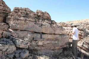
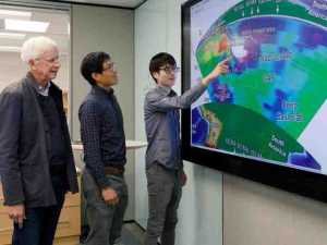
Professor Tetsuo Irifune of the Geodynamics Research Center (GRC) of Ehime University heads a research group investigating the Earth’s interior by means of experiments at extreme pressures and temperatures, simulating those expected in the deepest regions of our planet.

Using a combination of ultrasonic techniques and a large volume press apparatus, GRC researchers were successful in measuring the sound velocities of CaSiO3 perovskite (CaPv), an important mineral of the mantle at depths below 560 km. This result allowed them to directly interpret seismic observations by a comparison with their velocity profiles obtained in the laboratory, and derived some composition models for the regions across the 660 km depth discontinuity that marks the boundary between the upper and lower mantle.

The scientific article that presents their results was published on January 10 in the journal Nature.

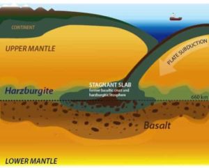
CaPv constitutes 7-10 vol% of the pyrolitic mantle and up to 30 vol% of subducted basaltic rocks below ~560 km depth and therefore is an important constituent mineral in both the mantle transition region (MTR; 410-660 km in depth) and lower mantle (660-2900 km in depth). CaPv also plays an important role in immobilizing heavy elements such as rare earth elements or actinides in the mantle due to its large calcium site, which can easily accommodate such large elements. But despite such importance, no measurements of sound velocities have been made CaPv at high temperatures, because this phase is unstable at ambient conditions and hence there was no adequate sample for such measurements.

“Because CaPv is only stable at pressure and temperature conditions of the mantle, we designed an experiment that allows us to synthesize this phase with the adequate shape and dimension under high pressure, then subsequently send an acoustic wave directly into the pressurized sample. Using this new approach, we can study high-pressure minerals, which are not stable at atmospheric conditions, such as CaPv.” says Steeve Gréaux, the researcher leading this project.

Professor Irifune and his team already demonstrated in 2008, that pyrolite, a hypothetical rock composition derived as a mixture of basalt and peridotite agree well with geophysical observations at depths down to 560 km, which was also reported in Nature. However, at that time, they could not draw further conclusions at depths lower than 560 km because there was no available data on CaPv. Their 2019 results became the last piece of a puzzle and allowed them to complete their hypotheses for the seismic structure of the mantle in between the depths of 560 km and 800 km.

“We did find that the cubic form of CaPv, which is most likely to be present in the mantle, has lower velocities than what was formerly predicted by theoretical studies. This result refutes previous models that proposed formation of CaPv in pyrolite could explain the steep velocity gradient above a depth of 660 km. On the other hand, it is in good agreement with a former study proposing the presence of basalts beneath a depth of 660 km on the basis of density measurements.” says Tetsuo Irifune.

These new results indeed show that the presence of subducted oceanic crust can explain the magnitude of the reduction of shear velocity below a depth of 660 km, as observed beneath North America. Incidentally, the model they proposed is very consistent with the recent discovery, in 2018, of CaPv in a natural diamond, which provides evidence for the presence of oceanic crust material in the uppermost lower mantle. It is also compatible with global-scale geodynamics calculations that predicted basalt enrichment beneath 660 km would stabilize the subducted slab in this region.

The authors conclude “CaPv, which was once called “invisible” in the lower mantle as this phase was predicted to have velocities similar to those of the most abundant mineral (MgSiO3 perovskite or bridgmanite) in fact holds velocities substantially lower than those of bridgmanite at depths of 660-800 km, which should greatly contribute to tracing the existence and recycling of the former oceanic crust in the Earth’s lower mantle..”

Reference:
Steeve Gréaux, Tetsuo Irifune, Yuji Higo, Yoshinori Tange, Takeshi Arimoto, Zhaodong Liu, Akihiro Yamada. Sound velocity of CaSiO3 perovskite suggests the presence of basaltic crust in the Earth’s lower mantle. Nature, 2019; 565 (7738): 218 DOI: 10.1038/s41586-018-0816-5

Note: The above post is reprinted from materials provided by Ehime University.

New oviraptorosaur species discovered in Mongolia

Gobiraptor reconstruction.
Gobiraptor reconstruction. Credit: Do Yoon Kim (2019)

A new oviraptorosaur species from the Late Cretaceous was discovered in Mongolia, according to a study published in February 6, 2019 in the open-access journal PLOS ONE by Yuong-Nam Lee from Seoul National University, South Korea, and colleagues.

Oviraptorosaurs were a diverse group of feathered, bird-like dinosaurs from the Cretaceous of Asia and North America. Despite the abundance of nearly complete oviraptorosaur skeletons discovered in southern China and Mongolia, the diet and feeding strategies of these toothless dinosaurs are still unclear. In this study, Lee and colleagues described an incomplete skeleton of an oviraptorosaur found in the Nemegt Formation of the Gobi desert of Mongolia.

The new species, named Gobiraptor minutus, can be distinguished from other oviraptorosaurs in having unusual thickened jaws. This unique morphology suggests that Gobiraptor used a crushing feeding strategy, supporting previous hypotheses that oviraptorosaurs probably fed on hard food items such as eggs, seeds or hard-shell mollusks. Histological analyses of the femur revealed that the specimen likely belonged to a very young individual.

The finding of a new oviraptorosaur species in the Nemegt Formation, which consists mostly of river and lake deposits, confirms that these dinosaurs were extremely well adapted to wet environments. The authors propose that different dietary strategies may explain the wide taxonomic diversity and evolutionary success of this group in the region.

The authors add: “A new oviraptorid dinosaur Gobiraptor minutus gen. et sp. nov. from the Upper Cretaceous Nemegt Formation is described here based on a single holotype specimen that includes incomplete cranial and postcranial elements. The unique morphology of the mandible and the accordingly inferred specialized diet of Gobiraptor also indicate that different dietary strategies may be one of important factors linked with the remarkably high diversity of oviraptorids in the Nemegt Basin.”

Reference:
Sungjin Lee, Yuong-Nam Lee, Anusuya Chinsamy, Junchang Lü, Rinchen Barsbold, Khishigjav Tsogtbaatar. A new baby oviraptorid dinosaur (Dinosauria: Theropoda) from the Upper Cretaceous Nemegt Formation of Mongolia. PLOS ONE, 2019; 14 (2): e0210867 DOI: 10.1371/journal.pone.0210867

Note: The above post is reprinted from materials provided by PLOS.

Earliest known seed-eating perching bird discovered in Fossil Lake, Wyoming

Eofringillirostrum boudreauxi
The 52-million-year-old fossil of Eofringillirostrum boudreauxi, the earliest known perching bird with a beak for eating seeds. Credit: Copyright Lance Grande, Field Museum

Most of the birds you’ve ever seen — sparrows, finches, robins, crows — have one crucial thing in common: they’re all what scientists refer to as perching birds, or “passerines.” The passerines make up about 6,500 of the 10,000 bird species alive today. But while they’re everywhere now, they were once rare, and scientists are still learning about their origins. In a new paper in Current Biology, researchers have announced the discovery of one of the earliest known passerine birds, from 52 million years ago.

“This is one of the earliest known perching birds. It’s fascinating because passerines today make up most of all bird species, but they were extremely rare back then. This particular piece is just exquisite,” says Field Museum Neguanee Distinguished Service Curator Lance Grande, an author of the paper. “It is a complete skeleton with the feathers still attached, which is extremely rare in the fossil record of birds.”

The paper describes two new fossil bird species — one from Germany that lived 47 million years ago, and another that lived in what’s now Wyoming 52 million years ago, a period known as the Early Eocene. The Wyoming bird, Eofringillirostrum boudreauxi, is the earliest example of a bird with a finch-like beak, similar to today’s sparrows and finches. This legacy is reflected in its name; Eofringilllirostrum means “dawn finch beak.” (Meanwhile, boudreauxi is a nod to Terry and Gail Boudreaux, longtime supporters of science at the Field Museum.)”

The fossil birds’ finch-like, thick beaks hint at their diet. “These bills are particularly well-suited for consuming small, hard seeds,” says Daniel Ksepka, the paper’s lead author, curator at the Bruce Museum in Connecticut. Anyone with a birdfeeder knows that lots of birds are nuts for seeds, but seed-eating is a fairly recent biological phenomenon. “The earliest birds probably ate insects and fish, some may have been eating small lizards,” says Grande. “Until this discovery, we did not know much about the ecology of early passerines. E. boudreauxi gives us an important look at this.”

“We were able to show that a comparable diversity of bill types already developed in the Eocene in very early ancestors of passerines,” says co-author Gerald Mayr of the Senckenberg Research Institute in Frankfurt. “The great distance between the two fossil sites implies that these birds were widespread during the Eocene, while the scarcity of known fossils suggests a rather low number of individuals,” adds Ksepka.

While passerine birds were rare 52 million years ago, E. boudreauxi had the good luck to live and die near Fossil Lake, a site famous for perfect fossilization conditions.

“Fossil Lake is a really graphic picture of an entire community locked in stone — it has everything from fishes and crocs to insects, pollen, reptiles, birds, and early mammals,” says Grande. “We have spent so much time excavating this locality, that we have a record of even the very rare things.”

Grande notes that Fossil Lake provides a unique look at the ancient world — one of the most detailed pictures of life on Earth after the extinction of the dinosaurs (minus the birds) 65 million years ago. “Knowing what happened in the past gives us a better understanding of the present and may help us figure out where we are going for the future.”

With that in mind, Grande plans to continue his exploration of the locale. “I’ve been going to Fossil Lake every year for the last 35 years, and finding this bird is one of the reasons I keep going back. It’s so rich,” says Grande. “We keep finding things that no one’s ever seen before.”

Reference:
Daniel T. Ksepka, Lance Grande, Gerald Mayr. Oldest Finch-Beaked Birds Reveal Parallel Ecological Radiations in the Earliest Evolution of Passerines. Current Biology, 2019 DOI: 10.1016/j.cub.2018.12.040

Note: The above post is reprinted from materials provided by Field Museum.

Unusual microbes hold clues to early life

Scientists use the deep-diving robot Jason to collect water samples from oceanic crust at a subseafloor observatory off the coast of Washington. A recent study found that a group of unusual microbes living below the seafloor provides clues to the evolution of life on Earth, and potentially other planets. Credit: Woods Hole Oceanographic Institution, courtesy of University of California, Santa Cruz, US National Science Foundation, ROV Jason dive J2-711, 2013, AT26-03 cruise chief scientist Andrew Fisher

A new study has revealed how a group of deep-sea microbes provides clues to the evolution of life on Earth, according to a recent paper in The ISME Journal. Researchers used cutting-edge molecular methods to study these microbes, which thrive in the hot, oxygen-free fluids that flow through Earth’s crust.

Called Hydrothermarchaeota, this group of microbes lives in such an extreme environment that they have never been cultivated in a laboratory for study. A research team from Bigelow Laboratory for Ocean Sciences, the University of Hawai’i at Manoa, and the Department of Energy Joint Genome Institute bypassed the problem of cultivation with genetic sequencing methods called genomics, a suite of novel techniques used to sequence large groups of genetic information. They found that Hydrothermarchaeota may obtain energy by processing carbon monoxide and sulfate, which is an overlooked metabolic strategy. The microbes use energy from this process to grow as a form of chemosynthesis.

“The majority of life on Earth is microbial, and most microbes have never been cultivated,” said Beth Orcutt, a senior research scientist at Bigelow Laboratory and one of the study’s senior authors. “These findings emphasize why single cell genomics are such important tools for discovering how a huge proportion of life functions.”

Analyzing Hydrothermarchaeota genomes revealed that these microbes belong to the group of single-celled life known as archaea and evolved early in the history of life on Earth — as did their unusual metabolic processes. These observations suggest that the subsurface ocean crust is an important habitat for understanding how life evolved on Earth, and potentially other planets.

The researchers also found genetic evidence that Hydrothermarchaeota have the ability to move on their own. Motility offers a valuable survival strategy for the extreme environment they call home, which has a limited supply of nutrients essential to life.

“Studying these unique microbes can give us insights into both the history of Earth and the potential strategies of life on other planets,” said Stephanie Carr, first author on the paper and a former postdoctoral researcher with Orcutt who is now an assistant professor at Hartwick College. “Their survival strategies make them incredibly versatile, and they play an important, overlooked role in the subsurface environments where they live.”

In 2011, Orcutt and other project scientists sailed to the flank of the Juan de Fuca Ridge, a mid-ocean ridge off the coast of Washington where two ocean plates are separating and generating new oceanic crust. They used Woods Hole Oceanographic Institution’s deep-diving robot Jason to travel 2.6 km to the seafloor and collect samples of the fluid that flows through the deep crust.

These crustal fluids contained microbes that had never before been studied. Working in partnership with the Department of Energy Joint Genome Institute, the researchers sorted and analyzed the microbes in the Single Cell Genomics Center at Bigelow Laboratory. This cutting-edge research facility is directed by Ramunas Stepanauskas, a senior research scientist and study author. The project team also analyzed the microbes using metagenomics, a technique that extracts genomic information directly from environmental samples. These analyses yielded insights into the genetic blueprints of Hydrothermarchaeota, their relationship to other archaea, and the strategies they have evolved to survive in the subseafloor.

The researchers will build upon this discovery when they return to the Juan de Fuca Ridge in May 2019 to continue investigating the extreme microbes thriving below the seafloor. Orcutt will lead a cruise using ROV Jason with this team of researchers to further explore the subseafloor environment, leveraging funding from the National Science Foundation and NASA.

“The microbes living ‘buried alive’ below the seafloor are really intriguing to us, since they can survive on low amounts of energy,” Orcutt said. “We hope that our experiments on these weird microbes can show how they do this, so we can imagine how life might exist on other planets.”

Reference:
Stephanie A. Carr, Sean P. Jungbluth, Emiley A. Eloe-Fadrosh, Ramunas Stepanauskas, Tanja Woyke, Michael S. Rappé, Beth N. Orcutt. Carboxydotrophy potential of uncultivated Hydrothermarchaeota from the subseafloor crustal biosphere. The ISME Journal, 2019; DOI: 10.1038/s41396-019-0352-9

Note: The above post is reprinted from materials provided by Bigelow Laboratory for Ocean Sciences.

Researchers help define Southern Ocean’s geological features

pillow basalts from undersea volcanic eruptions,
Pillow basalts from undersea volcanic eruptions. Credit: National Science Foundation

New data collected by University of Wyoming researchers and others point to a newly defined mantle domain in a remote part of the Southern Ocean.

UW Department of Geology and Geophysics Professor Ken Sims and recent Ph.D. graduate Sean Scott are co-authors of an article, “An isotopically distinct Zealandia-Antarctic mantle domain in the Southern Ocean,” published by the scientific journal Nature Geoscience in January.

“The Australian-Antarctic Ridge is the remotest mid-ocean ridge in the world’s oceans and one of the last explored ridge segments, and, lo and behold, our isotope measurements of the samples we collected provided us with quite a surprise — an entirely new domain in the Earth’s mantle,” Sims says.

The two were part of a group investigating the Australian-Antarctic Ridge (AAR) that included researchers from the United States, South Korea and France. Known as the last gap in the mapping and sampling of seafloor spreading centers, AAR is a 1,200-mile expanse in the most remote parts of the ocean ridge system. Specifically, the team was looking to resolve questions surrounding the boundaries of Earth’s mantle domains as seen in ocean basalt formations created during mantle melting.

Those basalt formations are pushed up from the Earth’s mantle beneath the Indian and Pacific oceans through the ridges and have distinct isotopic compositions. That has created a long-accepted boundary at the Australian-Antarctic Discordance along the Southeast Indian Ridge. This boundary has been widely used to place constraints on large-scale patterns of the mantle flow and composition in the Earth’s upper mantle. However, sampling between the Indian and Pacific ridges was lacking, because of difficulty in obtaining samples.

Now, Sims, Scott and company present data from the region that show the ridge has isotopic compositions distinct from both the Pacific and Indian mantle domains. The data define a separate Zealandia-Antarctic domain that appears to have formed in response to the deep mantle upwelling and ensuing volcanism that led to the breakup of ancient supercontinent Gondwana around 90 million years ago. The Zealandia-Antarctic domain currently persists at the margins of the Antarctic continent.

The group surmises that the relatively shallow depths of the AAR may be the result of this deep mantle upwelling, and large offset transformations to the east may be its boundary with the Pacific domain.

Reference:
Sung-Hyun Park, Charles H. Langmuir, Kenneth W. W. Sims, Janne Blichert-Toft, Seung-Sep Kim, Sean R. Scott, Jian Lin, Hakkyum Choi, Yun-Seok Yang, Peter J. Michael. An isotopically distinct Zealandia–Antarctic mantle domain in the Southern Ocean. Nature Geoscience, 2019; DOI: 10.1038/s41561-018-0292-4

Note: The above post is reprinted from materials provided by University of Wyoming.

T. rex possessed a unique flexible skull

T. rex had an unusually flexible skull. Credit: Senckenberg

Senckenberg scientist Ingmar Werneburg, together with an international team, re-examined the skull structure of Tyrannosaurus rex. Using an “anatomical network analysis,” the researchers showed that the carnivorous dinosaur had an extremely flexible skull structure. Different bone modules led to a highly flexible muzzle that aided in tearing apart prey animals. The study was published today in the journal Scientific Reports.

Tyrannosaurus rex – the “King of the Tyrant Lizards” – owes its name in part to its impressive teeth and skull. The latter was subject to closer scrutiny by an international team of scientists from Germany, Switzerland, Great Britain, Spain, and the USA. “We compared the skull of T. rex with the skull construction of modern terrestrial vertebrates and used an anatomical network analysis to examine which skull bones are connected to each other,” explains the study’s lead author, PD Dr. Ingmar Werneburg of the Senckenberg Centre for Human Evolution and Palaeoenvironment at the University of Tübingen.

The analysis revealed that, among all groups of animals analyzed in the study, the large carnivore possessed the highest number of “skull modules” – skull bones that form units with adjacent bones. This resulted in a particularly high mobility of the skull. “We were most surprised to discover the presence of separate upper and lower muzzle modules, which probably could move independent of each other,” adds the scientist from Tübingen.

The researchers hypothesize that the feeding habits of Tyrannosaurus rex may have led to the complexity of its skull. The division into a lower and an upper muzzle module may have provided a certain amount of flexibility to the tooth-bearing part of the muzzle that aided in the forceful tearing of prey animals. “This trait, combined with teeth anchored within tooth pockets and two large temporal fenestrae (openings) as attachment points for the strong jaw muscles, made T. rex the ‘ideal carnivore,’ adds Werneburg in summary.

Reference:
Ingmar Werneburg et al. Unique skull network complexity of Tyrannosaurus rex among land vertebrates, Scientific Reports (2019). DOI: 10.1038/s41598-018-37976-8

Note: The above post is reprinted from materials provided by Senckenberg Research Institute and Natural History Museum.

First discovered fossil feather did not belong to iconic bird Archaeopteryx

The isolated Archaeopteryx feather is the first fossil feather ever discovered. Top image, the feather as it looks today under white light. Middle image, the original drawing from 1862 by Hermann von Meyer. Bottom image, Laser-Stimulated Fluorescence (LSF) showing the halo of the missing quill. Scale bar is 1cm. Credit: Copyright The University of Hong Kong

A 150-year-old fossil feather mystery has been solved by an international research team including Dr Michael Pittman from the Department of Earth Sciences, The University of Hong Kong. Dr Pittman and his colleagues applied a novel imaging technique, Laser-Stimulated Fluorescence (LSF), revealing the missing quill of the first fossil feather ever discovered, dethroning an icon in the process.

This fossil feather was found in the Solnhofen area of southern Germany in 1861. The isolated feather was used to name the iconic fossil bird Archaeopteryx and was closely identified with its skeletons. Unlike the feather impressions preserved in some Archaeopteryx fossils, the isolated feather is preserved as a dark film. The detailed 1862 description of the feather mentions a rather long quill visible on the fossil, but this is unseen today. Even recent x-ray fluorescence and UV imaging studies did not end the debate of the “missing quill.” The original existence of this quill has therefore been debated and it was unclear if the single feather represented a primary, secondary, or primary covert feather.

The results of this study are described in the journal Scientific Reports, and underscore the potential and scientific importance of Laser-Stimulated Fluorescence, which is being developed by Thomas G Kaye of the Foundation for Scientific Advancement, USA and Dr Pittman. “My imaging work with Tom Kaye demonstrates that important discoveries remain to be made even in the most iconic and well-studied fossils,” says Dr Pittman.

With the help of the LSF images, the team finally solved the 150-year-old missing quill mystery. The now completely visible feather allowed detailed comparisons with the feather impressions of Archaeopteryx and with living birds. Before this LSF work, the feather was thought to represent a primary covert from Archaeopteryx, but this study shows that it differs from coverts of modern birds by lacking a distinct s-shaped centerline. The team also ruled out that the feather represented a primary, secondary, or tail feather of Archaeopteryx. Instead, the new data indicates that the isolated feather came from an unknown feathered dinosaur and that its attribution to Archaeopteryx was wrong. “It is amazing that this new technique allows us to resolve the 150-year-old mystery of the missing quill,” says Daniela Schwarz, co-author in the study and curator for the fossil reptiles and bird collection of the Museum für Naturkunde, Berlin. This discovery also demonstrates that the diversity of feathered dinosaurs was likely higher around the ancient Solnhofen Archipelago than previously thought. “The success of the LSF technique here is sure to lead to more discoveries and applications in other fields. But, you’ll have to wait and see what we find next!” added Tom Kaye, the study’s lead author.

Reference:
Thomas G. Kaye, Michael Pittman, Gerald Mayr, Daniela Schwarz, Xing Xu. Detection of lost calamus challenges identity of isolated Archaeopteryx feather. Scientific Reports, 2019; 9 (1) DOI: 10.1038/s41598-018-37343-7

Note: The above post is reprinted from materials provided by The University of Hong Kong.

These strange fossils are closely related to sea urchins

Stunningly well-preserved fossilized soft tissues of a stylophoran have recently been discovered
Stunningly well-preserved fossilized soft tissues of a stylophoran have recently been discovered. Shown here is the reconstruction of an individual of the stylophoran genus Thoralicystis. Stylophorans measured 0.5 to 4 cm and had flat, massive bodies or tests with paddle-like extensions, analogous to snowshoes, which allowed them to stay over soft seafloors. Credit: Rich Mooi / California Academy of Science

Just a few centimeters long, these animals thrived in the ocean roughly half a billion years ago. Because of their odd morphology, scientists have long struggled to find their branch on the tree of life.

Was their long appendage similar to a tail? That would make them ancestors of the vertebrates. However, their skeletons are made up of many calcite plates, suggestive of the bodies of echinoderms like sea urchins and starfish, even though they lack the characteristic symmetry of these animals.

A team led by Bertrand Lefebvre, a CNRS researcher at the Laboratoire de Géologie de Lyon, could finally settle this 150-year-old debate, using exceptionally preserved fossils from the Bou Izargane excavation in Morocco. Very unusually, the soft tissues of the fossilized creatures were preserved as pyrite, a ferrous mineral. By mapping the distribution of iron within the fossils, the researchers were able to clarify the fine structure of the appendage, which turns out to be comparable to that of a starfish arm. So these organisms had neither a head nor a tail, but rather a feeding arm.

Reference:
Bertrand Lefebvre et al. Exceptionally preserved soft parts in fossils from the Lower Ordovician of Morocco clarify stylophoran affinities within basal deuterostomes, Geobios (2018). DOI: 10.1016/j.geobios.2018.11.001

Note: The above post is reprinted from materials provided by CNRS.

Earthquake with magnitude 7.5 in Indonesia—an unusual and steady speed

On the area map on the left, the colored background is the ground displacement induced by the Palu earthquake and the thin black line is the fault, both derived from satellite radar images. The black dot is the city of Palu. The circles are spots that radiated waves during the earthquake; their color indicates time (blue at the beginning, red at the end). The right figure shows the timing and position of these earthquake radiators. Their alignment indicates a steady earthquake speed of about 4.1 km/s Credit: © Han Bao et al., Nature Geoscience

An international team of researchers from the French National Research Institute for Sustainable Development (IRD-France), Université Côte d”Azur, University of California Los Angeles and California Institute of Technology has determined the propagation speed of the 7.5 magnitude earthquake which occurred in Indonesia in September 2018: 4.1 km/s along 150 km. The results, which also shed light on the earthquake rupture path, are published on February 4th in Nature Geoscience.

Earthquakes happen when rocks on either side of a tectonic fault shift suddenly in opposite directions. Two main seismic waves that carry out shaking of a breaking fault are S-waves, which shear rocks and propagate at about 3.5 km/s, and P-waves, which compress rocks and propagate faster, at about 5 km/s.

Geophysical observations show that the speed at which an earthquake ruptures along the fault is either slower than S-waves or almost as fast as P-waves. The latter, so-called supershear earthquakes, occur very rarely and can produce very strong shaking. Only a few have been observed, and they happen on faults that are remarkably straight, geological “superhighways” that present little obstacle to speeding earthquakes.

“Forbidden” speed range

In this study, the international team coordinated by Jean-Paul Ampuero, seismologist at IRD and Université Côte d”Azur, analysed the 7.5 magnitude earthquake that rocked the Sulawesi island in Indonesia on September 28th, devastating Palu’s region.

The impact of the event—more than 2,000 deaths—was aggravated by a devastating sequence of secondary effects, involving soil liquefaction, landslides and a tsunami.

Thanks to a high-resolution analysis of seismological data, researchers identified the propagation speed of the earthquake: 4.1 km/s, an unusual speed, between the speed of S- and P-waves. “This is the first time we observed this speed so steadily,” underlines Jean-Paul Ampuero. “This earthquake ran in the ‘forbidden’ speed range, and can be considered as a supershear event, even if it’s not as fast as previous ones.”

By analyzing optical and radar images recorded by satellites especially re-tasked to observe the earthquake aftermath, the researchers determined the path of the fault rupture. They found that the fault was not straight, but had at least two major bends, and left more than five meters of ground offset across the city of Palu. ” This path has major obstacles, which should have reduced the earthquake’s speed, but it stayed at 4.1 km/s along 150 km,” says Jean-Paul Ampuero.

Toward a better anticipation of future earthquakes

The findings challenge current views of earthquakes in ways that could help researchers and public authorities prepare better for future events. “In classical earthquake models, faults live in idealized intact rocks “, says Ampuero, ” but real faults are wrapped in a layer of rocks that have been fractured and softened by previous earthquakes. Steady rupture at speeds that are unexpected on intact rocks can actually happen on damaged rocks, simply because they have slower seismic wave speeds.”

The Palu earthquake may offer the first clear test of such recent models if followed up by studies of the structure of the fault and its zone of damaged rocks. Because the impact of an earthquake depends strongly on its speed, such studies on other faults around the world could anticipate earthquake effects better.

Future work may also determine if the speed of the Palu earthquake enhanced its cascading effects, by promoting coastal and submarine landslides that in turn contributed to the tsunami.

Reference:
Early and persistent supershear rupture of the 2018 magnitude 7.5 Palu earthquake, Nature Geoscience (2019). DOI: 10.1038/s41561-018-0297-z

Note: The above post is reprinted from materials provided by Institut de recherche pour le développement.

Researchers unearth an ice age in the African desert

The drumlins were formed by fast-moving ice floes instead of slow melting ice. Credit: WVU

A field trip to Namibia to study volcanic rocks led to an unexpected discovery by West Virginia University geologists Graham Andrews and Sarah Brown.

While exploring the desert country in southern Africa, they stumbled upon a peculiar land formation—flat desert scattered with hundreds of long, steep hills. They quickly realized the bumpy landscape was shaped by drumlins, a type of hill often found in places once covered in glaciers, an abnormal characteristic for desert landscapes.

“We quickly realized what we were looking at because we both grew up in areas of the world that had been under glaciers, me in Northern Ireland and Sarah in northern Illinois,” said Andrews, an assistant professor of geology. “It’s not like anything we see in West Virginia where we’re used to flat areas and then gorges and steep-sided valleys down into hollows.”

After returning home from the trip, Andrews began researching the origins of the Namibian drumlins, only to learn they had never been studied.

“The last rocks we were shown on the trip are from a time period when southern Africa was covered by ice,” Andrews said. “People obviously knew that part of the world had been covered in ice at one time, but no one had ever mentioned anything about how the drumlins formed or that they were even there at all.”

Andrews teamed up with WVU geology senior Andy McGrady to use morphometrics, or measurements of shapes, to determine if the drumlins showed any patterns that would reflect regular behaviors as the ice carved them.

While normal glaciers have sequential patterns of growing and melting, they do not move much, Andrews explained. However, they determined that the drumlins featured large grooves, which showed that the ice had to be moving at a fast pace to carve the grooves.

These grooves demonstrated the first evidence of an ice stream in southern Africa in the late Paleozoic Age, which occurred about 300 million years ago.

“The ice carved big, long grooves in the rock as it moved,” Andrews said. “It wasn’t just that there was ice there, but there was an ice stream. It was an area where the ice was really moving fast.”

McGrady used freely available information from Google Earth and Google Maps to measure their length, width and height.

“This work is very important because not much has been published on these glacial features in Namibia,” said McGrady, a senior geology student from Hamlin. “It’s interesting to think that this was pioneer work in a sense, that this is one of the first papers to cover the characteristics of these features and gives some insight into how they were formed.”

Their findings also confirm that southern Africa was located over the South Pole during this period.

“These features provide yet another tie between southern Africa and south America to show they were once joined,” Andrews said.

The study, “First description of subglacial megalineations from the late Paleozoic ice age in southern Africa” is published in the Public Library of Science’s PLOS ONE journal.

“This is a great example of a fundamental discovery and new insights into the climatic history of our world that remain to be discovered,” said Tim Carr, chair of the Department of Geology and Geography.

Reference:
Graham D. Andrews et al, First description of subglacial megalineations from the late Paleozoic ice age in southern Africa, PLOS ONE (2019). DOI: 10.1371/journal.pone.0210673

Note: The above post is reprinted from materials provided by West Virginia University.

MERMAIDs reveal secrets from below the ocean floor

Floating seismometers dubbed MERMAIDs -- Mobile Earthquake Recording in Marine Areas by Independent Divers -- reveal that Galapagos volcanoes are fed by a mantle plume reaching 1,900 km deep. By letting their nine MERMAIDs float freely for two years, an international team of researchers created an artificial network of oceanic seismometers that could fill in one of the blank areas on the global geologic map, where otherwise no seismic information is available. Drifting a mile below the surface, MERMAIDs cover a large area. The red circles show where a MERMAID picked up a seismic signal. Credit: Courtesy of the researchers
Floating seismometers dubbed MERMAIDs — Mobile Earthquake Recording in Marine Areas by Independent Divers — reveal that Galapagos volcanoes are fed by a mantle plume reaching 1,900 km deep. By letting their nine MERMAIDs float freely for two years, an international team of researchers created an artificial network of oceanic seismometers that could fill in one of the blank areas on the global geologic map, where otherwise no seismic information is available. Drifting a mile below the surface, MERMAIDs cover a large area. The red circles show where a MERMAID picked up a seismic signal. Credit: Courtesy of the researchers

Seismologists use waves generated by earthquakes to scan the interior of our planet, much like doctors image their patients using medical tomography. Earth imaging has helped us track down the deep origins of volcanic islands such as Hawaii, and identify the source zones of deep earthquakes.

“Imagine a radiologist forced to work with a CAT scanner that is missing two-thirds of its necessary sensors,” said Frederik Simons, a professor of geosciences at Princeton. “Two-thirds is the fraction of the Earth that is covered by oceans and therefore lacking seismic recording stations. Such is the situation faced by seismologists attempting to sharpen their images of the inside of our planet.”

Some 15 years ago, when he was a postdoctoral researcher, Simons partnered with Guust Nolet, now the George J. Magee Professor of Geoscience and Geological Engineering, Emeritus, and they resolved to remediate this situation by building an undersea robot equipped with a hydrophone — an underwater microphone that can pick up the sounds of distant earthquakes whose waves deliver acoustic energy into the oceans through the ocean floor.

This week, Nolet, Simons and an international team of researchers published the first scientific results from the revolutionary seismic floats, dubbed MERMAIDs — Mobile Earthquake Recording in Marine Areas by Independent Divers.

The researchers, from institutions in the United States, France, Ecuador and China, found that the volcanoes on Galápagos are fed by a source 1,200 miles (1,900 km) deep, via a narrow conduit that is bringing hot rock to the surface. Such “mantle plumes” were first proposed in 1971 by one of the fathers of plate tectonics, Princeton geophysicist W. Jason Morgan, but they have resisted attempts at detailed seismic imaging because they are found in the oceans, rarely near any seismic stations.

MERMAIDs drift passively, normally at a depth of 1,500 meters — about a mile below the sea surface — moving 2-3 miles per day. When one detects a possible incoming earthquake, it rises to the surface, usually within 95 minutes, to determine its position with GPS and transmit the seismic data.

By letting their nine robots float freely for two years, the scientists created an artificial network of oceanic seismometers that could fill in one of the blank areas on the global geologic map, where otherwise no seismic information is available.

The unexpectedly high temperature that their model shows in the Galápagos mantle plume “hints at the important role that plumes play in the mechanism that allows the Earth to keep itself warm,” said Nolet.

“Since the 19th century, when Lord Kelvin predicted that Earth should cool to be a dead planet within a hundred million years, geophysicists have struggled with the mystery that the Earth has kept a fairly constant temperature over more than 4.5 billion years,” Nolet explained. “It could have done so only if some of the original heat from its accretion, and that created since by radioactive minerals, could stay locked inside the lower mantle. But most models of the Earth predict that the mantle should be convecting vigorously and releasing this heat much more quickly. These results of the Galápagos experiment point to an alternative explanation: the lower mantle may well resist convection, and instead only bring heat to the surface in the form of mantle plumes such as the ones creating Galápagos and Hawaii.”

To further answer questions on the heat budget of the Earth and the role that mantle plumes play in it, Simons and Nolet have teamed up with seismologists from the Southern University of Science and Technology (SUSTech) in Shenzhen, China, and from the Japan Agency for Marine-Earth Science and Technology (JAMSTEC). Together, and with vessels provided by the French research fleet, they are in the process of launching some 50 MERMAIDs in the South Pacific to study the mantle plume region under the island of Tahiti.

“Stay tuned! There are many more discoveries to come,” said professor Yongshun (John) Chen, a 1989 Princeton graduate alumnus who is head of the Department of Ocean Science and Engineering at SUSTech, which is leading the next phase of what they and their international team have called EarthScope-Oceans.

Reference:
Guust Nolet, Yann Hello, Suzan van der Lee, Sébastien Bonnieux, Mario C. Ruiz, Nelson A. Pazmino, Anne Deschamps, Marc M. Regnier, Yvonne Font, Yongshun J. Chen, Frederik J. Simons. Imaging the Galápagos mantle plume with an unconventional application of floating seismometers. Scientific Reports, 2019; 9 (1) DOI: 10.1038/s41598-018-36835-w

Note: The above post is reprinted from materials provided by Princeton University.

The 210-million-year-old Smok was crushing bones like a hyena

Coprolites, or fossil droppings, of the dinosaur-like archosaur Smok wawelski contain lots of chewed-up bone fragments. This led researchers at Uppsala University to conclude that this top predator was exploiting bones for salt and marrow, a behavior often linked to mammals but seldom to archosaurs. Credit: Martin Qvarnström

Coprolites, or fossil droppings, of the dinosaur-like archosaur Smok wawelski contain lots of chewed-up bone fragments. This led researchers at Uppsala University to conclude that this top predator was exploiting bones for salt and marrow, a behavior often linked to mammals but seldom to archosaurs.

Most predatory dinosaurs used their blade-like teeth to feed on the flesh of their prey, but they are commonly not thought to be much of bone crushers. The major exception is seen in the large tyrannosaurids, such as Tyrannosaurus rex, that roamed North America toward the end of the age of dinosaurs. The tyrannosaurids are thought to have been osteophagous (voluntarily exploiting bone) based on findings of bone-rich coprolites, bite-marked bones, and their robust teeth being commonly worn.

In a study published in Scientific Reports, researchers from Uppsala University were able to link ten large coprolites to Smok wawelski, a top predator of a Late Triassic (210 million year old) assemblage unearthed in Poland. This bipedal, 5-6 meters long animal lived some 140 million years before the tyrannosaurids of North America and had a T. rex-like appearance, although it is not fully clear whether it was a true dinosaur or a dinosaur-like precursor.

Three of the coprolites were scanned using synchrotron microtomography. This method has just recently been applied to coprolites and works somewhat like a CT scanner in a hospital, with the difference that the energy in the x-ray beams is much stronger. This makes it possible to visualize internal structures in fossils in three dimensions.

The coprolites were shown to contain up to 50 percent of bones from prey animals such as large amphibians and juvenile dicynodonts. Several crushed serrated teeth, probably belonging to the coprolite producer itself, were also found in the coprolites. This means that the teeth were repeatedly crushed against the hard food items (and involuntarily ingested) and replaced by new ones.

Further evidence for a bone-crushing behaviour can also be found in the fossils from the same bone beds in Poland. These include worn teeth and bone-rich fossil regurgitates from Smok wawelski, as well as numerous crushed or bite-marked bones.

Several of the anatomical characters related to osteophagy, such as a massive head and robust body, seem to be shared by S. wawelski and the tyrannosaurids, despite them being distantly related and living 140 million years apart. These large predators therefore seem to provide evidence of similar feeding adaptations being independently acquired at the beginning and end of the age of dinosaurs.

Reference:
Martin Qvarnström, Per E. Ahlberg, Grzegorz Niedźwiedzki. Tyrannosaurid-like osteophagy by a Triassic archosaur. Scientific Reports, 2019; 9 (1) DOI: 10.1038/s41598-018-37540-4

Note: The above post is reprinted from materials provided by Uppsala University.

Ancient asteroid impacts played a role in creation of Earth’s future continents

A model for the compositional evolution of the early Earth's crust due to fractional crystallization of impact melt sheets followed by detachment and sinking of their dense primitive portions towards the crust-mantle boundary. Credit: Rais Latypov
A model for the compositional evolution of the early Earth’s crust due to fractional crystallization of impact melt sheets followed by detachment and sinking of their dense primitive portions towards the crust-mantle boundary. Credit: Rais Latypov

The heavy bombardment of terrestrial planets by asteroids from space has contributed to the formation of the early evolved crust on Earth that later gave rise to continents — home to human civilisation.

More than 3.8 billion years ago, in a time period called the Hadean eon, our planet Earth was constantly bombarded by asteroids, which caused the large-scale melting of its surface rocks. Most of these surface rocks were basalts, and the asteroid impacts produced large pools of superheated impact melt of such composition. These basaltic pools were tens of kilometres thick, and thousands of kilometres in diameter.

“If you want to get an idea of what the surface of Earth looked like at that time, you can just look at the surface of the Moon which is covered by a vast amount of large impact craters,” says Professor Rais Latypov from the School of Geosciences of the University of the Witwatersrand in South Africa.

The subsequent fate of these ancient, giant melt sheet remains, however, highly debatable. It has been argued that, on cooling, they may have crystallized back into magmatic bodies of the same, broadly basaltic composition. In this scenario, asteroid impacts are supposed to play no role in the formation of the Earth’s early evolved crust.

An alternative model suggests that these sheets may undergo large-scale chemical change to produce layered magmatic intrusions, such as the Bushveld Complex in South Africa. In this scenario, asteroid impacts may have played an important role in producing various igneous rocks in the early Earth’s crust and therefore they may have contributed to its chemical evolution.

There is no direct way to rigorously test these two competing scenarios because the ancient Hadean impact melts have been later obliterated by plate tectonics. However, by studying the younger impact melt sheet of the Sudbury Igneous Complex (SIC) in Canada, Latypov and his research team have inferred that ancient asteroid impacts were capable of producing various rock types from the earlier Earth’s basaltic crust. Most importantly, these impacts may have made the crust compositionally more evolved, i.e. silica-rich in composition. Their research has been published in a paper in Nature Communications.

The SIC is the largest, best exposed and accessible asteroid impact melt sheet on Earth, which has resulted from a large asteroid impact 1.85 billion years ago. This impact produced a superheated melt sheet of up to 5 km thick. The SIC now shows a remarkable magmatic stratigraphy, with various layers of igneous rocks.

“Our field and geochemical observations — especially the discovery of large discrete bodies of melanorites throughout the entire stratigraphy of the SIC — allowed us to reassess current models for the formation of the SIC and firmly conclude that its conspicuous magmatic stratigraphy is the result of large-scale fractional crystallization,” says Latypov.

“An important implication is that more ancient and primitive Hadean impact melt sheets on the early Earth and other terrestrial planets would also have undergone near-surface, large-volume differentiation to produce compositionally stratified bodies. The detachment of dense primitive layers from these bodies and their sinking into the mantle would leave behind substantial volumes of evolved rocks (buoyant crustal blocks) in the Hadean crust. This would make the crust compositionally layered and increasingly more evolved from its base towards the Earth’s surface.”

“These impacts made the crust compositionally more evolved — in other words, silica-rich in composition,” says Latypov. “Traditionally, researchers believe that such silica-rich evolved rocks — which are essentially building buoyant blocks of our continents — can only be generated deep in the Earth, but we now argue that such blocks can be produced at new-surface conditions within impact melt pools.”

Reference:
Rais Latypov, Sofya Chistyakova, Richard Grieve, Hannu Huhma. Evidence for igneous differentiation in Sudbury Igneous Complex and impact-driven evolution of terrestrial planet proto-crusts. Nature Communications, 2019; 10 (1) DOI: 10.1038/s41467-019-08467-9

Note: The above post is reprinted from materials provided by University of the Witwatersrand.

Earth’s largest extinction event likely took plants first

This is a view of Coalcliff in New South Wales, Australia, where researchers discovered evidence that Earth's largest extinction may have extinguished plant life nearly 400,000 years before marine animal species disappeared. Credit: Christopher Fielding
This is a view of Coalcliff in New South Wales, Australia, where researchers discovered evidence that Earth’s largest extinction may have extinguished plant life nearly 400,000 years before marine animal species disappeared. Credit: Christopher Fielding

Little life could endure the Earth-spanning cataclysm known as the Great Dying, but plants may have suffered its wrath long before many animal counterparts, says new research led by the University of Nebraska-Lincoln.

About 252 million years ago, with the planet’s continental crust mashed into the supercontinent called Pangaea, volcanoes in modern-day Siberia began erupting. Spewing carbon and methane into the atmosphere for roughly 2 million years, the eruption helped extinguish about 96 percent of oceanic life and 70 percent of land-based vertebrates — the largest extinction event in Earth’s history.

Yet the new study suggests that a byproduct of the eruption — nickel — may have driven some Australian plant life to extinction nearly 400,000 years before most marine species perished.

“That’s big news,” said lead author Christopher Fielding, professor of Earth and atmospheric sciences. “People have hinted at that, but nobody’s previously pinned it down. Now we have a timeline.”

The researchers reached the conclusion by studying fossilized pollen, the chemical composition and age of rock, and the layering of sediment on the southeastern cliffsides of Australia. There they discovered surprisingly high concentrations of nickel in the Sydney Basin’s mud-rock — surprising because there are no local sources of the element.

Tracy Frank, professor and chair of Earth and atmospheric sciences, said the finding points to the eruption of lava through nickel deposits in Siberia. That volcanism could have converted the nickel into an aerosol that drifted thousands of miles southward before descending on, and poisoning, much of the plant life there. Similar spikes in nickel have been recorded in other parts of the world, she said.

“So it was a combination of circumstances,” Fielding said. “And that’s a recurring theme through all five of the major mass extinctions in Earth’s history.”

If true, the phenomenon may have triggered a series of others: herbivores dying from the lack of plants, carnivores dying from a lack of herbivores, and toxic sediment eventually flushing into seas already reeling from rising carbon dioxide, acidification and temperatures.

‘It Lets Us See What’s Possible’

One of three married couples on the research team, Fielding and Frank also found evidence for another surprise. Much of the previous research into the Great Dying — often conducted at sites now near the equator — has unearthed abrupt coloration changes in sediment deposited during that span.

Shifts from grey to red sediment generally indicate that the volcanism’s ejection of ash and greenhouse gases altered the world’s climate in major ways, the researchers said. Yet that grey-red gradient is much more gradual at the Sydney Basin, Fielding said, suggesting that its distance from the eruption initially helped buffer it against the intense rises in temperature and aridity found elsewhere.

Though the time scale and magnitude of the Great Dying exceeded the planet’s current ecological crises, Frank said the emerging similarities — especially the spikes in greenhouse gases and continuous disappearance of species — make it a lesson worth studying.

“Looking back at these events in Earth’s history is useful because it lets us see what’s possible,” she said. “How has the Earth’s system been perturbed in the past? What happened where? How fast were the changes? It gives us a foundation to work from — a context for what’s happening now.”

The researchers detailed their findings in the journal Nature Communications. Fielding and Frank authored the study with Allen Tevyaw, graduate student in geosciences at Nebraska; Stephen McLoughlin, Vivi Vajda and Chris Mays from the Swedish Museum of Natural History; Arne Winguth and Cornelia Winguth from the University of Texas at Arlington; Robert Nicoll of Geoscience Australia; Malcolm Bocking of Bocking Associates; and James Crowley of Boise State University.

The National Science Foundation and the Swedish Research Council funded the team’s work.

Reference:
Christopher R. Fielding, Tracy D. Frank, Stephen McLoughlin, Vivi Vajda, Chris Mays, Allen P. Tevyaw, Arne Winguth, Cornelia Winguth, Robert S. Nicoll, Malcolm Bocking, James L. Crowley. Age and pattern of the southern high-latitude continental end-Permian extinction constrained by multiproxy analysis. Nature Communications, 2019; 10 (1) DOI: 10.1038/s41467-018-07934-z

Note: The above post is reprinted from materials provided by University of Nebraska-Lincoln. Original written by Scott Schrage.

How predatory plankton created modern ecosystems after ‘Snowball Earth’

Grand Canyon
Grand Canyon (stock image). Max Planck researchers found 635 million year-old molecules in rock samples from the Grand Canyon, most likely from predatory plankton. The microorganisms probably prepared the soil for today’s ecosystems after the earth thawed again after a phase of complete glaciation. Credit: Bon / Fotolia

Around 635 to 720 million years ago, during Earth’s most severe glacial period, Earth was twice almost completely covered by ice, according to current hypotheses. The question of how life survived these ‘Snowball Earth’ glaciations, lasting up to about 50 million years, has puzzled scientists for many decades. An international team, led by Dutch and German researchers of the Max Planck Society, now found the first detailed glimpse of life after the ‘Snowball’ in the form of newly discovered ancient molecules, buried in old rocks.

“All higher animal life forms, including us humans, produce cholesterol. Algae and bacteria produce their own characteristic fat molecules,” says first author Lennart van Maldegem from Max Planck Institute (MPI) for Biogeochemistry, who recently moved to the Australian National University in Canberra, Australia. “Such fat molecules can survive in rocks for millions of years, as the oldest (chemical) remnants of organisms, and tell us now what type of life thrived in the former oceans long ago.”

But the fossil fats the researchers recently discovered in Brazilian rocks, deposited just after the last Snowball glaciation, were not what they suspected. “Absolutely not,” says team-leader Christian Hallmann from MPI for Biogeochemistry. “We were completely puzzled, because these molecules looked quite different from what we’ve ever seen before!”

Using sophisticated separation techniques, the team managed to purify minuscule amounts of the mysterious molecule and identify its structure by nuclear magnetic resonance in the NMR department of Christian Griesinger at Max Planck Institute for Biophysical Chemistry. “This is highly remarkable itself,” according to Klaus Wolkenstein from MPI for Biophysical Chemistry and the Geoscience Centre of the University of Göttingen. “Never has a structure been elucidated with such a small amount of such an old molecule.” The structure was chemically identified as 25,28-bisnorgammacerane — abbreviated as BNG, as van Maldegem suggests.

Fossil fats most likely from heterotropic plankton

Yet the origin of the compound remained enigmatic. “We of course looked if we could find it elsewhere,” says van Maldegem, who then studied hundreds of ancient rock samples, with rather surprising success. “In particular the Grand Canyon rocks really were an eye-opener,” says Hallmann. Although nowadays mostly sweltering hot, these rocks had also been buried under kilometres of glacial ice around 700 million years ago. Detailed additional analyses of molecules in Grand Canyon rocks — including presumed BNG-precursors, the distribution of steroids and stable carbon isotopic patterns — led the authors to conclude that the new BNG molecule most likely derives from heterotrophic plankton, marine microbes that rely on consuming other organisms for gaining energy. “Unlike for example green algae that engage in photosynthesis and thus belong to autotrophic organisms, these heterotrophic microorganisms were true predators that gained energy by hunting and devouring other algae and bacteria,” according to van Maldegem.

Predatory species create room for algae and other plankton

While predation is common amongst plankton in modern oceans, the discovery that it was so prominent 635 million years ago, exactly after the Snowball Earth glaciation, is a big deal for the science community. “Parallel to the occurrence of the enigmatic BNG molecule we observe the transition from a world whose oceans contained virtually only bacteria, to a more modern Earth system containing many more algae. We think that massive predation helped to ‘clear’ out the bacteria-dominated oceans and make space for algae,” says van Maldegem. The resulting more complex feeding networks provided the dietary requirements for larger, more intricate lifeforms to evolve — including the lineages that all animals, and eventually we humans, derive from. The massive onset of predation probably played a crucial role in the transformation of our planet and its ecosystems to its present state.

Reference:
Lennart M. van Maldegem, Pierre Sansjofre, Johan W. H. Weijers, Klaus Wolkenstein, Paul K. Strother, Lars Wörmer, Jens Hefter, Benjamin J. Nettersheim, Yosuke Hoshino, Stefan Schouten, Jaap S. Sinninghe Damsté, Nilamoni Nath, Christian Griesinger, Nikolay B. Kuznetsov, Marcel Elie, Marcus Elvert, Erik Tegelaar, Gerd Gleixner, Christian Hallmann. Bisnorgammacerane traces predatory pressure and the persistent rise of algal ecosystems after Snowball Earth. Nature Communications, 2019; 10 (1) DOI: 10.1038/s41467-019-08306-x

Note: The above post is reprinted from materials provided by Max-Planck-Gesellschaft.

Earth’s continental nurseries discovered beneath mountains

The central Andes Mountains and surrounding landscape, as seen in this true-color image from NASA’s Terra spacecraft, formed over the past 170 million years as the Nazca Plate lying under the Pacific Ocean has forced its way under the South American Plate. Credit: NASA

In his free time last summer, Rice University geoscientist Ming Tang made a habit of comparing the niobium content in various rocks in a global minerals database. What he found was worth skipping a few nights out with friends.

In a paper published this month by Nature Communications, Tang, Rice petrologist Cin-Ty Lee and colleagues offered an answer to one of Earth science’s fundamental questions: Where do continents form?

“If our conclusions are correct, every piece of land that we are now sitting on got its start someplace like the Andes or Tibet, with very mountainous surfaces,” said Tang, lead author of the study and a postdoctoral research associate in Rice’s Department of Earth, Environmental and Planetary Sciences (EEPS). “Today, most places are flat because that is the stable stage of the continental crust. But what we found was that when the crust formed, it had to start out with mountain-building processes.”

The connection between niobium, one of Earth’s rarest elements, and continent formation is a story that plays out over billions of years at scales as small as molecules and as large as mountain ranges. The leading players are niobium and tantalum, rare metals so alike that geologists often think of them as twins.

“They have very similar chemical properties and behave almost identically in most geological processes,” Tang said. “If you measure tantalum and niobium, you find that their ratio is nearly constant in Earth’s mantle. That means that when you find more niobium in a rock, you will find more tantalum, and when you find less niobium, you will find less tantalum.”

The mantle is Earth’s thickest layer, spanning about 1,800 miles between the planet’s core and its thin outer crust. Earth scientists believe that little, if anything, moves between the mantle and core, but the mantle and everything above it — seafloor, oceans, continents and atmosphere — are connected, and many of the atoms on Earth’s surface today, including the atoms in humans and other living things, have cycled through the mantle one or more times in Earth’s 4.6 billion years.

The rocks in continents are an exception. Geologists have found some that are up to 4 billion years old, which means they were formed near the surface and stayed on the surface, without being recycled into the mantle. That’s due in part to the nature of continental crust, which is far less dense than the basaltic rocks beneath Earth’s oceans. Lee, professor and EEPS department chair, said it’s no coincidence that Earth is the only rocky planet known to have both continents and life.

“Every day we live on continents, and we take most of our resources from continents,” Lee said. “We have oxygen in the air to breath and just the right temperature to support complex life. These things are so common that we take them for granted, but Earth didn’t start off with these conditions. They developed later in Earth’s history. And the emergence of continents is one of the things that shaped our planet and made it more livable.”

Scientists still lack details about how continents got their start and how they grew to cover 30 percent of Earth’s surface, but one big clue relates to niobium and tantalum, the geochemical twins.

“On average, the rocks in continental crust have about 20 percent less niobium than they should compared to the rock we see everywhere else,” Tang said. “We believe this missing niobium is tied to the mystery of continents. By solving or finding the missing the niobium, we can get important information about how continents form.”

Geologists have known about the imbalance for decades. And it certainly suggests that the geochemical processes that produce continental crust also remove niobium. But where was the missing niobium?

That nagging question prompted Tang to spend his free time perusing records in the Max Planck Institute’s GEOROC database, a comprehensive global collection of published analyses of volcanic rocks.

Based on those searches and months of follow-up tests, Tang, Lee and colleagues offer the first physical evidence that “arclogites” (pronounced ARC-loh-jyts) are responsible for the missing niobium. Arclogites are cumulates, the leftover dross that accumulates near the base of continental arcs. On rare occasions, chunks of these cumulates erupt onto the surface from volcanos.

The Rice group first sent arclogite samples that Lee had collected in Arizona to their collaborator, Kang Chen, a research fellow based at the China University of Geosciences in Wuhan. Chen spent a month getting precise readings of the relative amounts of niobium and tantalum in the samples. The rocks were created when the High Sierras were an active continental arc, like the Andes today.

Chen’s tests confirmed high niobium-tantalum ratios, but to better understand the mechanism by which this signature was developed, Tang and Lee used high precision laser ablation and “inductively coupled plasma mass spectrometry” in Lee’s laboratory at Rice to reveal the mineral rutile was responsible.

“Rutile is the mineral that hosts the niobium,” he said. “It’s a naturally occurring form of titanium oxide, and it is what actually ‘sees’ the difference between niobium and tantalum and captures one more than the other.”

But that happens only under specific conditions. For example, Tang said that at temperatures above 1,000 degrees Celsius, rutile traps normal ratios of tantalum and niobium. It only begins to prefer niobium when temperatures drop below 1,000 degrees Celsius. Tang said the only known place with that set of conditions is deep beneath continental arcs, like the Andes today or the High Sierras about 80 million years ago.

“The reason you need high pressure is that titanium oxide is relatively rare,” he said. “You need very high pressure to force it to crystalize and fall out of the magma.”

In an earlier arclogite study published in Science Advances last May, Tang and Lee discovered a subtle chemical signature that can explain why continental crust is iron-depleted. Lee said that finding and the discovery about rutile and niobium illustrate the central importance of continental arcs in Earth history.

“Continental arcs are like a magic system that links everything together, from climate and oxygen concentrations in the atmosphere to ore deposits,” Lee said. “They’re a sink for carbon dioxide after they die. They can drive greenhouse or icehouse, and they are the building blocks of continents.”

Reference:
Ming Tang, Cin-Ty A. Lee, Kang Chen, Monica Erdman, Gelu Costin, Hehe Jiang. Nb/Ta systematics in arc magma differentiation and the role of arclogites in continent formation. Nature Communications, 2019; 10 (1) DOI: 10.1038/s41467-018-08198-3

Note: The above post is reprinted from materials provided by Rice University. Original written by Jade Boyd.

Iguana-sized dinosaur cousin discovered in Antarctica

A slab containing fossils of Antarctanax. Credit: Copyright Brandon Peecook, Field Museum

Antarctica wasn’t always a frozen wasteland — 250 million years ago, it was covered in forests and rivers, and the temperature rarely dipped below freezing. It was also home to diverse wildlife, including early relatives of the dinosaurs. Scientists have just discovered the newest member of that family — an iguana-sized reptile whose name means “Antarctic king.”

“This new animal was an archosaur, an early relative of crocodiles and dinosaurs,” says Brandon Peecook, a Field Museum researcher and lead author of a paper in the Journal of Vertebrate Paleontology describing the new species. “On its own, it just looks a little like a lizard, but evolutionarily, it’s one of the first members of that big group. It tells us how dinosaurs and their closest relatives evolved and spread.”

The fossil skeleton is incomplete, but paleontologists still have a good feel for the animal, named Antarctanax shackletoni (the former means “Antarctic king,” the latter is a nod to polar explorer Ernest Shackleton). Based on its similarities to other fossil animals, Peecook and his coauthors (Roger Smith of the University of Witwatersrand and the Iziko South African Museum and Christian Sidor of the Burke Museum and University of Washington) surmise that Antarctanax was a carnivore that hunted bugs, early mammal relatives, and amphibians.

The most interesting thing about Antarctanax, though, is where it lived, and when. “The more we find out about prehistoric Antarctica, the weirder it is,” says Peecook, who is also affiliated with the Burke Museum. “We thought that Antarctic animals would be similar to the ones that were living in southern Africa, since those landmasses were joined back then. But we’re finding that Antarctica’s wildlife is surprisingly unique.”

About two million years before Antarctanax lived — the blink of an eye in geologic time — Earth underwent its biggest-ever mass extinction. Climate change, caused by volcanic eruptions, killed 90% of all animal life. The years immediately after that extinction event were an evolutionary free-for-all — with the slate wiped clean by the mass extinction, new groups of animals vied to fill the gaps. The archosaurs, including dinosaurs, were one of the groups that experienced enormous growth. “Before the mass extinction, archosaurs were only found around the Equator, but after it, they were everywhere,” says Peecook. “And Antarctica had a combination of these brand-new animals and stragglers of animals that were already extinct in most places — what paleontologists call ‘dead clades walking.’ You’ve got tomorrow’s animals and yesterday’s animals, cohabiting in a cool place.”

The fact that scientists have found Antarctanax helps bolster the idea that Antarctica was a place of rapid evolution and diversification after the mass extinction. “The more different kinds of animals we find, the more we learn about the pattern of archosaurs taking over after the mass extinction,” notes Peecook.

“Antarctica is one of those places on Earth, like the bottom of the sea, where we’re still in the very early stages of exploration,” says Peecook. “Antarctanax is our little part of discovering the history of Antarctica.”

Reference:
Brandon R. Peecook, Roger M. H. Smith, Christian A. Sidor. A novel archosauromorph from Antarctica and an updated review of a high-latitude vertebrate assemblage in the wake of the end-Permian mass extinction. Journal of Vertebrate Paleontology, 2019; 1 DOI: 10.1080/02724634.2018.1536664

Note: The above post is reprinted from materials provided by Field Museum.

Long-necked dinosaurs rotated their forefeet to the side

These are well preserved footprints of the find site in Morocco, with clearly visible claw impressions. Credit: The Society of Vertebrate Paleontology

Long-necked dinosaurs (sauropods) could orient their forefeet both forward and sideways. The orientation of their feet depended on the speed and centre of mass of the animals. An international team of researchers investigated numerous dinosaur footprints in Morocco at the foot of the Atlas Mountains using state-of-the-art methods. By comparing them with other sauropods tracks, the scientists determined how the long-necked animals moved forward. The results have now been published in the Journal of Vertebrate Paleontology.

“Long-necked dinosaurs” (sauropods) were among the most successful herbivores of the Mesozoic Era — the age of the dinosaurs. Characteristic for this group were a barrel-shaped body on columnar legs as well as an extremely long neck, which ended in a relatively small head. Long-necked dinosaurs existed from about 210 to 66 million years ago — they thus had been able to assert themselves on earth for a very long period. Also their gigantism, with which they far surpassed other dinosaurs, points at their success.

Sauropods included the largest land animals in Earth history, some over 30 metres long and up to 70 tonnes in weight. “However, it is still unclear how exactly these giants moved,” says Jens Lallensack, paleontologist at the Institute of Geosciences and Meteorology at the University of Bonn in Germany. The limb joints were partly cartilaginous and therefore not fossilised, allowing only limited conclusions about the range of movement.

Detective work with 3D computer analyses

The missing pieces of the puzzle, however, can be reconstructed with the help of fossil footprints of the giants. An international team of researchers from Japan, Morocco and Germany, led by the University of Bonn, has now investigated an unique track site in Morocco at the foot of the Atlas Mountains. The site consists of a surface of 54 x 6 metres which was vertically positioned during mountain formation and shows hundreds of individual footprints, some of which overlap. A part of these footprints could be assigned to a total of nine trackways (sequences of individual footprints). “Working out individual tracks from this jumbled mess of footprints was detective work and only possible through the analysis of high-resolution 3D models on the computer,” says Dr. Oliver Wings of the Zentralmagazin Naturwissenschaftlicher Sammlungen der Martin-Luther-Universität Halle-Wittenberg in Germany.

The researchers were amazed by the results: the trackways are extremely narrow — the right and left footprints are almost in line. Also, the forefoot impressions are not directed forwards, as is typical for sauropod tracks, but point to the side, and sometimes even obliquely backwards. Even more: The animals were able to switch between both orientations as needed. “People are able to turn their palms downwards by crossing the ulna and radius,” says Dr. Michael Buchwitz of the Museum für Naturkunde Magdeburg. However, this complicated movement is limited to mammals and chameleons in today’s terrestrial vertebrates. It was not possible in other animals, including dinosaurs. Sauropods must therefore have found another way of turning the forefoot forwards.

How can the rotation of the forefoot be explained?

How can the rotation of the forefoot in the sauropod tracks be explained? The key probably lies in the mighty cartilage layers, which allowed great flexibility in the joints, especially in the shoulder. But why were the hands rotated outwards at all? “Outwardly facing hands with opposing palms were the original condition in the bipedal ancestors of the sauropods,” explains Shinobu Ishigaki of the Okayama University of Science, Japan. The question should therefore be why most sauropods turned their forefeet forwards — an anatomically difficult movement to implement.

A statistical analysis of sauropod tracks from all over the world could provide important clues: Apparently the animals tended to have outwardly directed forefeet when the foreleg was not used for active locomotion but only for carrying body weight. Thus the forefeet were often rotated further outwards when the animal moved slowly and the centre of mass of the body was far back. Only if the hands were also used for the forward drive, a forefoot directed to the front was advantageous. The analysis furthermore showed that the outer rotation of the forefeet was limited to smaller individuals, whereas in larger animals they were mostly directed forward. The large animals apparently could no longer rotate their forefeet sideways. “This loss of mobility was probably a direct result of their gigantism,” says Lallensack.

Reference:
Jens N. Lallensack, Shinobu Ishigaki, Abdelouahed Lagnaoui, Michael Buchwitz, Oliver Wings. Forelimb Orientation and Locomotion of Sauropod Dinosaurs: Insights from the ?Middle Jurassic Tafaytour Tracksites (Argana Basin, Morocco). Journal of Vertebrate Paleontology, 2019; 1 DOI: 10.1080/02724634.2018.1512501

Note: The above post is reprinted from materials provided by University of Bonn.

Fault lines are no barrier to safe storage of CO2 below ground

Carbon dioxide emissions can be securely stored in underground rocks, with minimal possibility of the gas escaping from fault lines back into the atmosphere, research by the University of Edinburgh has shown. Credit: Johannes Miocic

Carbon dioxide emissions can be captured and securely stored in underground rocks, even if geological faults are present, research has confirmed.

There is minimal possibility of the gas escaping from fault lines back into the atmosphere, the study has shown.

The findings are further evidence that an emerging technology known as Carbon Capture and Storage (CCS), in which CO2 gas emissions from industry are collected and transported for underground storage, is reliable.

Such an approach can reduce emissions of CO2 and help to limit the impact of climate change. If widely adopted, CCS could help meet targets set by the 2015 UN Paris Agreement, which seeks to limit climate warming to below 2C compared with pre-industrial levels.

The latest findings, from tests on a naturally occurring CO2 reservoir, may address public concerns over the proposed long-term storage of carbon dioxide in depleted gas and oil fields.

Scientists from the Universities of Edinburgh, Freiburg, Glasgow and Heidelberg studied a natural CO2 repository in Arizona, US, where gas migrates through geological faults to the surface.

Researchers used chemical analysis to calculate the amount of gas that had escaped the underground store over almost half a million years.

They found that a very small amount of carbon dioxide escaped the site each year, well within the safe levels needed for effective storage.

The study, published in Scientific Reports, was supported by the European Union and Natural Environment Research Council.

Dr Stuart Gilfillan, of the University of Edinburgh’s School of GeoSciences, who jointly led the study, said: “This shows that even sites with geological faults are robust, effective stores for CO2. This find significantly increases the number of sites around the world that may be suited to storage of this harmful greenhouse gas.”

Dr Johannes Miocic, of the University of Freiburg, who jointly led the study, said: “The safety of carbon dioxide storage is crucial for successful widespread implementation of much-needed carbon capture and storage technology. Our research shows that even imperfect sites can be secure stores for hundreds of thousands of years.”

Reference:
Johannes M. Miocic, Stuart M. V. Gilfillan, Norbert Frank, Andrea Schroeder-Ritzrau, Neil M. Burnside, R. Stuart Haszeldine. 420,000 year assessment of fault leakage rates shows geological carbon storage is secure. Scientific Reports, 2019; 9 (1) DOI: 10.1038/s41598-018-36974-0

Note: The above post is reprinted from materials provided by University of Edinburgh.

Scientists reconstruct ancient lost plates under Andes mountains

University of Houston researchers John Suppe, left, Jonny Wu and Yi-Wei Chen have reconstructed the ancient plates under the Andes Mountains. Credit: University of Houston

The Andes Mountains are the longest continuous mountain range in the world, stretching about 7,000 kilometers, or 4,300 miles, along the western coast of South America.

The Andean margin, where two tectonic plates meet, has long been considered the textbook example of a steady, continuous subduction event, where one plate slipped under another, eventually forming the mountain range seen today.

In a paper published in the journal Nature, geologists from the University of Houston demonstrate the reconstruction of the subduction of the Nazca Ocean plate, the remnants of which are currently found down to 1,500 kilometers, or about 900 miles, below the Earth’s surface.

Their results show that the formation of the Andean mountain range was more complicated than previous models suggested.

“The Andes Mountain formation has long been a paradigm of plate tectonics,” said Jonny Wu, assistant professor of geology at UH and a co-author of the paper.

When tectonic plates move under the Earth’s crust and enter the mantle, they do not disappear. Rather, they sink toward the core, like leaves sinking to the bottom of a lake. As these plates sink, they retain some of their shape, offering glimpses of what the Earth’s surface looked like millions of years ago.

These plate remnants can be imaged, similar to the way CT scans allow doctors to see inside of a patient, using data gleaned from earthquake waves.

“We have attempted to go back in time with more accuracy than anyone has ever done before. This has resulted in more detail than previously thought possible,” Wu said. “We’ve managed to go back to the age of the dinosaurs.”

Nazca Plate Subduction

The paper describes the deepest and oldest plate remnants reconstructed to date, with plates dating back to the Cretaceous Period.

“We found indications that when the slab reached the transition zone, it created signals on the surface,” said Yi-Wei Chen, a PhD geology student in the UH College of Natural Sciences and Mathematics and first author on the paper. A transition zone is a discontinuous layer in the Earth’s mantle, one which, when a sinking plate hits it, slows the plate’s movement, causing a build-up above it.

In addition to Wu and Chen, John Suppe, Distinguished Professor of Earth and Atmospheric Sciences at UH, is a co-author on the paper.

The researchers also found evidence for the idea that, instead of a steady, continuous subduction, at times the Nazca plate was torn away from the Andean margin, which led to volcanic activity. To confirm this, they modeled volcanic activity along the Andean margin.

“We were able to test this model by looking at the pattern of over 14,000 volcanic records along the Andes,” Wu said.

The work was conducted as part of the UH Center for Tectonics and Tomography, which is directed by Suppe.

“The Center for Tectonics and Tomography brings together experts from different fields in order to relate tomography, which is the imaging of the Earth’s interior from seismology, to the study of tectonics,” Wu said. “For example, the same techniques we use to explore for these lost plates are adapted from petroleum exploration techniques.”

Reference:
Yi-Wei Chen, Jonny Wu & John Suppe. Southward propagation of Nazca subduction along the Andes. Nature, 2019 DOI: 10.1038/s41586-018-0860-1

Note: The above post is reprinted from materials provided by University of Houston.

Related Articles